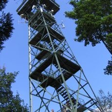
Gehrenberg, Mountain summit in Baden-Württemberg, Germany.
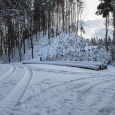
Gehrenberg is a mountain summit in the Bodenseekreis area of Baden-Württemberg, reaching around 754 meters in elevation. It sits within a forested landscape, and a set of marked trails leads to the top, with surfaces ranging from paved paths to natural woodland tracks.
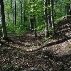
The 30-metre steel lattice Gehrenbergturm was inaugurated in 1903 as the Grossherzog-Friedrich-Warte. Around 1911 a landslide about 300 metres west of the tower left a 100-metre-wide scar, the "Rutsche", still visible today and possibly linked to the strong earthquake of 16 November 1911. In 2004 a roughly 30-metre radio mast was built just below the highest point.
The Gehrenberg is the local mountain of Markdorf, and the Gehrenbergturm belongs to the town even though it stands on the territory of Deggenhausertal. The tower is said to resemble the Eiffel Tower because the bracing between its legs is rounded at the top. It also carries antennas for amateur radio applications, including HAMNET.
The summit can be reached from several nearby towns, giving visitors a choice of starting points depending on how long a walk they prefer. Trail surfaces change with the weather, so sturdy shoes and appropriate clothing make the outing more comfortable.
The actual summit, at 751.9 m on the Stadtbühl, lies entirely in forest and offers no view; the panorama comes from the 30 m Gehrenbergturm below it at 704 m, a steel lattice tower opened in 1903 as the Großherzog-Friedrich-Warte and said to resemble the Eiffel Tower. The tower belongs to Markdorf though it stands on Deggenhausertal land, and it closes automatically at sunset.
The community of curious travelers
AroundUs brings together thousands of curated places, local tips, and hidden gems, enriched daily by 94,784 contributors worldwide.