Chest opened
+${chestReward.xp} XP
Explorer
NOUVEAU ×${chestReward.collectible.quantity}
tapez pour fermer

See the monuments around you in AR Open chests in the app

Around Us is built for your phone — point your camera at the streets and discover the monuments and places around you in augmented reality. Around Us is built for your phone — chests unlock when you walk, explore and capture nearby places.

•

Enable Location

We need your location to show you interesting places around you

Discover nearby places

Find interesting locations and hidden gems around you

Precise directions

Get accurate directions and distances to places

Your location is never shared with other users. It's only used when you tap the location button.

Biester-Berg

Log in to your account

Start exploring — it's free

Trusted by 93,975 travelers worldwide

Continue with Google
Continue with Apple
or

We will send you a code to connect

By continuing, you accept our Terms and Conditions and our Privacy Policy

Check your inbox

We've sent a pincode in your inbox. Please enter the code below.

Biester-Berg

Biester-Berg, Mountain summit in North Rhine-Westphalia, Germany

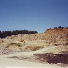
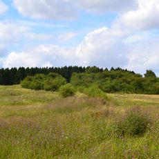
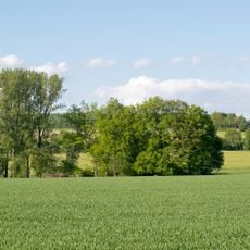
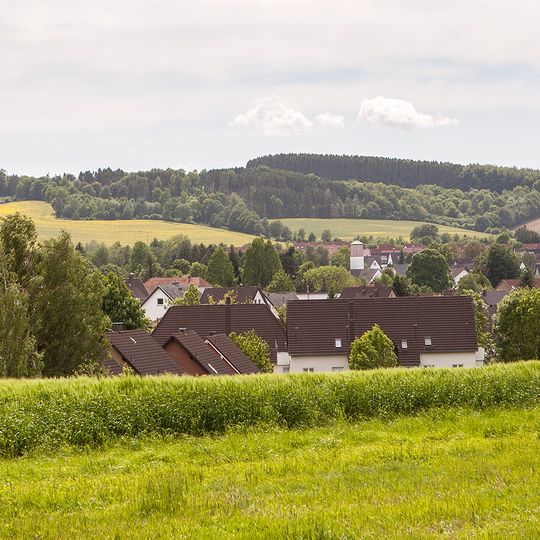
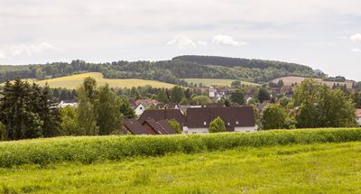
Biester-Berg is a 218 m high hill in southern Lemgo, North Rhine-Westphalia. Its summit area and slopes were used as a military training ground until 1993, and since 2009, 74.44 hectares have been protected as a nature reserve. The terrain includes open grassland, scattered bushes, and mixed woodland.

A small settlement called Bist, probably from Old High German bisut for clearing or village, stood here in the early Middle Ages and was abandoned as Lemgo grew in the late 12th and early 13th century. From 1883 to 1887 the hill passed to the city, which planted spruce on the poor northwestern soils while the south stayed grazed heath. In 1936 the Wehrmacht bought the pasture, and from 1953 British troops ran a tank training area of nearly 50 hectares until they left in 1993.

The name Biesterberg comes from the medieval village of Bist, probably from Old High German bisut, meaning clearing or village; the settlement was abandoned as Lemgo grew in the late 12th and early 13th centuries. The former training ground is now grazed by sheep to keep the dry grassland open, and the Landwehr earthwork along the southern edge is being restored over about 30 metres by the Biologische Station Lippe.

Several marked paths lead to the summit from different starting points and make it easy to reach. Visitors should wear proper footwear and allow about an hour for a relaxed climb with time to enjoy the views.

The Biesterberg's open grassland is kept free of scrub by sheep grazing, a practice that preserves the lean turf where species such as the fringed gentian and the great crested newt live. The hill was a British Army tank training ground until 1993, and the area has been a nature reserve since 2009.

The community of curious travelers

AroundUs brings together thousands of curated places, local tips, and hidden gems, enriched daily by 93,975 contributors worldwide.
Start exploring
GPS coordinates
52.00483,8.90308
Latest update
October 29, 2026 07:13
Reviews
Share your experience

No review yet

Discussions
Start a discussion...

No discussion yet

« Biester-Berg - Mountain summit in North Rhine-Westphalia, Germany » is provided by Around Us (aroundus.com). Images and texts are derived from Wikimedia project under a Creative Commons license. You are allowed to copy, distribute, and modify copies of this page, under the conditions set by the license, as long as this note is clearly visible.

Discover hidden gems everywhere you go!

From secret cafés to breathtaking viewpoints, skip the crowded tourist spots and find places that match your style. Our app makes it easy with voice search, smart filtering, route optimization, and insider tips from travelers worldwide. Download now for the complete mobile experience.
Around Us App Screenshot
❝

A unique approach to discovering new places❞

— Le Figaro

❝

All the places worth exploring❞

— France Info

❝

A tailor-made excursion in just a few clicks❞

— 20 Minutes

Around Us
Travel Guide & Maps
Download

Send to your phone

QR Code
1

Open the camera app on your mobile.

2

Point at the QR code with your camera. A notification will appear.

3

Tap the notification to open the link.