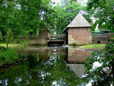
Haarmühle, Watermill in Alstätte, Germany
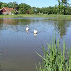
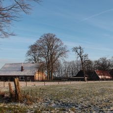
Haarmühle is a watermill building located directly on the German-Dutch border along the Alstätter Aa river. The stone structure houses the original milling equipment along with a restaurant serving regional cuisine, featuring both indoor dining areas and an outdoor terrace shaded by chestnut trees.
A mill has operated at this location since 1331, demonstrating the longstanding importance of water power in this region. The current stone structure was built in 1619 to replace an earlier building that had served the same purpose.
The mill serves as a gathering place for locals and visitors who appreciate traditional craftsmanship and water-powered engineering. It represents how communities once depended on natural water sources for their daily work.
The site has a restaurant with covered indoor areas and an outdoor terrace where visitors can eat and drink. The riverside location with shade from trees makes it comfortable to spend time outdoors when weather permits, and the border position makes it accessible from both countries.
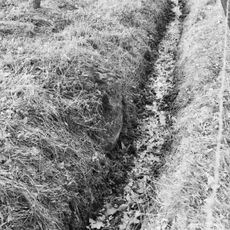
The river changes its name at the border: it is called Alstätter Aa on the German side and Buursebeek on the Dutch side. This shift in the water's official name is something many visitors overlook while enjoying the site.
GPS coordinates: 52.13272,6.87612
Latest update: December 14, 2025 14:44
Buurserzand
5.9 km
Schwattet Gatt
5.6 km
Witte Veen
1.6 km
St. Mariä Himmelfahrt
2.7 km
Lüntener Fischteiche
3.2 km
Wacholderheide Hörsteloe
4.2 km
Broekheurne
5.2 km
Vogelschutzgebiet 'Moore und Heiden des westlichen Münsterlandes'
2.7 km
Lüntener Wald
5 km
Smalenbroek
5.5 km
Stroink
6.1 km
Haaksbergerweg 13, Buurse
4.4 km
Barn Zendvelderweg 7, Buurse
3.3 km
Bruininkslaan 24, Enschede
4.9 km
Beerenbroek, Enschede
5.1 km
De Bommelas, Buurse
6 km
Zonnebeek: schaapskooi met duiventil
6.4 km
Grenspaal Hoek Twistveenweg-Weustinkhoekweg
3.3 km
Alsteedseweg 50, Haaksbergen
1.7 km
Wacholderheide Hörsteloe
4.7 km
Zonnebeek: Kutschhaus mit Pferdeboxen und Dienstwohnung
6.4 km
Schwattet Gatt
5.6 km
Berenbroek: schuur
5.1 km
Berenbroek: boerderij
5.1 km
Zwerfkei in weide achter Broekheurnerheegde; scheiding tussen Usseler- en Buursermarke
3.4 km
Berktepaal aan de Moorveenweg; scheiding tussen Usseler- en Buursermarke
3.8 km
Slagersmatenpaal in weide aan de Leppeweg; scheiding tussen Usseler- en Buursermarke
5.4 km
Leppenpaal in weide bij Oude Haaksbergerdijk 310; scheiding tussen Usseler- en Buursermarke
6 kmVisited this place? Tap the stars to rate it and share your experience / photos with the community! Try now! You can cancel it anytime.
Discover hidden gems everywhere you go!
From secret cafés to breathtaking viewpoints, skip the crowded tourist spots and find places that match your style. Our app makes it easy with voice search, smart filtering, route optimization, and insider tips from travelers worldwide. Download now for the complete mobile experience.
A unique approach to discovering new places❞
— Le Figaro
All the places worth exploring❞
— France Info
A tailor-made excursion in just a few clicks❞
— 20 Minutes