Enable Location

We need your location to show you interesting places around you

Discover nearby places

Find interesting locations and hidden gems around you

Precise directions

Get accurate directions and distances to places

Your location is never shared with other users. It's only used when you tap the location button.

Witte Veen

Log in to your account

Start exploring — it's free

Trusted by 61,536 travelers worldwide

Continue with Google
Continue with Apple
or

We will send you a code to connect

By continuing, you accept our Terms and Conditions and our Privacy Policy

Check your inbox

We've sent a pincode in your inbox. Please enter the code below.

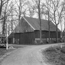
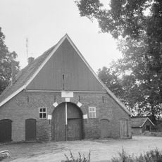
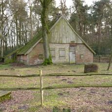
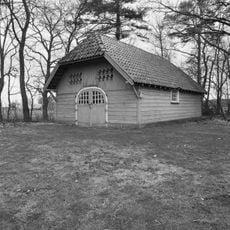
Witte Veen, Nature reserve in Haaksbergen, Netherlands

Description

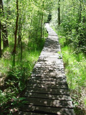
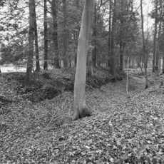
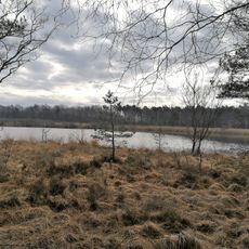
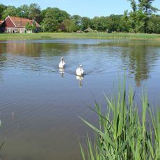
Witte Veen covers approximately 294 hectares of peatland, heath fields, and forested sections positioned at the Dutch-German border. Visitors traverse the terrain using walking paths that wind through rough grasslands and shallow pools.

History

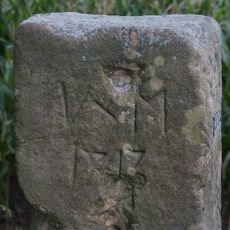
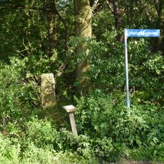
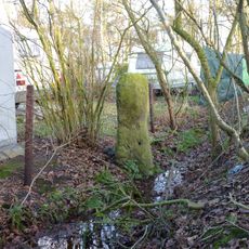
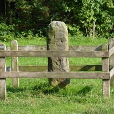
The area contains boundary markers from the 18th century made of Bentheim sandstone that once demarcated the Netherlands-Germany border. The region formerly served as a smuggling corridor before becoming a nature reserve.

Culture

The reserve displays the classic features of raised bog with sphagnum mosses and cotton grass that visitors notice while walking through. Cross-border management with German conservation groups has kept the natural landscape largely unchanged since earlier times.

Practical

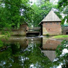
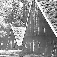
Access to the area is available through a parking lot near the Haarmühle restaurant and water mill. The ground is rough and muddy in places, so sturdy footwear and weather-appropriate clothing are advisable.

Did you know?

The southern section called Markslag harbors a growing population of tree frogs that increasingly inhabit this bog-forest transition area. The region supports 31 bee species, including three endangered varieties that attentive visitors may observe.

Location
Inception
March 2003
GPS coordinates
52.14691,6.87420
Latest update
December 14, 2025 18:43

AroundUs brings together thousands of curated places, local tips, and hidden gems, enriched daily by 60,000 contributors worldwide. Discover all places nearby (Haaksbergen).

Around this place
Zonnebeek
Netherlands

Zonnebeek

5.5 km
Netherlands

Buurserzand

5.2 km
Haarmühle
Germany

Haarmühle

1.6 km
St. Mariä Himmelfahrt
Germany

St. Mariä Himmelfahrt

3.5 km
Lüntener Fischteiche
Germany

Lüntener Fischteiche

4.3 km
Broekheurne
Netherlands

Broekheurne

3.6 km
Vogelschutzgebiet 'Moore und Heiden des westlichen Münsterlandes'
Germany

Vogelschutzgebiet 'Moore und Heiden des westlichen Münsterlandes'

4.1 km
Smalenbroek
Netherlands

Smalenbroek

4 km
Stroink
Netherlands

Stroink

4.6 km
Barn Zendvelderweg 7, Buurse
Netherlands

Barn Zendvelderweg 7, Buurse

3.3 km
Haaksbergerweg 13, Buurse
Netherlands

Haaksbergerweg 13, Buurse

4.1 km
De Bommelas, Buurse
Netherlands

De Bommelas, Buurse

5.4 km
Zonnebeek: schaapskooi met duiventil
Netherlands

Zonnebeek: schaapskooi met duiventil

5.3 km
Bruininkslaan 24, Enschede
Netherlands

Bruininkslaan 24, Enschede

3.4 km
Beerenbroek, Enschede
Netherlands

Beerenbroek, Enschede

3.7 km
Zonnebeek: witgepleisterde garage op rechthoekige grondslag onder wolfsdak
Netherlands

Zonnebeek: witgepleisterde garage op rechthoekige grondslag onder wolfsdak

5.3 km
Berenbroek: boerderij
Netherlands

Berenbroek: boerderij

3.7 km
Grenspaal Hoek Twistveenweg-Weustinkhoekweg
Germany

Grenspaal Hoek Twistveenweg-Weustinkhoekweg

1.9 km
Alsteedseweg 50, Haaksbergen
Netherlands

Alsteedseweg 50, Haaksbergen

1.9 km
Zonnebeek: tuinaanleg
Netherlands

Zonnebeek: tuinaanleg

5.3 km
Zonnebeek: houten hek tussen twee vierkante pijlers onder deksteen met sierbol
Netherlands

Zonnebeek: houten hek tussen twee vierkante pijlers onder deksteen met sierbol

5.3 km
Zonnebeek: ommuurde moestuin met tegen de muur aan gebouwde houten schuur
Netherlands

Zonnebeek: ommuurde moestuin met tegen de muur aan gebouwde houten schuur

5.3 km
Berenbroek: schuur
Netherlands

Berenbroek: schuur

3.7 km
Zonnebeek: Kutschhaus mit Pferdeboxen und Dienstwohnung
Netherlands

Zonnebeek: Kutschhaus mit Pferdeboxen und Dienstwohnung

5.3 km
Zwerfkei in weide achter Broekheurnerheegde; scheiding tussen Usseler- en Buursermarke
Netherlands

Zwerfkei in weide achter Broekheurnerheegde; scheiding tussen Usseler- en Buursermarke

1.8 km
Berktepaal aan de Moorveenweg; scheiding tussen Usseler- en Buursermarke
Netherlands

Berktepaal aan de Moorveenweg; scheiding tussen Usseler- en Buursermarke

2.4 km
Slagersmatenpaal in weide aan de Leppeweg; scheiding tussen Usseler- en Buursermarke
Netherlands

Slagersmatenpaal in weide aan de Leppeweg; scheiding tussen Usseler- en Buursermarke

4.1 km
Leppenpaal in weide bij Oude Haaksbergerdijk 310; scheiding tussen Usseler- en Buursermarke
Netherlands

Leppenpaal in weide bij Oude Haaksbergerdijk 310; scheiding tussen Usseler- en Buursermarke

4.9 km
Show the full map
« Witte Veen - Nature reserve in Haaksbergen, Netherlands » is provided by Around Us (aroundus.com). Images and texts are derived from Wikimedia project under a Creative Commons license. You are allowed to copy, distribute, and modify copies of this page, under the conditions set by the license, as long as this note is clearly visible.

Discover hidden gems everywhere you go!

From secret cafés to breathtaking viewpoints, skip the crowded tourist spots and find places that match your style. Our app makes it easy with voice search, smart filtering, route optimization, and insider tips from travelers worldwide. Download now for the complete mobile experience.

Around Us App Screenshot

A unique approach to discovering new places

Le Figaro

All the places worth exploring

France Info

A tailor-made excursion in just a few clicks

20 Minutes

Around Us
Travel Guide & Maps
Download

Send to your phone

QR Code
1

Open the camera app on your mobile.

2

Point at the QR code with your camera. A notification will appear.

3

Tap the notification to open the link.