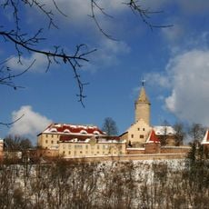
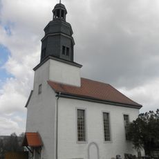
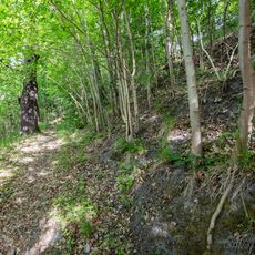
Walpersberg, Mountain summit in Thuringia, Germany.
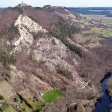
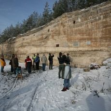
Walpersberg is a limestone mountain in Thuringia featuring an intricate system of underground chambers and passages carved through its interior. These passages span multiple levels and connect different sections of the excavated space.
Initially developed for kaolin extraction, the mountain's caverns were repurposed as a weapons production facility during the Second World War. Aircraft assembly occurred here under forced labor conditions imposed by the regime.
The site carries weight as a place where the region confronts difficult history through its preserved spaces and exhibitions. Visitors encounter direct evidence of human suffering and industrial exploitation that shaped this location.
Access to the underground sections requires advance booking for guided group tours. Visitors should wear sturdy footwear and bring warm clothing, as the temperature inside remains cool year-round.
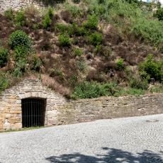
The extensive tunnel system originated from kaolin mining, a clay mineral used in ceramics and bleaching. This earlier purpose shaped the layout of passages and chambers that visitors encounter today.
GPS coordinates: 50.79671,11.55354
Latest update: December 10, 2025 20:08
Leuchtenburg Castle
4.2 km
Museum Leuchtenburg
4.2 km
Kemenate Orlamünde
2.8 km
Porzellanwelten Leuchtenburg
4.2 km
Dohlenstein
3.7 km
Stadtkirche St. Marien (Orlamünde)
3.1 km
St. Nikolaus
2.6 km
Stadtkirche St. Margarethen
2.7 km
St. Maria
3.8 km
St. Sebastian (Dienstädt)
3.5 km
St. Petrus (Zwabitz)
1.9 km
Herrenhaus Altenberga
3.9 km
Dorfkirche Schmölln
4.4 km
Dorfkirche Löbschütz
2.8 km
Saint Paul Church
923 m
St. Peter und Paulus (Kleineutersdorf)
2 km
St. Georg (Großeutersdorf)
1.1 km
Dohlenstein und Pfaffenberg
3.6 km
St. Peter und Paul (Gumperda)
2.6 km
Dorfkirche Eichenberg
1.6 km
St. Laurentius (Freienorla)
3.2 km
Protestant Church (Großpürschütz)
3.8 km
Dokumentationszentrum REIMAHG
1.2 km
Cemetery Chapel Kahla
1.8 km
Dohlenstein und Pfaffenberg
3.7 km
Fledermausquartiere Orlamünde
3.1 km
Landschaftsschutzgebiet Kemnatenberg und Spitalsberg
2.8 km
St. Ursula (Lindig)
3.4 kmVisited this place? Tap the stars to rate it and share your experience / photos with the community! Try now! You can cancel it anytime.
Discover hidden gems everywhere you go!
From secret cafés to breathtaking viewpoints, skip the crowded tourist spots and find places that match your style. Our app makes it easy with voice search, smart filtering, route optimization, and insider tips from travelers worldwide. Download now for the complete mobile experience.
A unique approach to discovering new places❞
— Le Figaro
All the places worth exploring❞
— France Info
A tailor-made excursion in just a few clicks❞
— 20 Minutes