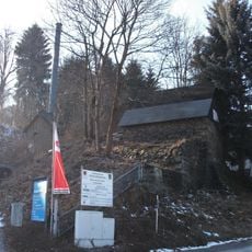
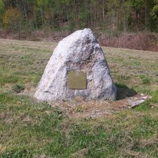
Floßgraben bei Schlema, Log driving canal in Erzgebirgskreis, Germany.
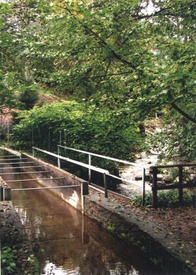
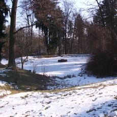
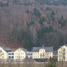
The Floßgraben bei Schlema is a water channel system that stretches about 15 kilometers through forests and meadows with stone-reinforced banks. The landscape shows water control structures and is today accompanied by walking paths that follow the entire route.
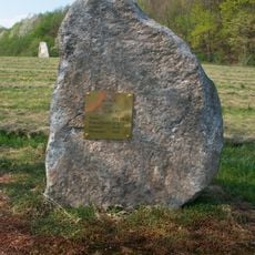
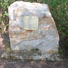
Construction of this canal system began in 1556 under surveyor Christoph Kunzmann to transport timber to the mines and furnaces of the region. The project relied on careful calculations and later received UNESCO World Heritage recognition for representing precise medieval engineering.
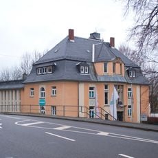
Today the canal serves walkers and cyclists who explore the landscape and experience the historical engineering embedded in nature. The paths along the waterway are how locals and visitors engage with the mining heritage of the region.
A marked walking path runs along the entire canal from Rechenhaus in Albernau to the spa park in Bad Schlema and is easy to access for visitors. The path is partly flat and partly hilly, with several entry points so you can choose a shorter or longer walk.
The water system crosses over railway tunnels and handles an elevation drop of roughly 70 meters using calculations from the 16th century made without modern surveying equipment. The precision of this early mathematical planning is still remarkable to visitors today who understand how the system actually works.
Location: Erzgebirgskreis
GPS coordinates: 50.60070,12.65500
Latest update: December 14, 2025 18:00
Geotop Roter Kamm
71 m
Local Court Amtsgericht Schneeberg
896 m
Kgl.-sächs. Postmeilenstein in Schneeberg
1 km
BSZ Schneeberg
891 m
Wohnhaus in Ecklage und halboffener Bebauung Ritterstraße 16
1.1 km
Villa Gymnasialstraße 12
928 m
Schulgebäude Ringstraße 12
839 m
Auferstehungskirche Schneeberg
852 m
Stadtpark Schneeberg
1.1 km
Kornzeche
690 m
Bergarbeiterkrankenhaus Schneeberg
942 m
Villa Gymnasialstraße 14
945 m
Villa mit Einfriedung Gymnasialstraße 15
924 m
Einzeldenkmal in der Sachgesamtheit Stadtpark: Pavillon (heute Voliere) - (siehe auch Sachgesamtheitsliste Obj. 09301580) Hartensteiner Straße -
1.1 km
Wohnhaus in offener Bebauung Gymnasialstraße 6
850 m
Wohnhaus in offener Bebauung Hartensteiner Straße 8
1 km
Wohnhaus in geschlossener Bebauung Kirchgasse 5
1.1 km
Fundgrube Greif
886 m
Schacht 15 IIbis
153 m
Stadtbad mit Schwimmhalle Amtsgerichtsstraße 1
962 m
Verwaltungsgebäude in offener Bebauung Ringstraße 14
861 m
Schacht 7bis
753 m
Schacht 6bis
659 m
Schacht 7
797 m
Westliches Wohnhaus, südliches Wohnhaus, nördliches ehemaliges Wirtschaftsgebäude und Keller einer ehemaligen Kurheimanlage Köhlerweg 1
1 km
Vorderer Gebäudeteil der ehemaligen Münze, heute Stadtarchiv Schulgasse 9
1 km
Fabrik Schneeberg
778 m
Wohnhaus in offener Bebauung, heute Kirchgemeindehaus Ringstraße 1
836 mVisited this place? Tap the stars to rate it and share your experience / photos with the community! Try now! You can cancel it anytime.
Discover hidden gems everywhere you go!
From secret cafés to breathtaking viewpoints, skip the crowded tourist spots and find places that match your style. Our app makes it easy with voice search, smart filtering, route optimization, and insider tips from travelers worldwide. Download now for the complete mobile experience.
A unique approach to discovering new places❞
— Le Figaro
All the places worth exploring❞
— France Info
A tailor-made excursion in just a few clicks❞
— 20 Minutes