Naherholungsgebiet Waldbad Zeischa, Recreation area in Bad Liebenwerda, Germany.
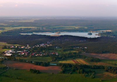
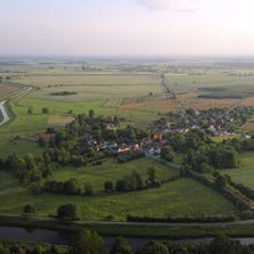
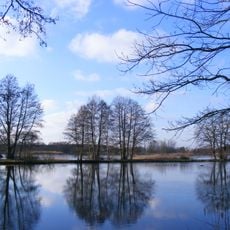
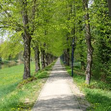
Waldbad Zeischa is a recreation area in Bad Liebenwerda that spans about 80 hectares and contains a former gravel excavation site transformed into a lake with swimming zones, a campground offering 135 spaces and eight bungalows. The site combines water areas with cycling paths and green spaces suited for walking and spending time outdoors.
In 1888, merchant Carl Weiland started extracting gravel and sand here using bucket chain excavators and a narrow-gauge railway for transport. After decades of mining, the excavated pit gradually filled with water and was eventually developed into a recreational lake.
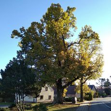
The name comes from the nearby village of Zeischa and today serves as a gathering place for locals and visitors seeking outdoor water activities and leisure. The shoreline shows both natural sections and family-friendly areas where recreation and nature coexist visibly.
The area is easy to reach and has ample parking plus accessible paths to main zones. Bring sunscreen and water, and stick to marked swimming areas for safety.
Although the water meets European bathing standards, parts of the site technically remain under mining law, preserving its industrial past. This overlap shows how places can carry their history while shifting to new purposes.
Location: Bad Liebenwerda
GPS coordinates: 51.50350,13.44850
Latest update: December 14, 2025 16:40
Lubwartturm
3.7 km
Burg Liebenwerda
3.7 km
Schloss Würdenhain
3.4 km
St Nikolai (Bad Liebenwerda)
4.1 km
Alte Röder bei Prieschka
2.5 km
Wassermühle Prieschka
2.8 km
Dorfkirche (Würdenhain)
3.2 km
Grabmal des Elias Borßdorff
1.6 km
Kaiserliches Postamt (Bad Liebenwerda)
3.9 km
Village church Dobra
1.3 km
Glockenturm Prieschka
3 km
Friedrich-Wilhelm-Denkmal (Bad Liebenwerda)
3.6 km
Jagdhaus Dobra (Bad Liebenwerda)
1.5 km
Rosmaringasse 4
3.9 km
Wegweiser Berliner Straße 8 (Bad Liebenwerda)
4 km
Dovecot Dobra
1.2 km
Kreismuseum Bad Liebenwerda
3.7 km
Fachwerkhaus Dorfstraße 62 (Prieschka)
2.8 km
Dorfstraße 10
3.2 km
Wohnhaus Dorfstraße 23
4.1 km
Elsteraue und Teichlandschaft um Bad Liebenwerda
521 m
Naturdenkmal Stieleiche im Wäldchen
3.4 km
Naturdenkmal Rotbuche
3.7 km
Naturdenkmal Rosskastanie Marktplatz; Flur 19, Flurstück 40 (vorn links am Marktbrunnen) in Bad Liebenwerda
4.1 km
Naturdenkmal Winterlinde Dobra
1.3 km
Naturdenkmal Linde vor dem Denkmal Dorfstraße; Flur 1, Flurstück 8 in Kraupa
4.1 km
Winterlindenallee an der Schwarzen Elster in Bad Liebenwerda
3.6 km
Naturdenkmal Rosskastanie Marktplatz; Flur 19, Flurstück 4040 (vorn rechts am Marktbrunnen) in Bad Liebenwerda
4.1 kmVisited this place? Tap the stars to rate it and share your experience / photos with the community! Try now! You can cancel it anytime.
Discover hidden gems everywhere you go!
From secret cafés to breathtaking viewpoints, skip the crowded tourist spots and find places that match your style. Our app makes it easy with voice search, smart filtering, route optimization, and insider tips from travelers worldwide. Download now for the complete mobile experience.
A unique approach to discovering new places❞
— Le Figaro
All the places worth exploring❞
— France Info
A tailor-made excursion in just a few clicks❞
— 20 Minutes