Jägersee, Natural swimming lake in Wendelstein, Germany
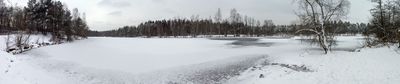
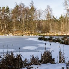
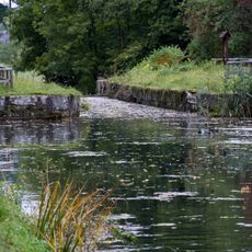
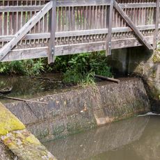
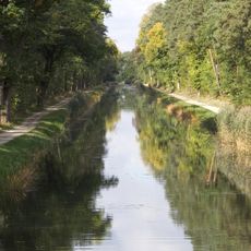
Jägersee consists of two lakes separated by a narrow dam situated in the Lorenzer Reichswald forest southeast of Nuremberg. Both bodies of water originated from sand mining and are surrounded by forested terrain.
The lakes were created as a result of sand mining during the expansion of the A9 highway between Berlin and Munich. After extraction ended, the excavated areas were allowed to fill with water and naturally develop into lakes during the 1970s.
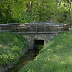
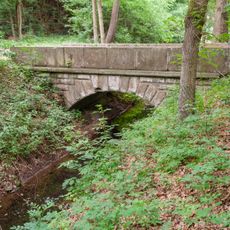
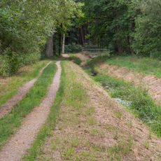
The lakes sit along popular hiking routes including the pilgrimage trail and the regional path, drawing visitors who combine walking with time by the water. Local people use these routes regularly as part of their outdoor recreation.
Access is limited to pedestrians and cyclists since there are no parking facilities nearby and amenities around the lakes are minimal. Plan to bring what you need and allow extra time for walking or cycling to reach the location.
The larger lake has brown-tinted water that warms significantly in summer, while the smaller lake contains an island and stays noticeably cooler. These differences create distinct swimming experiences depending on the season and personal preference.
Location: Wendelstein
Elevation above the sea: 348 m
GPS coordinates: 49.37230,11.19160
Latest update: December 10, 2025 20:04
Schloss Kugelhammer
1.3 km
Krugsweiher
392 m
Gauchsbach-Leitgraben
921 m
Erdbauten des Ludwig-Donau-Main-Kanals #20
859 m
Erdbauten des Ludwig-Donau-Main-Kanals #19
1.1 km
Brücke über den Ludwig-Donau-Main-Kanal bei Gugelhammer
1.3 km
Urbogenschütze
1.3 km
Gedenkstein J.C.Meixner
527 m
Brückkanal über den Gauchsbach
1.2 km
Schleuse 62 des Ludwig-Donau-Main-Kanals in Kugelhammer
1.2 km
Köblergut
1.3 km
Wolfgangsquelle am Gauchsbach
1.3 km
Gauchsbach-Schütz und Wehr
506 m
Bogenbrücke über den Gauchsbach-Leitgraben
900 m
Gauchsbach Ausleitung in den Gauchsbach-Leitgraben
465 m
Gauchsbach-Leitgraben nördlich der A 73
547 m
Gauchsbach-Leitgraben südlich der A 73
999 m
Wasserfall
1.1 km
Verwalterhaus
1.3 km
Bildstock Wendelstein
1.3 km
Einfriedung Schlüsselfeldersches Schloss
1.3 km
Grund und Mittelschule
1.3 km
Gauchsbach-Leitgraben Schütz
506 m
Grenzstein 1 bei Röthenbach bei Sankt Wolfgang
1.2 km
Grenzstein 2 bei Röthenbach bei Sankt Wolfgang
1.1 km
Schleusenhaltung der Schleuse 62 am Ludwig-Donau-Main-Kanal
1.2 km
Nebengebäude Verwalterhaus
1.2 km
Steg und Wehr am Gauchsbach
430 mVisited this place? Tap the stars to rate it and share your experience / photos with the community! Try now! You can cancel it anytime.
Discover hidden gems everywhere you go!
From secret cafés to breathtaking viewpoints, skip the crowded tourist spots and find places that match your style. Our app makes it easy with voice search, smart filtering, route optimization, and insider tips from travelers worldwide. Download now for the complete mobile experience.
A unique approach to discovering new places❞
— Le Figaro
All the places worth exploring❞
— France Info
A tailor-made excursion in just a few clicks❞
— 20 Minutes