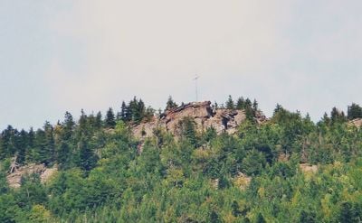
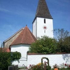
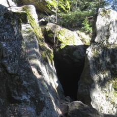
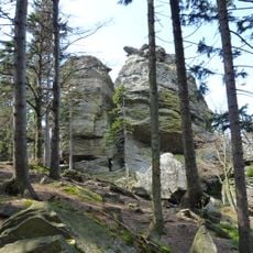
Kreuzfelsen, Mountain summit in Bavaria, Germany.
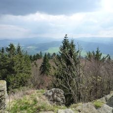
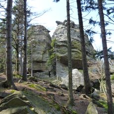
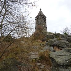
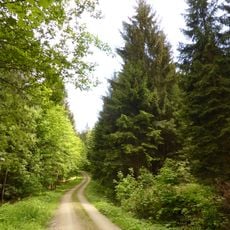
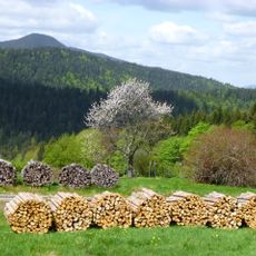
Kreuzfelsen is a mountain in the Bavarian Forest reaching about 999 meters, distinguished by a prominent cross at its peak. The terrain offers broad views from its edges across surrounding forests and toward distant horizons on clear days.
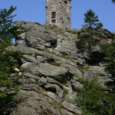
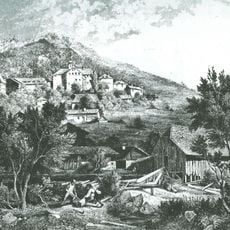
The rock formation took shape through geological forces millions of years ago and was first noted in the 1800s as a hideout for a local outlaw. Over time it became known as a landmark for mountain travelers.
The cross at the summit serves as a local landmark that has drawn hikers for generations and helps them navigate the forest. Visitors often leave small notes or objects at the cross to mark their successful climb.
Marked trails lead to the summit from Bad Kotzting, with the E6 European long-distance path offering a direct route. Visitors should bring weather-appropriate gear and stick to marked paths, especially during bad weather or darker months.
Several secured climbing routes for top-rope climbing are built into the rock formation, offering access for experienced climbers. On clear days, visitors can see as far as the Alps from this vantage point.
GPS coordinates: 49.17645,12.92280
Latest update: December 14, 2025 14:43
Großer Riedelstein
3.8 km
Hohenbogen-Kaserne
5 km
St. Nikolaus
2.7 km
St. Anna
2.6 km
Denkmal für Maximilian Schmidt (Großer Riedelstein)
3.8 km
Schloss Grafenwiesen
4.1 km
St. Laurentius
4.4 km
Schloss Hohenwarth
3.1 km
Kuratiekirche Hl. Dreifaltigkeit
4 km
Sankt Johannes Baptist
3.1 km
Räuber-Heigl-Höhle von Reitenberg
152 m
Gipfel des Großen Riedelsteins von Arrach
3.8 km
Sogenannte Kirchenburg, ehemaliges Pflegschloss, jetzt Pfarrhof
4.8 km
Kirchenburg
4.8 km
Katholische Kirche St. Veit, sogenannte Marktkirche
5 km
Felsgruppe Rauchröhren SW von Arrach
2.8 km
Bauernhaus, Wohnstallhaus
4.6 km
Wohnstallhaus
4.5 km
Waldschmidt-Denkmal
3.8 km
Waldlerhaus, Wohnstallhaus
4.5 km
Altes Rathaus
4.8 km
Turnhalle
4.4 km
Kaitersberg-Felshänge
2.3 km
Wohnstallhaus
4.5 km
Winterquartiere der Mopsfledermaus im Oberpfälzer Wald
5.3 km
Oberlauf des Weißen Regens bis Kötzting mit Kaitersbachaue
5.3 km
Gasthof Zur Post
4.8 km
Rathaus
4.8 kmVisited this place? Tap the stars to rate it and share your experience / photos with the community! Try now! You can cancel it anytime.
Discover hidden gems everywhere you go!
From secret cafés to breathtaking viewpoints, skip the crowded tourist spots and find places that match your style. Our app makes it easy with voice search, smart filtering, route optimization, and insider tips from travelers worldwide. Download now for the complete mobile experience.
A unique approach to discovering new places❞
— Le Figaro
All the places worth exploring❞
— France Info
A tailor-made excursion in just a few clicks❞
— 20 Minutes