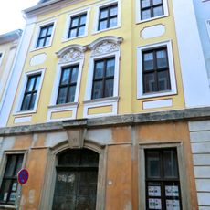
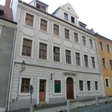
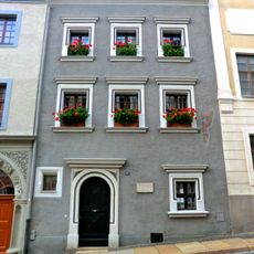
Vogtshof, Medieval administrative building in Görlitz, Germany
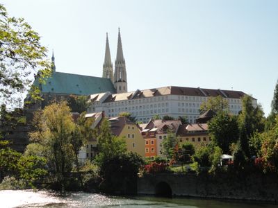
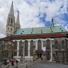
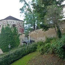
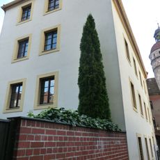
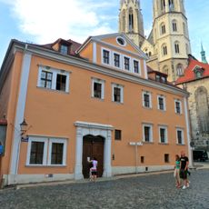
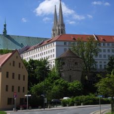
The Vogtshof is a medieval administrative building that rises above the Nikolaivorstadt district in Görlitz and overlooks the Neiße River to the east. The structure stands directly beside St. Peter and Paul Church.
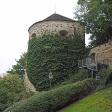
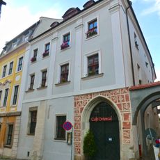
The structure was built in 1268 on the orders of Margrave Otto IV of Brandenburg and served as the administrative seat for Upper Lusatia following the region's division. It later underwent several changes in its use and function.
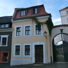
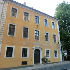
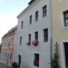
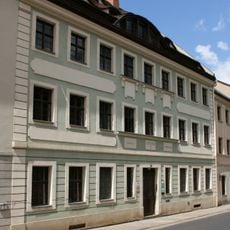
The name reflects its original role as the administrative seat for the region's officials, and the building remains a defining landmark in the Nikolaivorstadt district. Its location shaped how this neighborhood developed and how people navigate the area today.
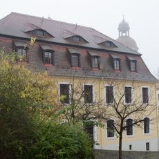
The site is easily accessible from the Nikolaivorstadt district and offers plenty of angles for viewing from outside. The best perspective on the building can be found from the nearby garden and fortification area.
The complex now houses student housing and is often overlooked by visitors who focus on more famous attractions. Its current role as student accommodation offers an interesting contrast to its medieval origins.
Location: Görlitz
GPS coordinates: 51.15896,14.99163
Latest update: December 14, 2025 18:11
Saint Peter and Paul
82 m
Pipe organ in St. Peter und Paul
82 m
Hotherturm
59 m
Alle Teile der nördlichen Stadtbefestigung, dazu gehören äußere Zwingermauer und innere Stadtmauer, der Teil der Stadtmauer östlich der Peterskirche bis Neißstraße 12 sowie Grünanlage im Nikolaizwinger zwischen Nikolaiturm und Peterskirche mi
65 m
Wohnhaus in geschlossener Bebauung, Eckhaus mit Schwibbogen zum Vogtshof Karpfengrund 9
29 m
Wohnhaus in geschlossener Bebauung Karpfengrund 6
46 m
Wohnhaus, nach links freistehend, mit Mauer, die in Ostwest-Richtung zur Stadtmauer führt Karpfengrund 4
63 m
Wohnhaus in geschlossener Bebauung, mit Hofflügel Nikolaistraße 13
93 m
Bei der Peterskirche 5
55 m
Wohnhaus in geschlossener Bebauung Karpfengrund 7
40 m
Wohnhaus in geschlossener Bebauung Karpfengrund 8
35 m
Wohnhaus Karpfengrund 3
102 m
Wohnhaus in geschlossener Bebauung, Eckhaus und vier Schwibbögen über die Krebsgasse Krebsgasse 1, 2 (Hauptanschrift: Nikolaistraße 14)
81 m
Wohnhaus in geschlossener Bebauung Karpfengrund 5
53 m
Bei der Peterskirche 1
89 m
Bei der Peterskirche 4
69 m
Karpfengrund 1
63 m
Bei der Peterskirche 3
80 m
Nikolaistraße 10
106 m
Wohnhaus in geschlossener Bebauung Nikolaistraße 11
99 m
Wohnhaus in geschlossener Bebauung, mit rechtem Hofflügel Nikolaistraße 12
96 m
Wohnhaus in nach links geschlossener Bebauung Nikolaigraben 18
90 m
Gasthaus in geschlossener Bebauung, Ecklage zur Rothenburger Straße Nikolaigraben 14
109 m
Vierflügelanlage des ehemaligen Vogtshof (Görlitz) Gottfried-Kiesow-Platz 2
34 m
Wohnhaus in geschlossener Bebauung und Hofgebäude Hotherstraße 31
94 m
Teichmühle, später Wollspinnerei Bergmann und Krause mit allen bestehenden Bauten Rothenburger Straße 57; Kleine Wallstraße 4, 5
95 m
Wohnhaus in geschlossener Bebauung Nikolaigraben 17
84 m
Mietshaus in geschlossener Bebauung Nikolaigraben 16
79 mVisited this place? Tap the stars to rate it and share your experience / photos with the community! Try now! You can cancel it anytime.
Discover hidden gems everywhere you go!
From secret cafés to breathtaking viewpoints, skip the crowded tourist spots and find places that match your style. Our app makes it easy with voice search, smart filtering, route optimization, and insider tips from travelers worldwide. Download now for the complete mobile experience.
A unique approach to discovering new places❞
— Le Figaro
All the places worth exploring❞
— France Info
A tailor-made excursion in just a few clicks❞
— 20 Minutes