Enable Location

We need your location to show you interesting places around you

Discover nearby places

Find interesting locations and hidden gems around you

Precise directions

Get accurate directions and distances to places

Your location is never shared with other users. It's only used when you tap the location button.

Rubjerg Knude

Log in to your account

Start exploring — it's free

Trusted by 61,555 travelers worldwide

Continue with Google
Continue with Apple
or

We will send you a code to connect

By continuing, you accept our Terms and Conditions and our Privacy Policy

Check your inbox

We've sent a pincode in your inbox. Please enter the code below.

Rubjerg Knude

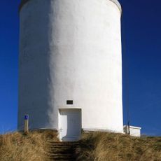
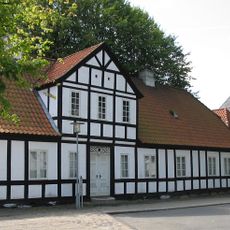
Rubjerg Knude, Coastal dune and lighthouse location in Hjørring Municipality, Denmark

Description

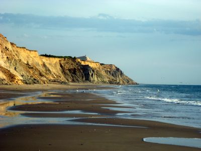
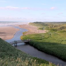
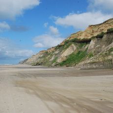
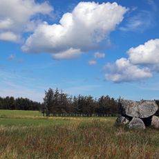
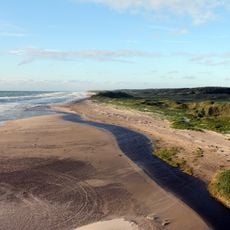
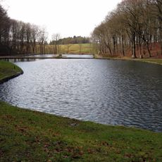
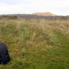
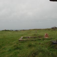
Rubjerg Knude is a dune formation along the North Sea coast that rises roughly 60 meters above sea level and shows signs of ongoing coastal erosion. The site contains a lighthouse and displays how this stretch of shoreline has transformed over the decades.

History

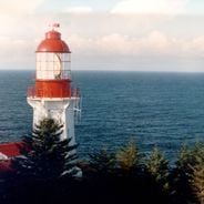
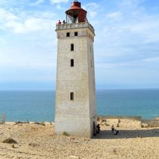
The lighthouse was built in 1899 and guided ships for generations along this treacherous coastline. It had to be abandoned in 1968 when sand dunes advanced faster and the sea crept too close to the structure.

Culture

The site reflects how coastal communities adapted to harsh natural forces that constantly reshaped their environment. Walking here, you notice how sand movement has influenced the way people built and protected their structures over generations.

Practical

You can reach the site by bus to Lønstrup and then walk from there across the dunes to the lighthouse. The paths are open and relatively flat, but weather along the coast changes quickly, so bring clothing suitable for wind and shifting conditions.

Did you know?

In 2019, engineers moved the entire lighthouse structure 70 meters inland to prevent it from tumbling into the sea. This remarkable rescue operation shows how people work to save historic buildings from nature's relentless power.

Part of
Lønstrup Klint
GPS coordinates
57.44889,9.77437
Latest update
December 20, 2025 13:48

AroundUs brings together thousands of curated places, local tips, and hidden gems, enriched daily by 60,000 contributors worldwide. Discover all places nearby (Hjørring Municipality).

Historic lighthouses: maritime architecture, navigation and history

Lighthouses tell the history of sailing with their shapes and building styles. Some go back to Roman times, like the Tower of Hercules in Galicia, a structure from the second century still working today. Others are from the Middle Ages, such as the Hook Lighthouse in Ireland, with its...

« Rubjerg Knude - Coastal dune and lighthouse location in Hjørring Municipality, Denmark » is provided by Around Us (aroundus.com). Images and texts are derived from Wikimedia project under a Creative Commons license. You are allowed to copy, distribute, and modify copies of this page, under the conditions set by the license, as long as this note is clearly visible.

Discover hidden gems everywhere you go!

From secret cafés to breathtaking viewpoints, skip the crowded tourist spots and find places that match your style. Our app makes it easy with voice search, smart filtering, route optimization, and insider tips from travelers worldwide. Download now for the complete mobile experience.

Around Us App Screenshot

A unique approach to discovering new places

Le Figaro

All the places worth exploring

France Info

A tailor-made excursion in just a few clicks

20 Minutes

Around Us
Travel Guide & Maps
Download

Send to your phone

QR Code
1

Open the camera app on your mobile.

2

Point at the QR code with your camera. A notification will appear.

3

Tap the notification to open the link.