Bouira Province, Administrative province in northern Algeria
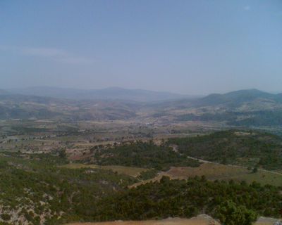
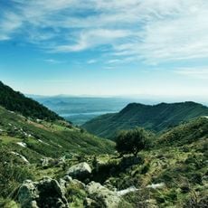
Bouira Province is an administrative region in northern Algeria that spans varied landscapes featuring mountains, valleys, and agricultural plains. Twelve districts and forty-five municipalities divide this territory into smaller administrative units.
The province was established as an independent administrative region in 1974 following a reorganization of the former territories of Médéa and Tizi-Ouzou. This administrative restructuring was part of a national reform that reshaped Algeria's governance following independence.
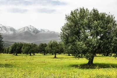
The province contains forty-five municipalities where residents maintain agricultural traditions, particularly in olive cultivation and local food production.
The province is accessible through national roads including the RN5 and RN30 highways that link its districts and connect to major cities. Travelers can navigate between settlements using these established routes that provide basic orientation throughout the region.
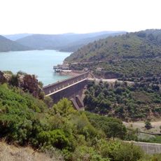
Two dams, Koudiat Acerdoune and Tilesdit, supply water to multiple regions and shape the province's water management. These structures are essential for agriculture and drinking water supply across the territory.
Location: Algeria
Inception: 1974
Capital city: Bouïra
Elevation above the sea: 647 m
Area: 4439
Reference: 10
Shares border with: Médéa Province, Boumerdès Province, Tizi Ouzou Province, Béjaïa Province, Bordj Bou Arréridj Province, M'Sila Province, Blida Province
GPS coordinates: 36.38333,3.90000
Latest update: December 20, 2025 11:48
Lalla-Khedidja
30.3 km
Djurdjura National Park
22.9 km
Koudiat Acerdoune Dam
30 km
Rapidum
50.3 kmGrotte du Macchabée
40.9 kmOuadi El Roukham bridge
10.1 kmAnou Ifflis
23.3 km
Hamiz Dam
54.8 km
Mosquée de Bouira
2.4 kmAnou Timedouine
31.7 kmThéâtre régional Amar-Laskri
840 mJeux pour enfants
37 kmFoire Larbi cherif
18.3 kmChâteaux boghni
21.4 kmGnater
39.3 kmEnsej ade cnas
52.7 kmThéâtre en plein air moudjahid Mechedou Salah
835 mTheatre municipal
298 mJeux pour enfants
37.1 kmTala melulen
36.4 kmStatue de Fatma N'Soumer
43.4 kmPark vente poutrelle
43.4 kmRue Mohammed boudiaf
1.3 kmWork of art
24.8 kmSomma
16.7 kmMausolée de Tacfarinas
34.5 kmAmirouche le Lion du Djurdjura
35.1 kmProclamation 1er Novembre 1945
22.9 kmVisited this place? Tap the stars to rate it and share your experience / photos with the community! Try now! You can cancel it anytime.
Discover hidden gems everywhere you go!
From secret cafés to breathtaking viewpoints, skip the crowded tourist spots and find places that match your style. Our app makes it easy with voice search, smart filtering, route optimization, and insider tips from travelers worldwide. Download now for the complete mobile experience.
A unique approach to discovering new places❞
— Le Figaro
All the places worth exploring❞
— France Info
A tailor-made excursion in just a few clicks❞
— 20 Minutes