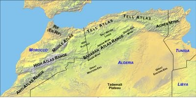
Saharan Atlas, Mountain range in northern Algeria.
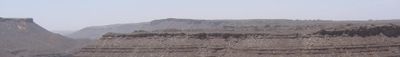
The Saharan Atlas is a mountain chain running across northern Africa, with its highest peak reaching about 2,236 meters. The range features steep slopes, broad plateaus, and numerous valleys that create varied landscapes throughout.
The mountains formed millions of years ago through tectonic activity deep beneath Earth's surface. This range became a natural divide that shaped travel and trade patterns across the region.
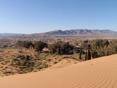
Berber communities live throughout the mountain villages, relying on farming and herding as their main activities in these high areas. Visitors can see how daily life is shaped by the steep terrain and the resources available there.
The best hiking season runs from late autumn through early spring, when temperatures are milder and trails are easier to navigate. Main entry points are the nearby towns of Laghouat and Bou-Saada, from where trails branch out to reach different parts.
The range creates a sharp climate boundary, with Mediterranean conditions on the north side and desert dryness on the south side. Visitors can witness these dramatic shifts in plant life and weather within a relatively short distance.
The community of curious travelers
AroundUs brings together thousands of curated places, local tips, and hidden gems, enriched daily by 60,000 contributors worldwide.