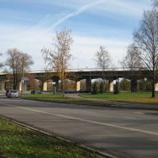
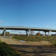
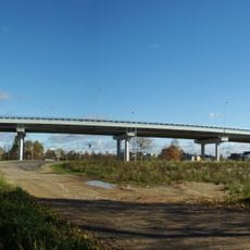
Ihaste sild, Road bridge in Tartu, Estonia
Ihaste Bridge is a concrete structure spanning the Emajõgi River with viewing platforms and stairways throughout its form. The construction connects different city areas while displaying a modern approach to river crossing design.
The bridge was designed and completed in the early 2010s as part of Tartu's urban development. This project represented an important moment in the region's modern infrastructure history.
Locals view the bridge as a modern landmark that shapes how they perceive their city. Visitors experience the architecture from multiple vantage points that define this location's character.
The bridge is accessible to pedestrians and cyclists with multiple paths to cross it. The best time to explore is during daylight when the viewing platforms and surroundings are clearly visible.
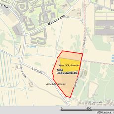
The bridge was specially constructed to minimize disturbance to surrounding protected natural areas during building. This construction method demonstrated how modern architecture could coexist with environmental protection.
The community of curious travelers
AroundUs brings together thousands of curated places, local tips, and hidden gems, enriched daily by 60,000 contributors worldwide.