Kharga Oasis, Desert oasis in Western Desert, Egypt
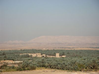
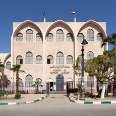
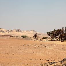
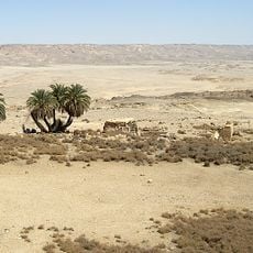
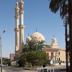
Kharga Oasis is a depression in the Western Desert of Egypt stretching across 160 kilometers (99 miles), irrigated by underground water. The capital Al-Kharga sits at its center, surrounded by smaller villages and agricultural zones.
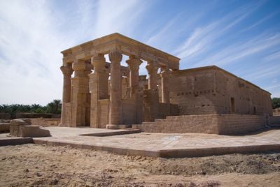
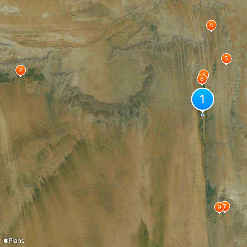
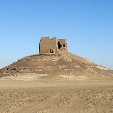
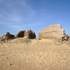
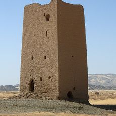
Persian rulers built early structures here, and later the Romans used the area as a waypoint on trade routes heading south. The Darb el Arbain, an old caravan trail, linked Egypt with Sudan for centuries.
The name comes from the ancient Egyptian word ḫꜣrgt, meaning outer land, referring to its remote location. Large date palms and agricultural plots around the settlements shape the rhythm of life here.
Buses link the area regularly with Aswan, Luxor and other western oases, and travel times are often long. Bringing water and sun protection is advisable, as the climate remains dry and hot.
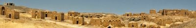
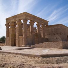
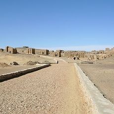
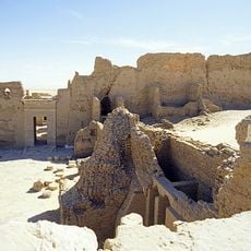
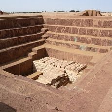
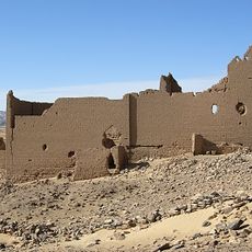
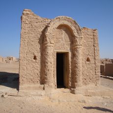
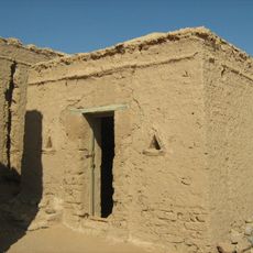
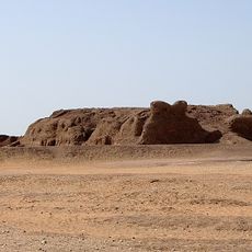
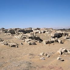
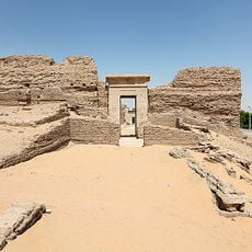
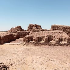
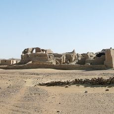
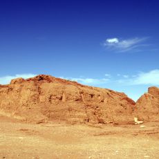
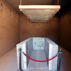
The ancient necropolis at Bagawat holds over 260 funeral chapels dating from the 4th to the 7th century with early Christian wall paintings. Many structures still stand upright, showing details of Coptic iconography and architecture.
Location: Al-Kharga
Elevation above the sea: 32 m
GPS coordinates: 25.25000,30.55000
Latest update: December 12, 2025 17:46
The deserts of the Middle East contain many places that see few visitors each year. This collection introduces historical sites, natural formations, and cultural landmarks spread across the region's sandy plains and rocky wilderness. From ancient ruins to geological features, these locations show...
Dakhla Oasis
142.3 km
Temple of Hibis
25.3 km
Bagawat Necropolis
26.2 km
Deir el-Munira
42.7 km
Museum of Alwady Algadid
23 km
Qasr Dush
76.5 km
Qasr al-Gibb
64.4 km
Ain Manawir
76.3 km
Mastaba of Khentika
132.2 km
Ain Mustafa Kashef
27.1 km
Ain Askar, Umm Mawagir
5.1 km
Halfat al-Bir
127.3 km
Ain Amur
71.8 km
Regional Research Center
22.4 km
Chapel of Peace
26.1 km
Chapel of Exodus
26.4 km
Qila' el-Dabba
132.2 km
Great Mosque
21.3 km
Gebel el-Teir, el-Kharga
29.7 km
Ain Birbiya
127.4 km
Tahunat Hawa
28.8 km
Qasr el-Zayyan
2.1 km
Mastaba of Ima-Pepi II
132.2 km
Church of Holy Virgin
23 km
Deir el-Bagawat
27.2 km
Egyptian Tourism Authority, New Valley office
23.2 km
Mastaba of Khentikau-Pepi
132.2 km
Tomb of Betju and Ideki
132.1 kmVisited this place? Tap the stars to rate it and share your experience / photos with the community! Try now! You can cancel it anytime.
Discover hidden gems everywhere you go!
From secret cafés to breathtaking viewpoints, skip the crowded tourist spots and find places that match your style. Our app makes it easy with voice search, smart filtering, route optimization, and insider tips from travelers worldwide. Download now for the complete mobile experience.
A unique approach to discovering new places❞
— Le Figaro
All the places worth exploring❞
— France Info
A tailor-made excursion in just a few clicks❞
— 20 Minutes