Robledo de Chavela

Log in to your account

AroundUs is a community-driven map of interesting places, built by curious explorers like you. It grows with every review, story, and photo you share.
Connect to save your favorite spots, contribute locations, and create personalized routes.
By continuing, you accept our Terms and Conditions and our Privacy Policy
Add to collection
Map
Suggest a change
Share

Robledo de Chavela, Mountain municipality in Sierra del Guadarrama, Spain

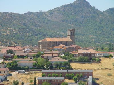
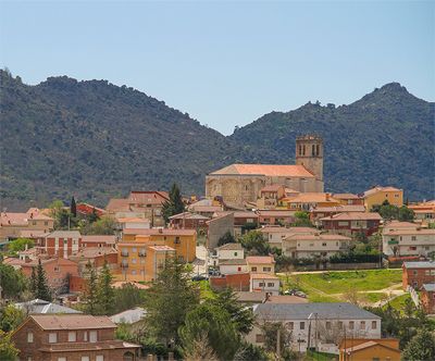
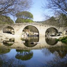
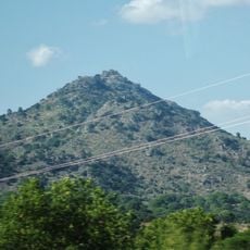
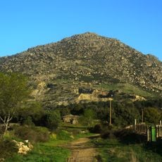
Robledo de Chavela is a mountain municipality in the Sierra del Guadarrama west of Madrid, sitting at roughly 900 meters elevation. The area spans several valleys and wooded slopes, with the Cofio River running through the landscape and shaping its water resources.

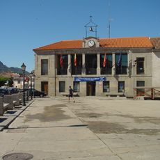
The settlement grew over centuries as a rural mountain community, maintaining its traditional character through agricultural and pastoral life. A major turning point came in 1968 when a dam was built on the Cofio River, transforming local infrastructure and water management systems.

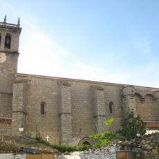
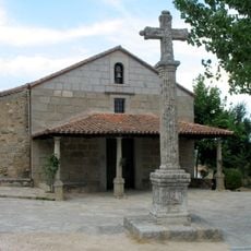
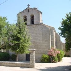
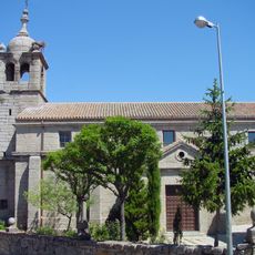
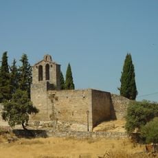
The name reflects its connection to the Chavela family, rooted in local heritage that shaped the settlement centuries ago. Walking through the village, you notice how traditional stone buildings cluster together in the mountain terrain, showing how residents have always adapted to their landscape.

The location is best reached by car due to its mountain position and limited public transport options. Plan extra time for the journey and be aware that mountain weather can affect road conditions, especially during autumn and winter months.

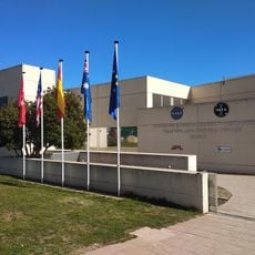
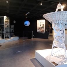
A major deep space communications facility for tracking space missions operates from this remote mountain location, connecting with spacecraft across the solar system. This advanced technology hub sits quietly hidden among the mountain valleys, creating an unexpected blend of rural landscape and cutting-edge space exploration infrastructure.

Location: Community of Madrid

Capital city: Robledo de Chavela

Elevation above the sea: 901 m

Part of: Mancomunidade de Concellos da Serra de Guadarrama, Mancomunitat de Serveis Socials de Sierra Oeste

Shares border with: Zarzalejo, El Escorial, Navalagamella, Fresnedillas de la Oliva, Colmenar del Arroyo, Navas del Rey, Cebreros, Valdemaqueda, Santa María de la Alameda

Website: http://robledodechavela.es

GPS coordinates: 40.49833,-4.23889

Latest update: December 7, 2025 09:23

Photos
Reviews

Visited this place? Tap the stars to rate it and share your experience / photos with the community! Try now! You can cancel it anytime.

« Robledo de Chavela - Mountain municipality in Sierra del Guadarrama, Spain » is provided by Around Us (aroundus.com). Images and texts are derived from Wikimedia project under a Creative Commons license. You are allowed to copy, distribute, and modify copies of this page, under the conditions set by the license, as long as this note is clearly visible.

Discover hidden gems everywhere you go!

From secret cafés to breathtaking viewpoints, skip the crowded tourist spots and find places that match your style. Our app makes it easy with voice search, smart filtering, route optimization, and insider tips from travelers worldwide. Download now for the complete mobile experience.

Around Us App Screenshot

A unique approach to discovering new places

Le Figaro

All the places worth exploring

France Info

A tailor-made excursion in just a few clicks

20 Minutes