Ayora, municipality in Spain
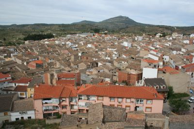
Ayora is a municipality in the Province of Valencia in southeastern Spain, situated in the Cofrentes-Ayora Valley. The town sits within a rural region known for vineyards and farmland, surrounded by rolling hills and traditional village architecture.
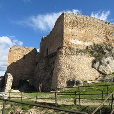
The town has roots in medieval settlement and developed as a rural community focused on agriculture and winemaking. The region experienced various historical periods that shaped the cultural and economic identity of the place.
The best time to visit is during the harvest season or in warmer months when the rural landscape is most active. Visitors should come prepared with good walking shoes and sun protection, as the area is mainly characterized by fields and open paths.
The community of curious travelers
AroundUs brings together thousands of curated places, local tips, and hidden gems, enriched daily by 60,000 contributors worldwide.