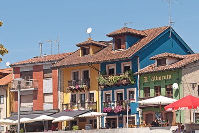
Pola de Siero, Industrial parish in north-central Asturias, Spain
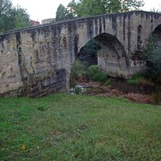
Pola de Siero is an industrial parish in central Asturias situated along the Nora River between Oviedo and Gijón, with the Cantabrian Mountains forming a natural boundary around the area. The town serves as a transportation hub connecting to major routes across the region.
King Alfonso X of Castile granted the town its charter in 1270 and established a weekly market in Plaza les Campes that continues to operate every Tuesday. This long-standing market reflects the enduring importance of trade to the settlement.
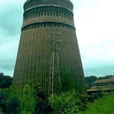
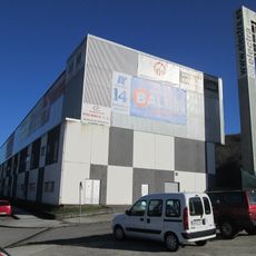
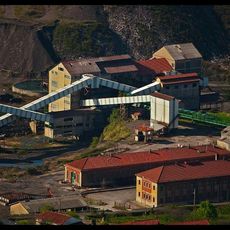
The town's identity centers on its meatpacking plants, breweries, and tanneries, which shape how people work and what they see when they move through the streets. These industries have defined the character of the place for generations and remain woven into daily life here.
The parish sits roughly 16 kilometers east of Oviedo and south of Gijón, providing convenient access to major transportation routes across Asturias. When exploring, be aware that the area is marked by industrial facilities, which helps orient your visit.
The municipality completely surrounds its neighboring town of Noreña except for a single connection point with Villaviciosa called La Peña de los Cuatro Jueces. This unusual geographical arrangement makes the boundary between the settlements visibly distinct on any map.
Location: Siero
Elevation above the sea: 213 m
Shares border with: Samartino, Celles / Ceis, La Carrera, Valdesoto, Santolaya de Vixil, Marcenao
GPS coordinates: 43.39122,-5.66099
Latest update: December 7, 2025 19:23
Estadio Ganzábal
10.2 km
Palace of Meres
7.5 km
San Pedro
9.7 km
Nitrastur factory, Langreo
9.3 km
Palace of the Tower of Celles
2.4 km
Palace of Valdesoto
2.8 km
Colloto Roman Bridge
10.4 km
Estadio El Bayu
757 m
Santuario de la Virgen del Remedio
8.7 km
Palace of Camposagrado (Langreo)
8.7 km
Santuario de la Virgen de la Salud
6.5 km
Palace of Martimporra
10.2 km
Puente atirantado del Nalón
10.5 km
Church of Santiago, Sariego
9.9 km
Church of San Martín
5.4 km
Church of Santa María de Narzana
7.4 km
Church of Santiago el Mayor
9.9 km
Mercado de La Felguera
9.5 km
Tower of Villa (Riaño)
8.7 km
Tower of San Julian
9.8 km
Church of Santa María Magdalena, La Rebollada
8.9 km
Biblioteca Pública Municipal de Carbayín - Fray Bernardo Martínez
5.2 km
Castillete del pozo n.º 3 de La Camocha
10.5 km
Castillete del pozo Mosquitera II
7.1 km
Biblioteca Pública Municipal de Lieres
7.2 km
Torre de extracción del pozo Candín I
8.8 km
Castillete del pozo Candín II
9.2 km
Torre de extracción del pozo Mosquitera I
6.7 kmVisited this place? Tap the stars to rate it and share your experience / photos with the community! Try now! You can cancel it anytime.
Discover hidden gems everywhere you go!
From secret cafés to breathtaking viewpoints, skip the crowded tourist spots and find places that match your style. Our app makes it easy with voice search, smart filtering, route optimization, and insider tips from travelers worldwide. Download now for the complete mobile experience.
A unique approach to discovering new places❞
— Le Figaro
All the places worth exploring❞
— France Info
A tailor-made excursion in just a few clicks❞
— 20 Minutes