Enable Location

We need your location to show you interesting places around you

Discover nearby places

Find interesting locations and hidden gems around you

Precise directions

Get accurate directions and distances to places

Your location is never shared with other users. It's only used when you tap the location button.

Saint-Julien-Chapteuil

Log in to your account

Start exploring — it's free

Trusted by 66,085 travelers worldwide

Continue with Google
Continue with Apple
or

We will send you a code to connect

By continuing, you accept our Terms and Conditions and our Privacy Policy

Check your inbox

We've sent a pincode in your inbox. Please enter the code below.

Saint-Julien-Chapteuil
Discussion Reviews 4 Photos
9.2k Popularity

Saint-Julien-Chapteuil, commune in Haute-Loire, France

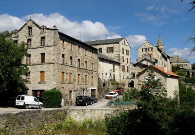
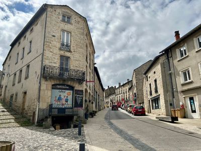
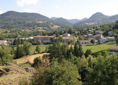
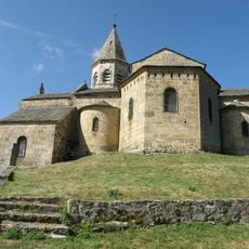
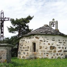
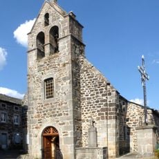
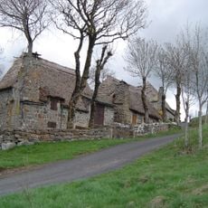
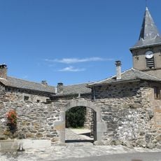
Saint-Julien-Chapteuil is a village in the Haute-Loire department, set on a hill with narrow lanes and stone houses topped with slate roofs. A Romanesque church stands at the highest point of the village and looks out over the rolling hills of the Meygal massif.

The village grew from a small farming community in the Middle Ages and gradually became a local hub for the hamlets around it. Over the centuries, the pilgrimage road to Santiago de Compostela passed through, shaping the way the village developed and how it related to passing travelers.

Saint-Julien-Chapteuil is the main town of its canton, which makes it a natural meeting point for people from the surrounding villages on market days. The central square fills with locals, and the rhythm of the day shifts noticeably as farmers, traders, and neighbors gather in an easy, unhurried way.

The village is easy to walk around, since the lanes are short and the stone buildings sit close together on the hillside. For those who want to go further, trails into the Meygal massif start near the village and are generally accessible to walkers of most levels.

The name of the village joins the dedication to Saint Julian with the word Chapteuil, which comes from the Latin for chief place or capital. This means the name itself quietly records the village's old role as the administrative center of the area, long before modern boundaries were drawn.

The community of curious travelers

AroundUs brings together thousands of curated places, local tips, and hidden gems, enriched daily by 60,000 contributors worldwide.

Start exploring
Location
Elevation above the sea
1,006 m
Shares border with
Champclause, Lantriac, Laussonne, Montusclat, Queyrières, Saint-Front, Saint-Germain-Laprade, Saint-Pierre-Eynac
Address
43260 Saint-Julien-Chapteuil, France
Phone
GPS coordinates
45.03472,4.06111
Latest update
March 3, 2026 08:19
Reviews
Share your experience

No review yet

Discussions
Start a discussion...

No discussion yet

« Saint-Julien-Chapteuil - commune in Haute-Loire, France » is provided by Around Us (aroundus.com). Images and texts are derived from Wikimedia project under a Creative Commons license. You are allowed to copy, distribute, and modify copies of this page, under the conditions set by the license, as long as this note is clearly visible.

Discover hidden gems everywhere you go!

From secret cafés to breathtaking viewpoints, skip the crowded tourist spots and find places that match your style. Our app makes it easy with voice search, smart filtering, route optimization, and insider tips from travelers worldwide. Download now for the complete mobile experience.

Around Us App Screenshot

A unique approach to discovering new places

Le Figaro

All the places worth exploring

France Info

A tailor-made excursion in just a few clicks

20 Minutes

Around Us
Travel Guide & Maps
Download

Send to your phone

QR Code
1

Open the camera app on your mobile.

2

Point at the QR code with your camera. A notification will appear.

3

Tap the notification to open the link.