Enable Location

We need your location to show you interesting places around you

Discover nearby places

Find interesting locations and hidden gems around you

Precise directions

Get accurate directions and distances to places

Your location is never shared with other users. It's only used when you tap the location button.

Sainte-Léocadie

Log in to your account

Start exploring — it's free

Trusted by 61,362 travelers worldwide

Continue with Google
Continue with Apple
or

We will send you a code to connect

By continuing, you accept our Terms and Conditions and our Privacy Policy

Check your inbox

We've sent a pincode in your inbox. Please enter the code below.

Sainte-Léocadie, Mountain commune in French Cerdagne, France

Description

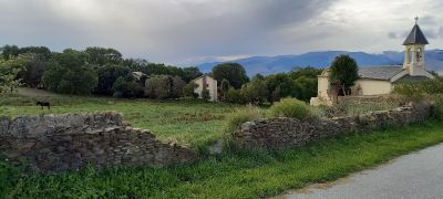
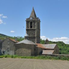
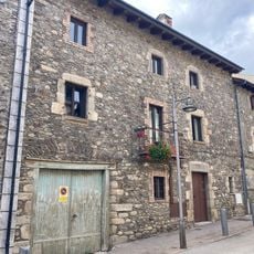
Sainte-Léocadie is a mountain village in French Cerdagne, situated on high terrain in the eastern Pyrenees. The settlement sits at elevations between roughly 1,200 and 2,000 meters and is surrounded by typical mountain landscapes.

History

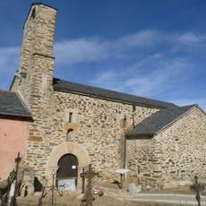
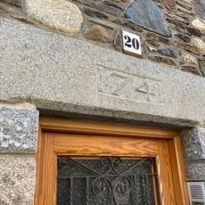
The settlement was first recorded in 839 as Darnacollecta and took its current name in 1034 when it became an ecclesiastical center. This change marked a shift in how the place was understood and used by people in the region.

Culture

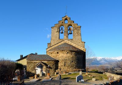
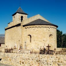
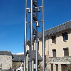
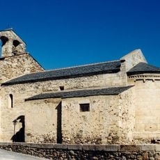
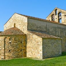
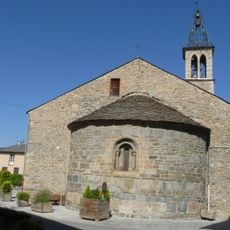
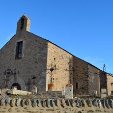
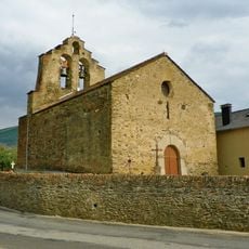
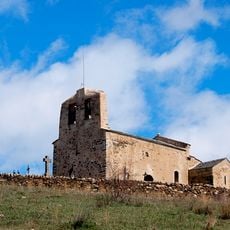
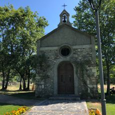
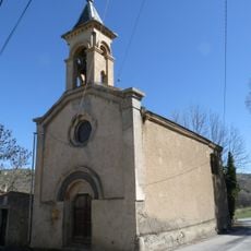
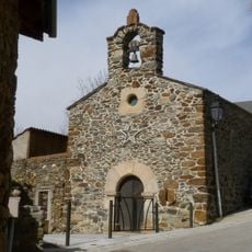
The village church displays architectural styles from different periods, featuring a bell wall that stands out as a distinctive element in the region. Walking inside, visitors can see how the building reflects changes made over centuries.

Practical

The village sits on sloped terrain, so visitors should be prepared for uneven ground and bring sturdy footwear. Spring and early autumn offer the most comfortable conditions for exploring.

Did you know?

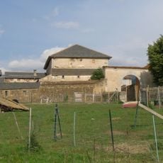
A local wine estate grows Europe's highest grapes at roughly 1,300 meters elevation and houses a museum with traditional farm tools from the area. The museum displays objects that show what daily farming life was like for people in Cerdagne over time.

Location
Elevation above the sea
1,420 m
Shares border with
Llívia, Saillagouse, Err, Osséja, Nahuja, Bourg-Madame
Address
66800 Sainte-Léocadie, France
Phone
GPS coordinates
42.43667,2.00333
Latest update
December 12, 2025 14:27

AroundUs brings together thousands of curated places, local tips, and hidden gems, enriched daily by 60,000 contributors worldwide. Discover all places nearby (French Cerdagne).

« Sainte-Léocadie - Mountain commune in French Cerdagne, France » is provided by Around Us (aroundus.com). Images and texts are derived from Wikimedia project under a Creative Commons license. You are allowed to copy, distribute, and modify copies of this page, under the conditions set by the license, as long as this note is clearly visible.

Discover hidden gems everywhere you go!

From secret cafés to breathtaking viewpoints, skip the crowded tourist spots and find places that match your style. Our app makes it easy with voice search, smart filtering, route optimization, and insider tips from travelers worldwide. Download now for the complete mobile experience.

Around Us App Screenshot

A unique approach to discovering new places

Le Figaro

All the places worth exploring

France Info

A tailor-made excursion in just a few clicks

20 Minutes

Around Us
Travel Guide & Maps
Download

Send to your phone

QR Code
1

Open the camera app on your mobile.

2

Point at the QR code with your camera. A notification will appear.

3

Tap the notification to open the link.