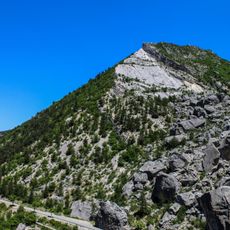
La Servelle, Mountain summit in Drôme region, France
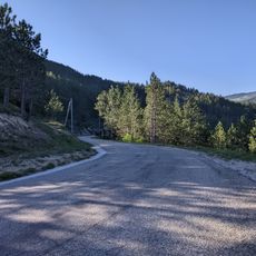
La Servelle is a mountain summit in the Drôme region rising to 965 meters, with varied terrain from base to top. Forests give way to boxwood-filled meadows, which then transition to alpine grasslands at the peak.
During World War II, the area around this summit was used for supply drops supporting resistance fighters in the Vercors region. The location served as a strategic point for liberation operations.
Shepherds in the area maintain a long-standing pastoral tradition, using the meadows to move their sheep and cattle herds according to the seasons.
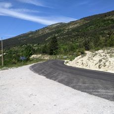
The hiking trail to the summit starts from Aucelon village, about 20 kilometers south of Saillans, with parking available near the town hall. Prepare for varying elevations and ground conditions, as the route passes through several landscape zones.
From the summit, visitors enjoy a complete circular view that stretches across several mountain ranges in the distance. The panorama includes sightlines to the Vercors cliffs, Oisans mountains, Dévoluy range, and Mont Ventoux.
Elevation above the sea: 965 m
GPS coordinates: 44.58917,5.34389
Latest update: December 15, 2025 13:25
Réserve naturelle régionale de la grotte des Sadoux
7.9 km
Église de Saint-Benoit-en-Diois
9.9 km
Le Saut de la Drôme
9.5 km
Chapelle du cimetière de Savel
7.8 km
Église de La Chaudière
11.2 km
Église Saint-Pierre de Bellegarde-en-Diois
8.8 km
Église Saint-Pierre de Chalancon
8.9 km
Église Saint-Pierre-ès-Liens de Pradelle
4.7 km
Église Notre-Dame de Gumiane
10.8 km
Église Saint-Pierre de Rochefourchat
7.7 km
Église Notre-Dame-de-la-Nativité de Volvent
3.3 km
Église Saint-André de Jonchères
5.2 km
Église Sainte-Anne de Montlaur-en-Diois
8.3 km
Église de la Sainte-Vierge de Luc-en-Diois
9 km
Pic de Luc
9.8 km
Église Saint-Nazaire-et-Saint-Celse de Saint-Nazaire-le-Désert
5.9 km
Viaduc du Claps
9 km
Temple de Luc-en-Diois
9.1 km
Temple de Poyols
6.2 km
Temple de Pennes-le-Sec
5.8 km
Chapelle Saint-Joseph de Saint-Nazaire-le-Désert
5.8 km
Chapelle Notre-Dame de l'Aribat
7.2 km
Col des Roustans
5.8 km
War memorial of Gumiane
10.8 km
Col de Tavard
5 kmScenic viewpoint
9.8 kmScenic viewpoint
6.7 kmScenic viewpoint
10.3 kmVisited this place? Tap the stars to rate it and share your experience / photos with the community! Try now! You can cancel it anytime.
Discover hidden gems everywhere you go!
From secret cafés to breathtaking viewpoints, skip the crowded tourist spots and find places that match your style. Our app makes it easy with voice search, smart filtering, route optimization, and insider tips from travelers worldwide. Download now for the complete mobile experience.
A unique approach to discovering new places❞
— Le Figaro
All the places worth exploring❞
— France Info
A tailor-made excursion in just a few clicks❞
— 20 Minutes