Fara San Martino

Log in to your account

AroundUs is a community-driven map of interesting places, built by curious explorers like you. It grows with every review, story, and photo you share.
Connect to save your favorite spots, contribute locations, and create personalized routes.
Continue with Google
Continue with Apple
Continue with X
Continue with Facebook
Continue with email
By continuing, you accept our Terms and Conditions and our Privacy Policy
Create an account
Add to collection
Map
Suggest a change
Share

Fara San Martino, Mountain commune in Province of Chieti, Italy.

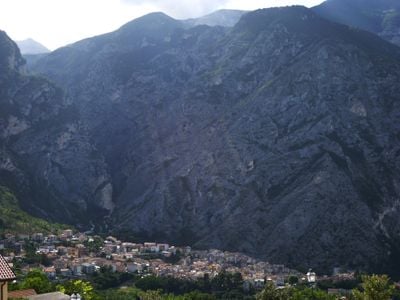
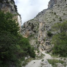
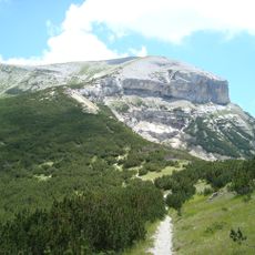
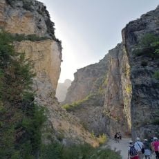
Fara San Martino is a commune in the hills of Chieti province, sitting at 440 meters elevation next to the Majella mountain range. The municipal territory spans 43 square kilometers and includes woodlands and the Fara San Martino-Palombaro Nature Reserve with its river springs.

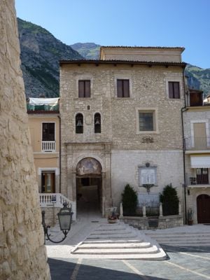
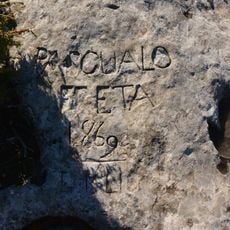
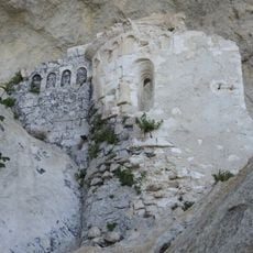
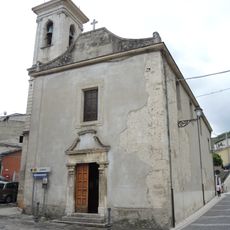
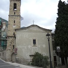
The settlement originates from Roman times, with Benedictine monks founding the monastery of St. Martino in Valle during the 10th century. These early establishments shaped the town's development as a religious and economic center.

The town has long been known for pasta production, with several factories using pure water from nearby springs for their work. This tradition shapes daily life and community identity today.

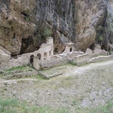
Visiting the nature reserve is possible via marked trails leading to the spring sources of the Verde river with walks of varying difficulty. The best time to explore is during warmer months when the paths are dry and easily accessible.

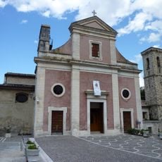
The Church of San Remigio contains a striking 17th-century painting by Tanzio da Varallo showing the region's religious art tradition. This work is a rare example of artistic connections between Abruzzo and the broader Italian art world.

Location: Province of Chieti

Capital city: Fara San Martino

Elevation above the sea: 440 m

Shares border with: Caramanico Terme, Lama dei Peligni, Palombaro, Pennapiedimonte, Sant'Eufemia a Maiella, Civitella Messer Raimondo, Pacentro

Website: http://comune.faranovarese.no.it

GPS coordinates: 42.09100,14.20620

Latest update: December 20, 2025 02:47

Photos
Cultural sites and natural areas in Abruzzo

Abruzzo brings together medieval villages, Roman sites, and mountain landscapes. Rocca Calascio rises to 1,460 meters (4,790 feet), offering views across the region from its ancient fortress walls. Gran Sasso and Majella national parks welcome hikers to explore trails through mountain terrain, where...

Reviews

Visited this place? Tap the stars to rate it and share your experience / photos with the community! Try now! You can cancel it anytime.

« Fara San Martino - Mountain commune in Province of Chieti, Italy » is provided by Around Us (aroundus.com). Images and texts are derived from Wikimedia project under a Creative Commons license. You are allowed to copy, distribute, and modify copies of this page, under the conditions set by the license, as long as this note is clearly visible.

Discover hidden gems everywhere you go!

From secret cafés to breathtaking viewpoints, skip the crowded tourist spots and find places that match your style. Our app makes it easy with voice search, smart filtering, route optimization, and insider tips from travelers worldwide. Download now for the complete mobile experience.

Around Us App Screenshot

A unique approach to discovering new places

Le Figaro

All the places worth exploring

France Info

A tailor-made excursion in just a few clicks

20 Minutes