·

Enable Location

We need your location to show you interesting places around you

Discover nearby places

Find interesting locations and hidden gems around you

Precise directions

Get accurate directions and distances to places

Your location is never shared with other users. It's only used when you tap the location button.

Bagnoregio

Log in to your account

Start exploring — it's free

Trusted by 62,668 travelers worldwide

Continue with Google
Continue with Apple
or

We will send you a code to connect

By continuing, you accept our Terms and Conditions and our Privacy Policy

Check your inbox

We've sent a pincode in your inbox. Please enter the code below.

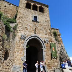
Bagnoregio, Medieval town in Province of Viterbo, Italy

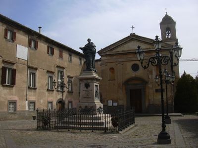
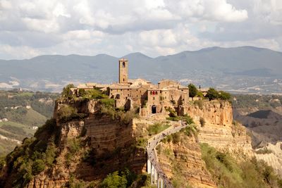
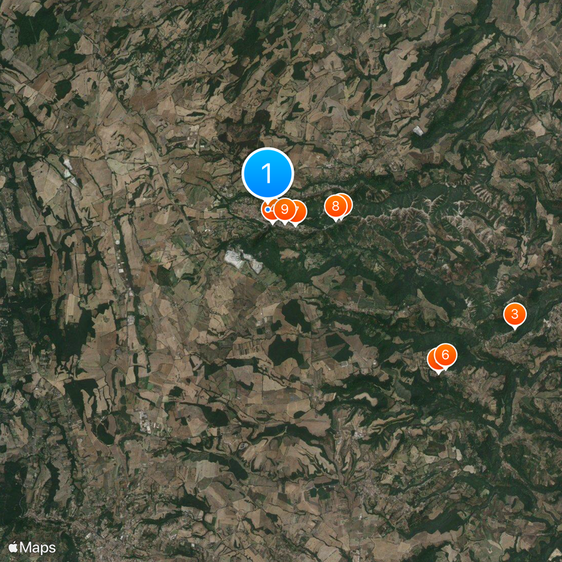
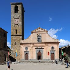
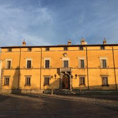
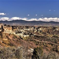
Bagnoregio is a municipality in the Province of Viterbo in Lazio, spreading across gentle hills and small valleys. The center sits at around 484 meters above sea level and includes several hamlets, among them Capraccia, Ponzano, and the world-famous Civita on its tufa rock.

The area became part of the Papal States in 822 when Emperor Louis I incorporated it into the Patrimonium Petri founded by Charlemagne. Over the centuries Civita faced danger from erosion while the municipal center shifted to more stable ground.

The name derives from Balneum Regis, referring to royal baths that once drew visitors. Today many know the town through its connection to Civita, the famous district perched on the tufa rock.

The municipality includes several scattered hamlets, so you need a vehicle to move between the different districts. It is best to start in the main town and then follow signs to the individual fractions.

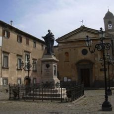
From the Civita district came Bonaventure, a Franciscan friar of the 13th century who numbered among the most important theologians of his time. His birthplace is believed to have stood in the small settlement before erosion destroyed many buildings.

The community of curious travelers

AroundUs brings together thousands of curated places, local tips, and hidden gems, enriched daily by 60,000 contributors worldwide.

Start exploring
Capital city
Bagnoregio
Elevation above the sea
484 m
Shares border with
Castiglione in Teverina, Celleno, Lubriano, Montefiascone, Viterbo, Bolsena, Civitella d'Agliano, Orvieto
GPS coordinates
42.63000,12.08917
Latest update
December 13, 2025 17:50
« Bagnoregio - Medieval town in Province of Viterbo, Italy » is provided by Around Us (aroundus.com). Images and texts are derived from Wikimedia project under a Creative Commons license. You are allowed to copy, distribute, and modify copies of this page, under the conditions set by the license, as long as this note is clearly visible.

Discover hidden gems everywhere you go!

From secret cafés to breathtaking viewpoints, skip the crowded tourist spots and find places that match your style. Our app makes it easy with voice search, smart filtering, route optimization, and insider tips from travelers worldwide. Download now for the complete mobile experience.

Around Us App Screenshot

A unique approach to discovering new places

Le Figaro

All the places worth exploring

France Info

A tailor-made excursion in just a few clicks

20 Minutes

Around Us
Travel Guide & Maps
Download

Send to your phone

QR Code
1

Open the camera app on your mobile.

2

Point at the QR code with your camera. A notification will appear.

3

Tap the notification to open the link.