·

Enable Location

We need your location to show you interesting places around you

Discover nearby places

Find interesting locations and hidden gems around you

Precise directions

Get accurate directions and distances to places

Your location is never shared with other users. It's only used when you tap the location button.

Kitahiroshima

Log in to your account

Start exploring — it's free

Trusted by 62,736 travelers worldwide

Continue with Google
Continue with Apple
or

We will send you a code to connect

By continuing, you accept our Terms and Conditions and our Privacy Policy

Check your inbox

We've sent a pincode in your inbox. Please enter the code below.

Kitahiroshima

Kitahiroshima, Mountain town in Yamagata district, Japan

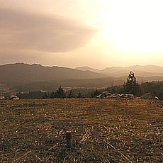
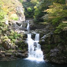
Kitahiroshima is a mountain town located across a large area in the Chugoku Mountains in north-central Hiroshima Prefecture. The region sits near the border with Shimane Prefecture and is shaped by forests and agricultural lands.

The town was created in 2005 through the merger of four separate municipalities in the Yamagata district. This consolidation brought together different communities under a single administrative structure.

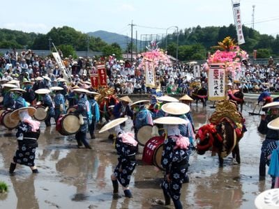
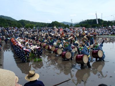
Traditional farming and forestry shape how people live and work in this mountain region. Local festivals throughout the year celebrate the connection between communities and their natural surroundings.

There are no railway connections in this area, but visitors can use the Chugoku Expressway and several national highways. These routes connect the region to neighboring areas and larger centers.

Heavy snowfall reaches this elevated area during winter months due to its mountain location. This creates opportunities for winter recreation and seasonal activities that many visitors find appealing.

The community of curious travelers

AroundUs brings together thousands of curated places, local tips, and hidden gems, enriched daily by 60,000 contributors worldwide.

Start exploring
Inception
February 1, 2005
Reference
343692
Shares border with
Hiroshima, Akitakata, Akiota, Masuda, Hamada, Ōnan
GPS coordinates
34.67456,132.53844
Latest update
December 17, 2025 10:08
« Kitahiroshima - Mountain town in Yamagata district, Japan » is provided by Around Us (aroundus.com). Images and texts are derived from Wikimedia project under a Creative Commons license. You are allowed to copy, distribute, and modify copies of this page, under the conditions set by the license, as long as this note is clearly visible.

Discover hidden gems everywhere you go!

From secret cafés to breathtaking viewpoints, skip the crowded tourist spots and find places that match your style. Our app makes it easy with voice search, smart filtering, route optimization, and insider tips from travelers worldwide. Download now for the complete mobile experience.

Around Us App Screenshot

A unique approach to discovering new places

Le Figaro

All the places worth exploring

France Info

A tailor-made excursion in just a few clicks

20 Minutes

Around Us
Travel Guide & Maps
Download

Send to your phone

QR Code
1

Open the camera app on your mobile.

2

Point at the QR code with your camera. A notification will appear.

3

Tap the notification to open the link.