Rotterdam Metro

Log in to your account

AroundUs is a community-driven map of interesting places, built by curious explorers like you. It grows with every review, story, and photo you share.
Connect to save your favorite spots, contribute locations, and create personalized routes.
Continue with Google
Continue with Apple
Continue with X
Continue with Facebook
Continue with email
By continuing, you accept our Terms and Conditions and our Privacy Policy
Create an account

Rotterdam Metro

Add to collection
Map
Suggest a change
Share

Rotterdam Metro, Rapid transit system in Rotterdam, Netherlands

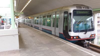
Rotterdam Metro is a rapid transit system in Rotterdam, Netherlands, spanning five lines and 71 stations across more than 100 kilometers. The network connects the city center with surrounding suburbs, the harbor area, and reaches as far as The Hague.

Service began on February 9, 1968, with a route of just under 6 kilometers between the central station and Zuidplein, giving the Netherlands its first rapid transit system. Over the following decades, the network grew steadily by connecting new suburbs and integrating tram lines into the rail system.

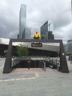
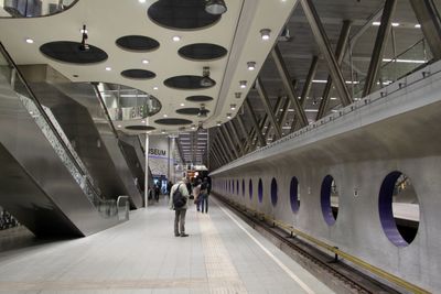
The network has grown steadily since the 1960s and now forms the backbone of urban transport, linking residential neighborhoods directly to office towers, shopping streets, and the port. Many stations serve as transfer points between buses, trams, and trains, making the lines a main artery in the daily life of commuters.

Travelers can use OV-chipkaart cards, credit or debit cards at gates, or buy single tickets from machines at stations. Most trains run every few minutes during the day, with reduced frequency in the evenings and on weekends.

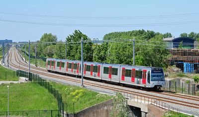
Some lines switch between underground tunnels and above-ground sections within the same journey, so passengers suddenly see daylight and street scenes. This combination arose from the gradual conversion of old tram routes into modern light rail connections.

Location: Rotterdam

Inception: February 9, 1968

Official opening: February 9, 1968

Part of: transports en commun de Rotterdam

Website: https://ret.nl/en.html

GPS coordinates: 51.92000,4.48000

Latest update: December 14, 2025 17:22

Photos
Rotterdam attractions: architecture, museums, parks

Rotterdam showcases a diverse collection of tourist attractions that reflect the city's transformation into a modern European metropolis. The rebuilt city center features contemporary architectural landmarks such as the Cube Houses, the Erasmus Bridge spanning the Nieuwe Maas river, and the Euromast...

Reviews

Visited this place? Tap the stars to rate it and share your experience / photos with the community! Try now! You can cancel it anytime.

« Rotterdam Metro - Rapid transit system in Rotterdam, Netherlands » is provided by Around Us (aroundus.com). Images and texts are derived from Wikimedia project under a Creative Commons license. You are allowed to copy, distribute, and modify copies of this page, under the conditions set by the license, as long as this note is clearly visible.

Discover hidden gems everywhere you go!

From secret cafés to breathtaking viewpoints, skip the crowded tourist spots and find places that match your style. Our app makes it easy with voice search, smart filtering, route optimization, and insider tips from travelers worldwide. Download now for the complete mobile experience.

Around Us App Screenshot

A unique approach to discovering new places

Le Figaro

All the places worth exploring

France Info

A tailor-made excursion in just a few clicks

20 Minutes