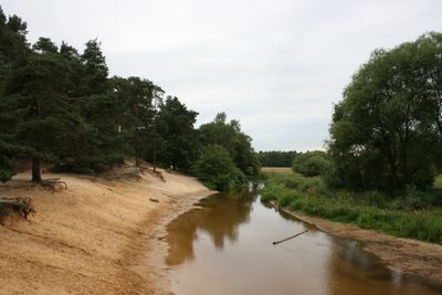
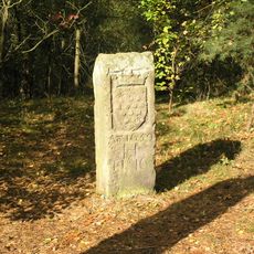
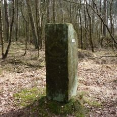
Lutterzand, Nature area with sand dunes and river banks in Twente, Netherlands
Lutterzand is a 750-hectare nature reserve in Twente featuring pine forests, heathlands, and sand dunes shaped by natural processes. The Dinkel River cuts through the landscape, constantly reshaping steep riverbanks through erosion.
In the 1700s, shifting sands buried productive farmland, prompting authorities to allow sheep herding along the Dinkel to control sand movement. This strategy helped stabilize the area and shaped its long-term development.
The name reflects the sandy landscape that has shaped local identity for generations. Visitors notice how the sand formations remain central to how people experience and move through this environment today.
The area has well-marked hiking and cycling trails of varying difficulty levels throughout. Two restaurants and a campsite with vacation cottages serve visitors, and designated swimming areas are available along the river.
Eroding riverbanks create nesting sites for sand martins and kingfishers, birds that adapt to the constantly shifting steep banks. Juniper shrubs thrive across the protected dunes, a plant growth pattern that is uncommon in Dutch landscapes.
GPS coordinates: 52.33360,7.02917
Latest update: December 14, 2025 09:47
Saint Nicholas Church
4.9 kmArboretum Poort-Bulten
4.2 km
Borgbeuningen
4.4 km
St. Nikolaus-Kirche
4.9 km
Erve Olde Möllink
1.4 km
Sint-Nicolaaskerk
4.9 km
Austiebergweg 2, Beuningen
3 km
De Boschkamp, De Lutte
4.4 km
Paandersdijk 10, Beuningen
3.1 km
Mensmanweg 1, Beuningen
2.8 km
Hanhofweg 22, De Lutte
1.9 km
Saksische houten wagenschuur onder rieten zadeldak
4.6 km
Aardappelkelder
1.1 km
Molterheurneweg 6, De Lutte
1.2 km
Kerkplein 2, Denekamp
4.8 km
Grenspaal nr 18
2.6 km
Grenspaal nr 24, bij boerderij haarjan-beuningerveld
3.5 km
Grenspaal nr 20
2.1 km
Grenspaal 16
3.5 km
Pastorie St. Nicolaaskerk
4.8 km
Boerderij van het hallehuistype met krimp onder met rode hollandse pannen gedekt zadeldak
3.2 km
Grenspaal 23
2.7 km
Borgbeuningen, Beuningen
4.4 km
Grenspaal nr 25 van Bentheimerzandsteen, voorzien van renaissanceschild met Andreaskruis en vuurslag (wapen der Bourgondische gewesten)
3.7 km
Vrijstaande schuur
3.2 km
Landgoed Austie: schuur
3.1 km
Geallieerd erehof
3.6 km
Monument voor Geallieerde Vliegers
569 mVisited this place? Tap the stars to rate it and share your experience / photos with the community! Try now! You can cancel it anytime.
Discover hidden gems everywhere you go!
From secret cafés to breathtaking viewpoints, skip the crowded tourist spots and find places that match your style. Our app makes it easy with voice search, smart filtering, route optimization, and insider tips from travelers worldwide. Download now for the complete mobile experience.
A unique approach to discovering new places❞
— Le Figaro
All the places worth exploring❞
— France Info
A tailor-made excursion in just a few clicks❞
— 20 Minutes