Międzygórz, Village in Świętokrzyskie, Poland.
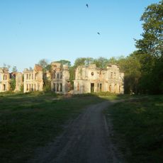
Międzygórz is a village in Świętokrzyskie Voivodeship in south-central Poland, set among rolling hills with fields and forests. The settlement consists of scattered farmhouses and dwellings spread along local roads that reflect the rural character of the region.
The village developed from agricultural settlement roots and became part of Gmina Lipnik, with a history spanning centuries of rural growth. Its structure and function were shaped by the gradual changes typical of Polish village communities over time.
The village is rooted in rural traditions, where residents maintain farming practices and handicrafts passed down through generations. These customs shape how people work the land and organize daily life in this agricultural community.
The village connects to nearby communities through local roads, with the nearest larger town accessible by vehicle. Visitors should plan to use their own transportation, as the location requires travel along rural routes that may be unpaved.
The settlement sits where two different landscape types of the region meet, with flatter farmland gradually giving way to more wooded hills. This location makes it an interesting point to experience both landscape characters within a short distance.
Location: Gmina Lipnik
GPS coordinates: 50.73917,21.53944
Latest update: December 10, 2025 16:22
Ossolin Castle
7.5 km
Karski Palace in Włostów
7 km
Dungeons under Opatów
10.7 km
Miedzygorz Castle
711 m
Podziemna trasa turystyczna
10.7 km
Opatów Town Hall
10.5 km
Cmentarz parafialny w Goźlicach
6.6 km
Grave of Ludwik Zwierzdowski
10.8 km
Jewish cemetery in Opatów
10.3 km
Church of SS. Peter and Paul in Obrazów
9.6 km
Cemetery in Obrazów
9.9 km
Oficyna pałacowa (ruina)
7 km
Church of the Assumption in Goźlice
6.4 km
Church of Saint John the Baptist in Włostów
7 km
Parish cemetery in Jankowice Kościelne
7.5 km
Saints Catherine and Stanislaus church in Kleczanów
3.3 km
Pozostałości murów obronnych
10.8 km
Underground Chapel in Ossolin
6.9 km
Tudorów Castle
6.9 km
Zespół kościoła św. św. Piotra i Pawła, lata 1760-1767
9.5 km
Urban layout of Opatów
10.7 km
Zbór ariański (lamus), poł. XIX w.
7 km
Parish cemetery in Włostów
7.3 km
Zespół kościoła św. Jana Chrzciciela we Włostowie
7 km
Zespół kaplicy podziemnej Grobu Chrystusa
6.9 km
Figura Matki Boskiej z Dzieciątkiem
7 km
Zespół kościoła św. Katarzyny i św. Stanisława Kostki w Kleczanowie
3.3 km
Brama główna z lwami
6.9 kmVisited this place? Tap the stars to rate it and share your experience / photos with the community! Try now! You can cancel it anytime.
Discover hidden gems everywhere you go!
From secret cafés to breathtaking viewpoints, skip the crowded tourist spots and find places that match your style. Our app makes it easy with voice search, smart filtering, route optimization, and insider tips from travelers worldwide. Download now for the complete mobile experience.
A unique approach to discovering new places❞
— Le Figaro
All the places worth exploring❞
— France Info
A tailor-made excursion in just a few clicks❞
— 20 Minutes