Obora
Location: Rajgród
Inception: 19 century
Part of: Zespół dworski, Opartowo 2 w Rajgrodzie
GPS coordinates: 53.73525,22.66851
Latest update: October 27, 2025 09:46
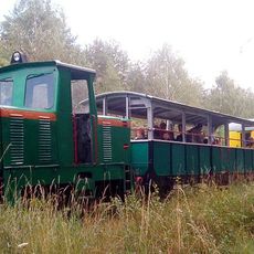
Ełcka Kolej Wąskotorowa
9 km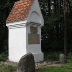
Boundary marker in Bogusze
15.2 km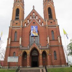
Church of the Nativity of the Virgin Mary in Rajgród
2 km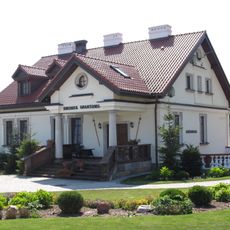
Opartowo manor in Rajgród
29 m
Exaltation of the Holy Cross church in Ostrykół
16.1 km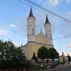
Exaltation of the Holy Cross church in Bargłów Kościelny
10.6 km
Church of the Assumption in Kalinowo
15.4 km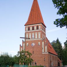
Our Lady Queen of Poland church in Pisanica
11.5 km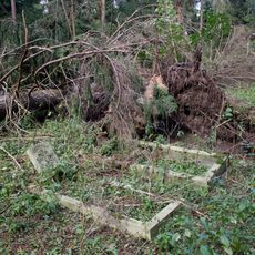
Cemetery in Grądzkie Ełckie
12.6 km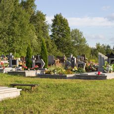
Cmentarz ewangelicki w Romanowie
10.8 km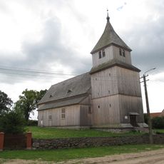
Kościół ewangelicki, ob. rzym.-kat. Podwyższenia Krzyża
16.1 km
Folwark
2.4 km
Scenic viewpoint
15.3 km
Old Catholic cemetry. Chapel.
2.1 km
Cmentarz parafialny
11 km
Kościół pw. Świętego Wojciecha
9.3 km
Park poddworski
2.5 km
Scenic viewpoint
7 km
Góra zamkowa
1.2 km
Platforma widokowa
15 km
Dworek Opartowo
77 m
Scenic viewpoint
15.3 km
Scenic viewpoint
15.3 km
Scenic viewpoint
15.3 km
Scenic viewpoint
1.5 km
Scenic viewpoint
1.5 km
Scenic viewpoint
1.1 km
Kościół pw. Podwyższenia Krzyża Świętego
10.6 kmReviews
Visited this place? Tap the stars to rate it and share your experience / photos with the community! Try now! You can cancel it anytime.
Discover hidden gems everywhere you go!
From secret cafés to breathtaking viewpoints, skip the crowded tourist spots and find places that match your style. Our app makes it easy with voice search, smart filtering, route optimization, and insider tips from travelers worldwide. Download now for the complete mobile experience.

A unique approach to discovering new places❞
— Le Figaro
All the places worth exploring❞
— France Info
A tailor-made excursion in just a few clicks❞
— 20 Minutes