Boundary marker in Bogusze, Political border monument in Bogusze, Poland
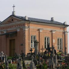
The boundary marker in Bogusze is a brick, plastered structure about 6 metres tall with a red tiled roof, resembling a small chapel. It stands on a nearly square plan (1.75 m by 1.80 m) with a high base, profiled cornices, a triangular gable and a gabled roof. Copies of the coats of arms of Prussia and Lithuania and a rectangular inscription plaque are on the front wall.
The stone was established around 1545 to mark where three powers met: the Grand Duchy of Lithuania, the Duchy of Prussia, and the Kingdom of Poland. This location documents an important example of the complex political boundaries of early modern Eastern Europe.
The monument was entered in the Polish register of monuments in December 1964 under number 202, and again on 13 February 1979 under number 11. Its German name, "Ostrokollnische Grenzsäule", recalls the nearby settlement of Ostrokół. The Latin inscription on the east wall and the copied coats of arms of Lithuania and Ducal Prussia are the details to look for.
The boundary marker is located in the Gmina Prostki area in Ełk County and can be reached on foot. There are no special visitor facilities at the site, so coming prepared for the countryside environment is advisable.
The marker represents one of the few remaining physical structures that demonstrate the territorial divisions of 16th-century Eastern European states.
The community of curious travelers
AroundUs brings together thousands of curated places, local tips, and hidden gems, enriched daily by 93,125 contributors worldwide.