Tarnowskie Góry Lead-Silver-Zinc Mine and its Underground Water Management System
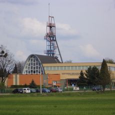
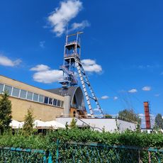
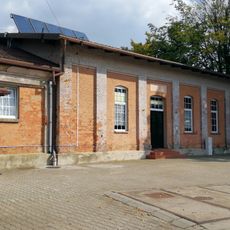
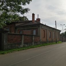
Tarnowskie Góry Lead-Silver-Zinc Mine and its Underground Water Management System, Underground mining complex in Tarnowskie Góry, Poland
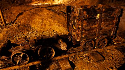
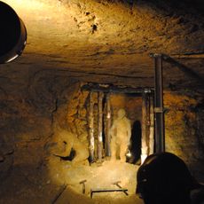
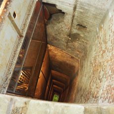
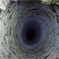
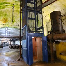
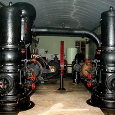
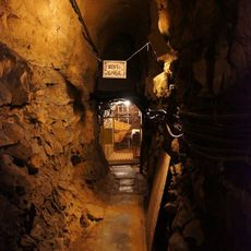
Tarnowskie Góry is an underground mining complex with roughly 150 kilometers of passages designed for extracting ore and managing water through a network of tunnels and shafts. The site includes mining chambers, drainage systems, and storage areas that operated together as a single industrial system.
Lead ore was discovered in 1526, starting centuries of mining that brought steady technological improvements to the region. The site continued expanding and being refined until ore extraction finally stopped in the 20th century.
The mine reflects how knowledge about mining techniques spread across Europe through workers who moved between Poland, Germany, Bohemia, Hungary, and Britain. Local people today view this place as a symbol of their ancestors' skill and hard work.
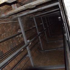
Visitors can explore about 1.7 kilometers (just over 1 mile) of tunnels through guided tours, including a 270-meter (885-foot) boat ride through flooded sections. Wear sturdy shoes, as underground passages are narrow and slippery in places.
The water management system built roughly two centuries ago continues working today and supplies drinking water to local residents. Few historical engineering systems remain this functional after so much time.
Location: Tarnowskie Góry
GPS coordinates: 50.44270,18.85123
Latest update: December 7, 2025 20:21
Historic Silver Mine in Tarnowskie Góry
1.8 km
Water wheel
1.9 km
The Friedrich Mine Washing Tip in Tarnowskie Góry
3 km
Skansen Maszyn Parowych
1.8 km
Kunszt Park in Tarnowskie Góry
1.9 km
Piny Park in Tarnowskie Góry
1.2 km
Chapel in Bobrowniki Śląskie
2.4 km
Tarnowskie Góry – Bytom Underground Workings
2.1 km
Jewish cemetery in Tarnowskie Góry
708 m
Adolph Shaft
2.5 km
Bohr Shaft
2.7 km
Heinitz Shaft
1.9 km
Machine Shaft
2.5 km
Adolph and Machine Shafts
2.5 km
3 podziemne hale: „A” (1883-1884), „B” (1902-1903), „C” (1902-1903)
2.5 km
God Bless Shaft
1.7 km
Adolph Shaft Waterworks
2.5 km
Budynek rozdzielni elektrycznej NN
2.5 km
Budynek warsztatowo-magazynowy
2.5 km
Budynek łaźni
2.5 km
Reden Shaft
1.1 km
Angel Shaft
1.9 km
Viper Shaft
2 km
Teren dawnej bocznicy kolejowej
2.4 km
Folwark Segiet
2.6 km
Chapel on Grundmann Shaft in Tarnowskie Góry-Bobrowniki
2.4 km
Ogrodzenie od strony północnej, zachodniej i wschodniej (mur)
2.5 km
Portiernia
2.5 kmVisited this place? Tap the stars to rate it and share your experience / photos with the community! Try now! You can cancel it anytime.
Discover hidden gems everywhere you go!
From secret cafés to breathtaking viewpoints, skip the crowded tourist spots and find places that match your style. Our app makes it easy with voice search, smart filtering, route optimization, and insider tips from travelers worldwide. Download now for the complete mobile experience.
A unique approach to discovering new places❞
— Le Figaro
All the places worth exploring❞
— France Info
A tailor-made excursion in just a few clicks❞
— 20 Minutes