Enable Location

We need your location to show you interesting places around you

Discover nearby places

Find interesting locations and hidden gems around you

Precise directions

Get accurate directions and distances to places

Your location is never shared with other users. It's only used when you tap the location button.

Skały Kroczyckie

Log in to your account

Start exploring — it's free

Trusted by 63,502 travelers worldwide

Continue with Google
Continue with Apple
or

We will send you a code to connect

By continuing, you accept our Terms and Conditions and our Privacy Policy

Check your inbox

We've sent a pincode in your inbox. Please enter the code below.

Skały Kroczyckie
Discussion Reviews 1 Photos
1.1k Popularity

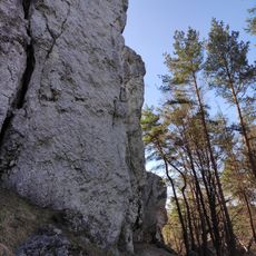
Skały Kroczyckie, mountain

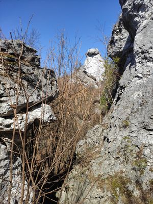
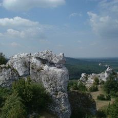
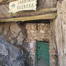
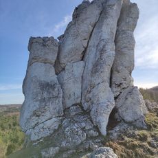
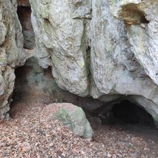
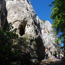
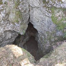
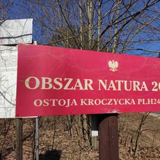
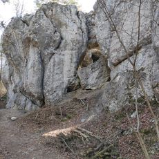
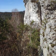
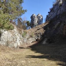
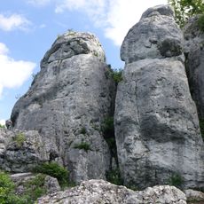
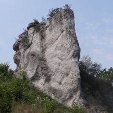
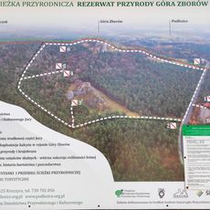
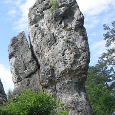
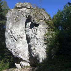
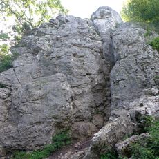
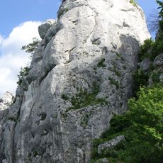
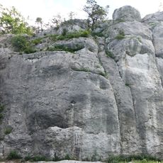
Skały Kroczyckie is a series of limestone hills in the middle of the Jura region that stretch across several kilometers and take their name from the nearby town of Kroczyce. The highest point, Góra Zborów, rises to 462 meters and contains unusual rock formations along with the accessible cave Jaskinia Głęboka within a protected nature reserve.

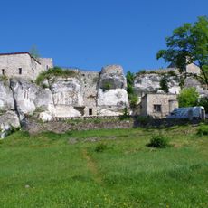
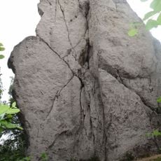
These hills formed as part of the Krakowsko-Czestochowska Jura over millions of years through geological processes that created limestone layers. Medieval castles were later built on these rocky outcrops, and their ruins remain visible today, telling the story of defensive settlements in the region.

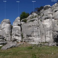
The rock formations carry local names like Młynarz, Wielbłąd, and Zakonnica, many inspired by their resemblance to animals or figures, reflecting how people have understood this landscape for generations. Visitors notice these names on trails and connect them with the unusual stone shapes that define the area.

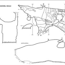
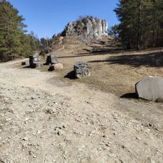
The area is crossed by marked trails offering various difficulty levels and connecting climbing routes throughout the region. Visitors should wear sturdy footwear and be aware that paths run along cliffs and across gentle slopes, which can become slippery during wet weather.

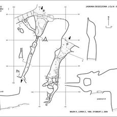
The cave Jaskinia Głęboka is embedded within the rocks and displays underground structures formed by natural processes over thousands of years. This hidden world beneath the hills offers visitors an unexpected glimpse into geological processes that make the surface formations even more intriguing.

The community of curious travelers

AroundUs brings together thousands of curated places, local tips, and hidden gems, enriched daily by 60,000 contributors worldwide.

Start exploring
GPS coordinates
50.57346,19.52995
Latest update
February 9, 2026 11:07
Reviews
Share your experience

No review yet

Discussions
Start a discussion...

No discussion yet

« Skały Kroczyckie - mountain » is provided by Around Us (aroundus.com). Images and texts are derived from Wikimedia project under a Creative Commons license. You are allowed to copy, distribute, and modify copies of this page, under the conditions set by the license, as long as this note is clearly visible.

Discover hidden gems everywhere you go!

From secret cafés to breathtaking viewpoints, skip the crowded tourist spots and find places that match your style. Our app makes it easy with voice search, smart filtering, route optimization, and insider tips from travelers worldwide. Download now for the complete mobile experience.

Around Us App Screenshot

A unique approach to discovering new places

Le Figaro

All the places worth exploring

France Info

A tailor-made excursion in just a few clicks

20 Minutes

Around Us
Travel Guide & Maps
Download

Send to your phone

QR Code
1

Open the camera app on your mobile.

2

Point at the QR code with your camera. A notification will appear.

3

Tap the notification to open the link.