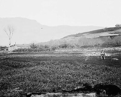
Dothan, Archaeological site near Jenin, Palestine
Dothan is an archaeological mound in northern Palestine containing layers of settlement spanning thousands of years of human habitation. The site reveals remains from nineteen distinct periods of occupation, beginning with the Early Bronze Age and extending through later medieval times.
Settlement at the location began in the Early Bronze Age and continued through many centuries as successive empires and peoples left their mark. In the medieval period, Crusaders built a tower on the mound, indicating the site retained strategic importance in later times.
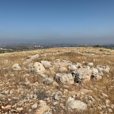
The site holds significance in biblical narratives and reveals layers of settlement from multiple ancient cultures that coexisted and succeeded one another across millennia. Walking through the mound, visitors encounter tangible remains from Canaanite and Israelite periods that illustrate how different peoples shaped this location.
The location sits at a junction of historic trade routes connecting northern and southern regions of the broader territory. Visiting requires no special preparations, though sturdy shoes and sufficient water are advisable since the surroundings are open and largely undeveloped.
A Crusader tower called Castellum Belismum was built around 1156 on the ancient mound, showing the site remained strategically valued long after antiquity. This medieval fortification overlaid the ancient ruins, creating an unusual connection between different time periods at a single location.
The community of curious travelers
AroundUs brings together thousands of curated places, local tips, and hidden gems, enriched daily by 60,000 contributors worldwide.