·

Enable Location

We need your location to show you interesting places around you

Discover nearby places

Find interesting locations and hidden gems around you

Precise directions

Get accurate directions and distances to places

Your location is never shared with other users. It's only used when you tap the location button.

Seliger

Log in to your account

Start exploring — it's free

Trusted by 62,645 travelers worldwide

Continue with Google
Continue with Apple
or

We will send you a code to connect

By continuing, you accept our Terms and Conditions and our Privacy Policy

Check your inbox

We've sent a pincode in your inbox. Please enter the code below.

Seliger, Protected lake system in Tver Oblast, Russia.

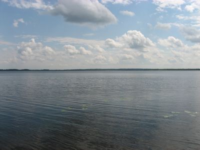
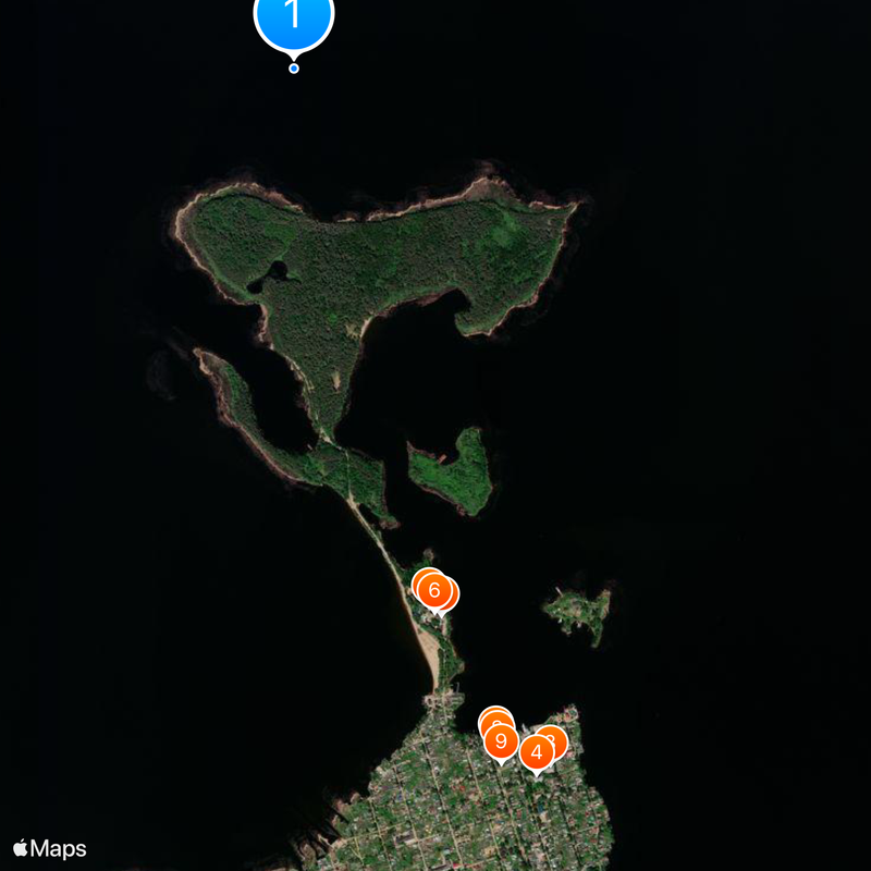
Seliger is a protected lake system in Tver Oblast and Novgorod Oblast, containing more than 160 islands and forming interconnected bodies of water linked by narrow channels. The entire system spreads across the Valdai Hills and shows a heavily indented shoreline with numerous bays and shallow sections.

The lake landscape formed during the Ice Age, when glaciers shaped the hilly topography of the region and left behind interconnected basins. For centuries, the water body served as a trade route between the northern and central areas of Russia.

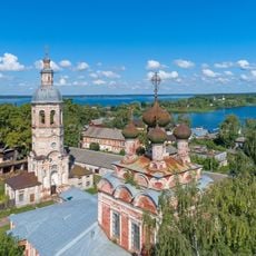
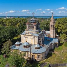
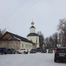
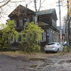
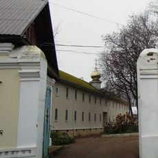
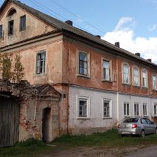
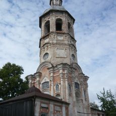
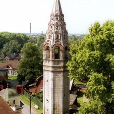
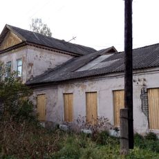
The Nilo-Stolobensky Monastery on Stolobny Island represents a significant religious center that has influenced the spiritual development of the Tver region since 1594.

The shoreline areas are surrounded by pine forests that offer opportunities for mushroom and berry picking during summer and autumn. The water is home to around 30 fish species, making different fishing spots along the coast accessible.

Local fishermen use traditional boats called seligerka, constructed with high sides and raised ends to meet the waves and changing conditions of the lake system. These special watercraft show a centuries-old adaptation to the local waters.

The community of curious travelers

AroundUs brings together thousands of curated places, local tips, and hidden gems, enriched daily by 60,000 contributors worldwide.

Start exploring
Location
Location
Elevation above the sea
205 m
GPS coordinates
57.18900,33.08333
Latest update
December 12, 2025 22:09
Around this place
Zhitenny Smolensky Monastery
Russian Federation

Zhitenny Smolensky Monastery

2.4 km
Category:Holy Trinity Cathedral, Ostashkov
Russian Federation

Category:Holy Trinity Cathedral, Ostashkov

3.3 km
Church of the Resurrection of Christ, Ostashkov
Russian Federation

Church of the Resurrection of Christ, Ostashkov

3.3 km
Надвратная церковь Иоанна Богослова и Андрея Первозванного с настоятельскими кельями (Осташков)
Russian Federation

Надвратная церковь Иоанна Богослова и Андрея Первозванного с настоятельскими кельями (Осташков)

2.5 km
Smolensky Cathedral of Zhitenny Smolensky Monastery
Russian Federation

Smolensky Cathedral of Zhitenny Smolensky Monastery

2.5 km
Жилой дом (Осташков)
Russian Federation

Жилой дом (Осташков)

3.1 km
Жилой дом (Осташков)
Russian Federation

Жилой дом (Осташков)

3.1 km
Жилой дом (Осташков)
Russian Federation

Жилой дом (Осташков)

3.2 km
Konstantin Zaslonov memorial stone, Ostashkov
Russian Federation

Konstantin Zaslonov memorial stone, Ostashkov

3.1 km
Жилой дом (Осташков)
Russian Federation

Жилой дом (Осташков)

3.1 km
Жилой дом (Осташков)
Russian Federation

Жилой дом (Осташков)

3.2 km
Жилой дом (Осташков)
Russian Federation

Жилой дом (Осташков)

3.1 km
Главный дом (Осташков)
Russian Federation

Главный дом (Осташков)

3.3 km
Жилой дом (Осташков)
Russian Federation

Жилой дом (Осташков)

3.3 km
Жилой дом (Осташков)
Russian Federation

Жилой дом (Осташков)

3.2 km
Pechatnikova street, 5 (Ostashkov)
Russian Federation

Pechatnikova street, 5 (Ostashkov)

3.3 km
Жилой дом (Осташков)
Russian Federation

Жилой дом (Осташков)

3.3 km
Жилой дом (Осташков)
Russian Federation

Жилой дом (Осташков)

2.9 km
Жилой дом (Воронского) (Осташков)
Russian Federation

Жилой дом (Воронского) (Осташков)

3 km
Братский корпус (Осташков)
Russian Federation

Братский корпус (Осташков)

2.5 km
Жилой дом (Осташков)
Russian Federation

Жилой дом (Осташков)

3.3 km
Жилой дом (Осташков)
Russian Federation

Жилой дом (Осташков)

3.4 km
Жилой дом и ворота (двое) (Осташков)
Russian Federation

Жилой дом и ворота (двое) (Осташков)

3.2 km
Metochion of Nilo-Stolobensky monastery, Ostashkov
Russian Federation

Metochion of Nilo-Stolobensky monastery, Ostashkov

3.2 km
Братская могила советских воинов, умерших от ран в госпиталях (Осташков)
Russian Federation

Братская могила советских воинов, умерших от ран в госпиталях (Осташков)

2.3 km
Bell tower of Holy Trinity Cathedral, Ostashkov
Russian Federation

Bell tower of Holy Trinity Cathedral, Ostashkov

3.3 km
Bell tower of the Resurrection of Christ church, Ostashkov
Russian Federation

Bell tower of the Resurrection of Christ church, Ostashkov

3.3 km
Volodarskogo Street, 7 (Ostashkov)
Russian Federation

Volodarskogo Street, 7 (Ostashkov)

3.2 km
Show the full map
« Seliger - Protected lake system in Tver Oblast, Russia » is provided by Around Us (aroundus.com). Images and texts are derived from Wikimedia project under a Creative Commons license. You are allowed to copy, distribute, and modify copies of this page, under the conditions set by the license, as long as this note is clearly visible.

Discover hidden gems everywhere you go!

From secret cafés to breathtaking viewpoints, skip the crowded tourist spots and find places that match your style. Our app makes it easy with voice search, smart filtering, route optimization, and insider tips from travelers worldwide. Download now for the complete mobile experience.

Around Us App Screenshot

A unique approach to discovering new places

Le Figaro

All the places worth exploring

France Info

A tailor-made excursion in just a few clicks

20 Minutes

Around Us
Travel Guide & Maps
Download

Send to your phone

QR Code
1

Open the camera app on your mobile.

2

Point at the QR code with your camera. A notification will appear.

3

Tap the notification to open the link.