Enable Location

We need your location to show you interesting places around you

Discover nearby places

Find interesting locations and hidden gems around you

Precise directions

Get accurate directions and distances to places

Your location is never shared with other users. It's only used when you tap the location button.

Upper Kolomensky Pond

Log in to your account

Start exploring — it's free

Trusted by 62,380 travelers worldwide

Continue with Google
Continue with Apple
or

We will send you a code to connect

By continuing, you accept our Terms and Conditions and our Privacy Policy

Check your inbox

We've sent a pincode in your inbox. Please enter the code below.

Upper Kolomensky Pond

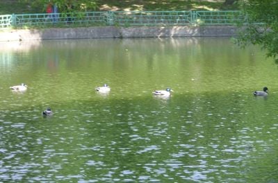
Upper Kolomensky Pond, pond in Moscow, Russia

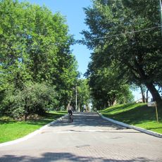
Upper Kolomensky Pond is a small rectangular reservoir in Moscow's Kolomenskoe district with a surface area of about 0.1 hectares. The pond is surrounded by neat grass lawns and trees including round-shaped willows, with concrete edges and well-kept smooth banks that make it easy to walk around.

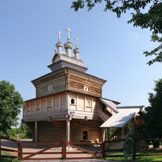
The pond was created around 1980 as a decorative addition to the area. It is located along the Kolomensky stream within the larger Kolomenskoe preserve, which has historical connections to royal estate gardens and traditional leisure spaces.

The pond's name comes from the Kolomensky stream that flows through the area. It serves as a natural gathering point where locals pause during their daily walks and families spend time near the water.

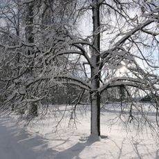
The area is accessible on foot or by bicycle year-round. In winter the pond freezes over, making it usable for cold-weather activities, while warmer months are ideal for walking and picnicking around the water.

The pond sits on the left bank of the Kolomensky stream as one of two water bodies positioned side by side in this section. Visitors often notice mist rising from the surface in early mornings, especially as sunlight breaks through the trees.

The community of curious travelers

AroundUs brings together thousands of curated places, local tips, and hidden gems, enriched daily by 60,000 contributors worldwide.

Start exploring
Location
GPS coordinates
55.66528,37.66944
Latest update
February 9, 2026 08:21
Around this place

Church of the Ascension, Kolomenskoye
Russian Federation

Church of the Ascension, Kolomenskoye

233 m
Church of the Theotokos of Kazan in Kolomenskoye
Russian Federation

Church of the Theotokos of Kazan in Kolomenskoye

395 m
Dyakovo Ravine, Kolomenskoe
Russian Federation

Dyakovo Ravine, Kolomenskoe

1.1 km
Nagatinsky Metro Bridge
Russian Federation

Nagatinsky Metro Bridge

2.4 km
Yuri Luzhkov Park
Russian Federation

Yuri Luzhkov Park

1 km
House of Peter I in Kolomenskoe
Russian Federation

House of Peter I in Kolomenskoe

284 m
Church of Saint George in Kolomenskoe
Russian Federation

Church of Saint George in Kolomenskoe

205 m
Saviour Gates (Kolomenskoe)
Russian Federation

Saviour Gates (Kolomenskoe)

506 m
Church of Saint Thomas at Kantemirovskaya
Russian Federation

Church of Saint Thomas at Kantemirovskaya

2.7 km
Front Gate in Kolomenskoe
Russian Federation

Front Gate in Kolomenskoe

270 m
Church of Dmitry Donskoy in Sadovniki
Russian Federation

Church of Dmitry Donskoy in Sadovniki

1.4 km
Water Tower in Kolomenskoye Residence
Russian Federation

Water Tower in Kolomenskoye Residence

179 m
Church of Great Martyr St. George the Victorious
Russian Federation

Church of Great Martyr St. George the Victorious

926 m
Palace Pavilion in Kolomenskoe
Russian Federation

Palace Pavilion in Kolomenskoe

389 m
Zhuzha Street
Russian Federation

Zhuzha Street

1.1 km
Church of the Beheading of Saint John the Baptist in Dyakovo
Russian Federation

Church of the Beheading of Saint John the Baptist in Dyakovo

153 m
Приказные палаты (Нагатинский Затон)
Russian Federation

Приказные палаты (Нагатинский Затон)

281 m
North Vestibule of Kashirskaya
Russian Federation

North Vestibule of Kashirskaya

1.6 km
Кормовой (Сытный) двор (Нагатинский Затон)
Russian Federation

Кормовой (Сытный) двор (Нагатинский Затон)

216 m
Passsage tower of Nikolo-Korelsky monastery relocated to Kolomenskoye
Russian Federation

Passsage tower of Nikolo-Korelsky monastery relocated to Kolomenskoye

1.1 km
Часовой столб (Челобитный столб) (Нагатинский Затон)
Russian Federation

Часовой столб (Челобитный столб) (Нагатинский Затон)

275 m
Трапезная (Нагатинский Затон)
Russian Federation

Трапезная (Нагатинский Затон)

206 m
Colonel palace (Kolomenskoe)
Russian Federation

Colonel palace (Kolomenskoe)

241 m
Brew-House in Kolomenskoe
Russian Federation

Brew-House in Kolomenskoe

322 m
Mokhovaya Tower of Sumskoy Stockaded Fort relocated to Kolomenskoye
Russian Federation

Mokhovaya Tower of Sumskoy Stockaded Fort relocated to Kolomenskoye

1.1 km
Nagatinsky Zaton
Russian Federation

Nagatinsky Zaton

306 m
Wooden tower of Bratsk Stocaded Fort relocated to Kolomenskoye
Russian Federation

Wooden tower of Bratsk Stocaded Fort relocated to Kolomenskoye

1 km
Show the full map
« Upper Kolomensky Pond - pond in Moscow, Russia » is provided by Around Us (aroundus.com). Images and texts are derived from Wikimedia project under a Creative Commons license. You are allowed to copy, distribute, and modify copies of this page, under the conditions set by the license, as long as this note is clearly visible.

Discover hidden gems everywhere you go!

From secret cafés to breathtaking viewpoints, skip the crowded tourist spots and find places that match your style. Our app makes it easy with voice search, smart filtering, route optimization, and insider tips from travelers worldwide. Download now for the complete mobile experience.

Around Us App Screenshot

A unique approach to discovering new places

Le Figaro

All the places worth exploring

France Info

A tailor-made excursion in just a few clicks

20 Minutes

Around Us
Travel Guide & Maps
Download

Send to your phone

QR Code
1

Open the camera app on your mobile.

2

Point at the QR code with your camera. A notification will appear.

3

Tap the notification to open the link.