Ärtemark 134:3, stone setting in Bengtsfors Municipality, Älvsborg County, Sweden
Location: Bengtsfors Municipality
GPS coordinates: 59.04512,12.17614
Latest update: October 23, 2025 23:11
Gemeinde Bengtsfors
2.8 km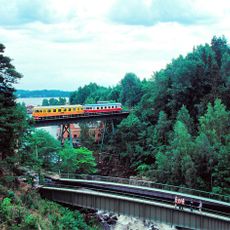
Mellerud–Arvika railway
3.8 km
Ärtemark 173:1
4.5 km
Ärtemark 10:1
3.9 km
Ärtemark 54:1
904 m
Ärtemark 53:1
1.1 km
Ärtemark 153:1
3.9 km
Ärtemark 188:1
5.7 km
Ärtemark 21:2
4.5 km
Ärtemark 63:1
4.4 km
Ärtemark 72:1
1.7 km
Ärtemark 56:1
3.3 km
Ärtemark 189:1
5.6 km
Ärtemark 57:1
3.5 km
Ärtemark 141:1
2.4 km
Ärtemark 37:1
6.5 km
Ärtemark 21:1
4.5 km
Ärtemark 106:1
1.5 km
Ärtemark 110:1
2.1 km
Ärtemark 118:1
3.9 km
Ärtemark 46:1
4 km
Ärtemark 147:1
3 km
Ärtemark 5:1
4.9 km
Ärtemark 154:1
3.8 km
Ärtemark 154:2
3.8 km
Ärtemark 1:1
6 km
Håbol 56:1
6.2 km
Gammelgårdens friluftsmuseum
3.9 kmReviews
Visited this place? Tap the stars to rate it and share your experience / photos with the community! Try now! You can cancel it anytime.
Discover hidden gems everywhere you go!
From secret cafés to breathtaking viewpoints, skip the crowded tourist spots and find places that match your style. Our app makes it easy with voice search, smart filtering, route optimization, and insider tips from travelers worldwide. Download now for the complete mobile experience.

A unique approach to discovering new places❞
— Le Figaro
All the places worth exploring❞
— France Info
A tailor-made excursion in just a few clicks❞
— 20 Minutes