Naverstad 48:1, röse i Bohuslän
Location: Tanum Municipality
GPS coordinates: 58.83985,11.57292
Latest update: October 25, 2025 19:57
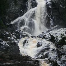
Elgåfossen
5.5 km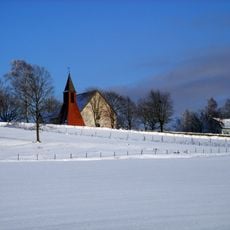
Naverstad Church
8.5 km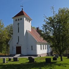
Søndre Enningdal Chapel
8.2 km
Naverstad 114:1
4.8 km
Naverstad 40:1
1.4 km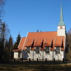
Fagerhults kapell
2.6 km
Naverstad 351:1
3.1 km
Naverstad 43:2
1.5 km
Naverstad 53:1
5.2 km
Naverstad 57:1
7.5 km
Gullhög
7.5 km
Naverstad 54:1
5.5 km
Porsås kyrka
5.5 km
Naverstad 298:2
3.5 km
Naverstad 166:8
8.4 km
Naverstad 133:2
4 km
Naverstad 133:1
4 km
Naverstad 29:2
3.1 km
Naverstad 293:1
2.8 km
Naverstad 298:1
3.5 km
Kinnekulle
3.5 km
Naverstad 44:1
1.5 km
Gullhög
7.5 km
Naverstad 43:1
1.5 km
Naverstad 354:1
820 m
Naverstad 375:1
4.9 km
Naverstad 376:1
3.9 km
Naverstad 41:1
645 mReviews
Visited this place? Tap the stars to rate it and share your experience / photos with the community! Try now! You can cancel it anytime.
Discover hidden gems everywhere you go!
From secret cafés to breathtaking viewpoints, skip the crowded tourist spots and find places that match your style. Our app makes it easy with voice search, smart filtering, route optimization, and insider tips from travelers worldwide. Download now for the complete mobile experience.

A unique approach to discovering new places❞
— Le Figaro
All the places worth exploring❞
— France Info
A tailor-made excursion in just a few clicks❞
— 20 Minutes