Nätra 4:1, röse i Ångermanland
Location: Örnsköldsvik Municipality
GPS coordinates: 63.17637,18.69889
Latest update: November 3, 2025 09:37
Balesudden
637 m
Nätraån
5.9 km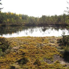
Ögeltjärn
6 km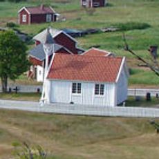
Trysunda kapell
6.3 km
Bäckfjärden
6.3 km
Trysundaön lighthouse
4.8 km
Åvikfjärden
4.3 km
Penninggrubban
3.6 km
Public beach Köpmanholmens havsbad
5.3 km
Köpmanholmen övre
5.8 km
Köpmanholmen nedre
5.8 km
Klöksgrubban
3.7 km
Västra Genesöviken
2.5 km
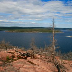
Scenic viewpoint
2.8 km
Storstenen
5.5 km
Rödskateviken
6.2 km
Fjälludden
5.5 km
Scenic viewpoint
828 m
Scenic viewpoint
601 m
Östra Genesöviken
2.7 km
Scenic viewpoint
5.7 km
Scenic viewpoint
6.4 km
Scenic viewpoint
4.5 km
Scenic viewpoint
5 km
Scenic viewpoint
5.7 km
Scenic viewpoint
5.8 km
Scenic viewpoint
2.4 km
Scenic viewpoint
6.5 kmReviews
Visited this place? Tap the stars to rate it and share your experience / photos with the community! Try now! You can cancel it anytime.
Discover hidden gems everywhere you go!
From secret cafés to breathtaking viewpoints, skip the crowded tourist spots and find places that match your style. Our app makes it easy with voice search, smart filtering, route optimization, and insider tips from travelers worldwide. Download now for the complete mobile experience.

A unique approach to discovering new places❞
— Le Figaro
All the places worth exploring❞
— France Info
A tailor-made excursion in just a few clicks❞
— 20 Minutes