
2004053 Strandtall, naturminne i Falu kommun
Location: Falun Municipality
Inception: June 6, 1928
GPS coordinates: 60.52585,15.73655
Latest update: March 10, 2025 07:45

Falun Mine
10.6 km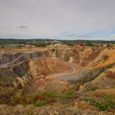
Falun Mine
10.5 km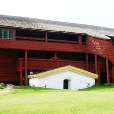
Ornässtugan
10.3 km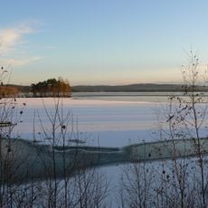
Runn
4.3 km
Svedens gård
9.6 km
Rottneby herrgård
7.6 km
Gamla Staberg
4.5 km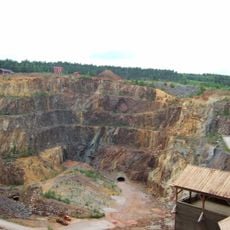
Great Pit
10.6 km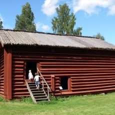
Rankhyttan
5.6 km
Vika Church
1.9 km
Birgittagården
6.1 km
Tisken
9.7 km
Mine museum
10.6 km
Hosjön
8 km
Linnés bröllopsstuga
9.6 km
Dalarna sports museum
10.6 km
Rottnebyskogen
8 km
Stämshöjen
10.1 km
Parlogen i Nyhyttan
4.7 km
Runns norra öar
6 km
Ringkällmyrberget
10.5 km
Vika bibliotek
1.8 km
Dalregementets museer
9.8 km
Moriska gården och Lustgården
10.6 km
Medicinhistoriska museet
10.4 km
Munktellska huset
10.6 km
Bult Karl-Eriks stuga
10.5 km
Museiföreningen GefleDala Jernväg
9.9 kmReviews
Visited this place? Tap the stars to rate it and share your experience / photos with the community! Try now! You can cancel it anytime.
Discover hidden gems everywhere you go!
From secret cafés to breathtaking viewpoints, skip the crowded tourist spots and find places that match your style. Our app makes it easy with voice search, smart filtering, route optimization, and insider tips from travelers worldwide. Download now for the complete mobile experience.

A unique approach to discovering new places❞
— Le Figaro
All the places worth exploring❞
— France Info
A tailor-made excursion in just a few clicks❞
— 20 Minutes