Karaabdal, Berggipfel in der Türkei
Location: Trabzon Province
Elevation above the sea: 1,819 m
GPS coordinates: 40.81240,39.42990
Latest update: November 16, 2025 05:59
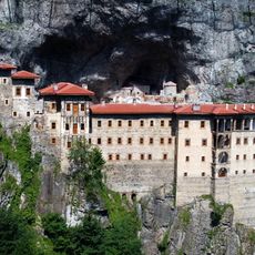
Sümela Monastery
23.6 km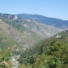
Zigana Pass
18.5 km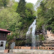
Çal Cave
7.2 km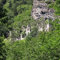
Vazelon Monastery
10.3 km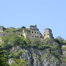
Kuştul Monastery
23.4 km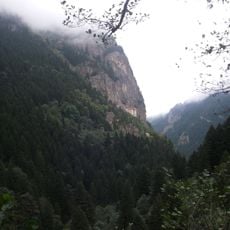
Altındere Valley National Park
21.8 km
Kadıralak Nature Park
13.1 km
Hıdırnebi Tepesi
17.5 km
Ayaser Tepesi
14.1 km
Çakıl Tepe
21 km
Lake Limni Nature Park
22.6 km
Çifte Oluk Suyu
23.5 km
Viewpoint Torul mountains
20.3 km
Picnic
2.1 km
Maçka Bayrak Tepesi
15.3 km
Yelef Suyu
20.4 km
Work of art
9.1 km
Work of art
14 km
Mağmat Boğazı
22.8 km
Scenic viewpoint
23.8 km
Picnic
16.1 km
Scenic viewpoint
23.6 km
Scenic viewpoint
19.2 km
View point
16.5 km
Gözlem alanı
21.5 km
Monastery Viewpoint
23.9 km
Scenic viewpoint
16.4 km
Karadağ Şelalesi
23.8 kmReviews
Visited this place? Tap the stars to rate it and share your experience / photos with the community! Try now! You can cancel it anytime.
Discover hidden gems everywhere you go!
From secret cafés to breathtaking viewpoints, skip the crowded tourist spots and find places that match your style. Our app makes it easy with voice search, smart filtering, route optimization, and insider tips from travelers worldwide. Download now for the complete mobile experience.

A unique approach to discovering new places❞
— Le Figaro
All the places worth exploring❞
— France Info
A tailor-made excursion in just a few clicks❞
— 20 Minutes