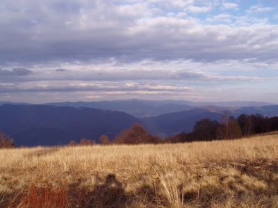
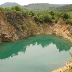
Yavirnyk, Mountain summit in Carpathian Mountains, Ukraine.
Yavirnyk is a summit in the eastern Carpathian Mountains that rises to about 1,069 meters. The mountain is accessible through several marked hiking trails that approach from different directions and converge toward the peak.
The summit has served as a vantage point since ancient times, giving local residents an advantage in observing the valleys below. This high location made it valuable for monitoring the surrounding region.
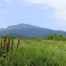
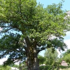
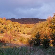
The name Yavirnyk comes from the Ukrainian word for maple trees, which grow abundantly on the mountain's slopes. These trees shape the landscape and form an essential part of what visitors see when they hike there.
The main hiking route starts from the eastern base and takes about three hours to reach the top. Good hiking boots and plenty of water are important since the path climbs steadily without flat sections.
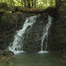
The mountain is home to several protected plant species that grow only above 900 meters in the Ukrainian Carpathians. These specialized plants are found nowhere else at lower elevations and make the summit notable for nature enthusiasts.
GPS coordinates: 48.90300,22.55940
Latest update: December 14, 2025 11:05
Velykyi Bereznyi
7.5 km
Uzh National Nature Park
13.7 km
East Carpathian Transboundary Biosphere Reserve
11.6 km
Dub zvychainyi
14.2 km
Knyahinyai meteorite
10 km
Rožok
10.8 km
Lumshory Waterfalls
16.5 km
Beňatinský travertín
17.7 km
Church of the Intercession, Kostryna
4.9 kmStinská
11.1 km
Saint Michael church in Chornoholova
6.6 km
Гора Яворник
781 m
Saint Michael Church, Vyshka
10.6 km
Church of St. Basil in Sil
6.1 km
Park-arboretum
7.5 km
Temple of St. Michael the Archangel
17.7 km
Saint Anne Orthodox church in Bukivtsovo
12.1 km
Saint John the Baptist Church, Sukhyi
17.6 km
Temple of St Michael, Uličské Krivé
13.2 km
Temple of Ascension of Jesus Christ in Šmigovec
17.6 km
Арборетум в дворі райвиконкому
7.4 km
Vojnový cintorín 1. sv. vojny
14.9 km
Býv. gr. k. chrám sv. Michala, kostol drevený
17.7 km
Wooden bell tower in Kolbasov
17.3 km
Ľudový dom
16 km
Býv. gr. k. chrám sv. Michala, brána opevnenia
17.7 km
Býv. gr. k. chrám sv. Michala, opevnenie kostola
17.7 km
Býv. gr. k. chrám sv. Michala, zvonica drevená
17.7 kmVisited this place? Tap the stars to rate it and share your experience / photos with the community! Try now! You can cancel it anytime.
Discover hidden gems everywhere you go!
From secret cafés to breathtaking viewpoints, skip the crowded tourist spots and find places that match your style. Our app makes it easy with voice search, smart filtering, route optimization, and insider tips from travelers worldwide. Download now for the complete mobile experience.
A unique approach to discovering new places❞
— Le Figaro
All the places worth exploring❞
— France Info
A tailor-made excursion in just a few clicks❞
— 20 Minutes