Chest opened
+${chestReward.xp} XP
Explorer
NOUVEAU ×${chestReward.collectible.quantity}
tapez pour fermer
Chest locked

Open chests in the app

Around Us is built for your phone — chests unlock when you walk, explore and capture nearby places.

Enable Location

We need your location to show you interesting places around you

Discover nearby places

Find interesting locations and hidden gems around you

Precise directions

Get accurate directions and distances to places

Your location is never shared with other users. It's only used when you tap the location button.

Log in to your account

Start exploring — it's free

Trusted by 72,876 travelers worldwide

Continue with Google
Continue with Apple
or

We will send you a code to connect

By continuing, you accept our Terms and Conditions and our Privacy Policy

Check your inbox

We've sent a pincode in your inbox. Please enter the code below.

Westmorland and Lonsdale
Discussion Reviews Photo
43.9k Popularity

Westmorland and Lonsdale, Parliamentary constituency in North West England, United Kingdom

Westmorland and Lonsdale is a parliamentary constituency covering southern Cumbria and including major towns such as Kendal, Windermere, and Appleby-in-Westmorland. The area combines urban centers with surrounding rural communities, all connected by road networks that serve residents throughout the region.

This constituency was created during a boundary reorganization before the 1983 general election, drawing its name from the historic county of Westmorland and the Lancashire Hundred of Lonsdale. The formation reflected efforts to adjust parliamentary representation as the area evolved.

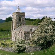
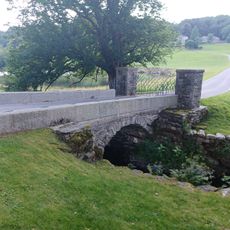
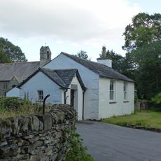
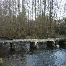
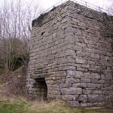
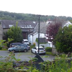
Farming and small communities shape daily life across the region, visible in the landscape and village structures. This rural character defines how people live and work in both the larger towns and surrounding areas.

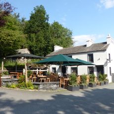
The region is best explored by car, as road networks connect the various towns and allow flexible travel between them. Larger towns like Kendal and Windermere serve as good starting points for visitors exploring both urban and rural areas.

During the 2016 EU membership referendum, this area voted differently from many comparable rural regions and chose to remain. This unexpected result made it a notable example of diverse opinions across the country.

The community of curious travelers

AroundUs brings together thousands of curated places, local tips, and hidden gems, enriched daily by 60,000 contributors worldwide.

Start exploring
Inception
June 9, 1983
GPS coordinates
54.31200,-2.88000
Latest update
December 14, 2025 20:50
Around this place
Church of St Mary
United Kingdom

Church of St Mary

1.8 km
Masons Arms
United Kingdom

Masons Arms

2.2 km
United Kingdom

Birks Bridge

1.7 km
United Kingdom

Great Hartbarrow Farmhouse, Cottage And Outbuilding

2.1 km
Winster Bridge (that part in Cartmel)
United Kingdom

Winster Bridge (that part in Cartmel)

2.2 km
Winster School
United Kingdom

Winster School

2.3 km
United Kingdom

Crosthwaite Corn Mill With Adjoining Store, Kiln, Stable And Mill Race

1.3 km
United Kingdom

Spout House

1.7 km
United Kingdom

Low Cartmell Fold

1.7 km
Footbridge Approximately 70 Metres To West Of Dodds Howe
United Kingdom

Footbridge Approximately 70 Metres To West Of Dodds Howe

918 m
United Kingdom

Farm Outbuilding East Of High Birks Farmhouse

493 m
United Kingdom

Bee House Facing South Approximately 35 Metres To North Of Crosthwaite House

1.9 km
United Kingdom

Former Dame School Approximately 15 Metres North Of Crosthwaite House

1.9 km
United Kingdom

High Cartmell Fold Farmhouse

1.7 km
United Kingdom

Winster potash pit

2.1 km
United Kingdom

Hill Farmhouse And Adjoining Outbuilding

699 m
United Kingdom

Crosthwaite House

1.9 km
Limekiln at SD 435 895
United Kingdom

Limekiln at SD 435 895

1.6 km
United Kingdom

Ormandy House And Outbuilding

2 km
United Kingdom

Bee House Facing East Approximately 35 Metres To North Of Crosthwaite House

1.9 km
United Kingdom

Privy 20 Metres To North West Of Crosthwaite House

1.9 km
United Kingdom

Mill Dam With Weir Sluice Gates, And Mill Race

1.2 km
United Kingdom

Lords Bridge

790 m
United Kingdom

Farmhouse And Adjoining Barn Approximately 46 Metres To North East Of Crosthwaite Corn Mill

1.3 km
United Kingdom

Farm Outbuilding East South East Of High Birks Farmhouse

487 m
United Kingdom

Pig-Sty Approximately 9 Metres To South East Of Farmhouse At Crosthwaite Corn Mill

1.3 km
Bryan Houses Cottage
United Kingdom

Bryan Houses Cottage

2.2 km
United Kingdom

Lime kiln

1.7 km
Show the full map
Reviews
Share your experience

No review yet

Discussions
Start a discussion...

No discussion yet

« Westmorland and Lonsdale - Parliamentary constituency in North West England, United Kingdom » is provided by Around Us (aroundus.com). Images and texts are derived from Wikimedia project under a Creative Commons license. You are allowed to copy, distribute, and modify copies of this page, under the conditions set by the license, as long as this note is clearly visible.

Discover hidden gems everywhere you go!

From secret cafés to breathtaking viewpoints, skip the crowded tourist spots and find places that match your style. Our app makes it easy with voice search, smart filtering, route optimization, and insider tips from travelers worldwide. Download now for the complete mobile experience.

Around Us App Screenshot

A unique approach to discovering new places

Le Figaro

All the places worth exploring

France Info

A tailor-made excursion in just a few clicks

20 Minutes

Around Us
Travel Guide & Maps
Download

Send to your phone

QR Code
1

Open the camera app on your mobile.

2

Point at the QR code with your camera. A notification will appear.

3

Tap the notification to open the link.