Chest opened
+${chestReward.xp} XP
Explorer
NOUVEAU ×${chestReward.collectible.quantity}
tapez pour fermer
Chest locked

Open chests in the app

Around Us is built for your phone — chests unlock when you walk, explore and capture nearby places.

Enable Location

We need your location to show you interesting places around you

Discover nearby places

Find interesting locations and hidden gems around you

Precise directions

Get accurate directions and distances to places

Your location is never shared with other users. It's only used when you tap the location button.

Log in to your account

Start exploring — it's free

Trusted by 72,882 travelers worldwide

Continue with Google
Continue with Apple
or

We will send you a code to connect

By continuing, you accept our Terms and Conditions and our Privacy Policy

Check your inbox

We've sent a pincode in your inbox. Please enter the code below.

Discussion Reviews Photo
18.5k Popularity

Lagan Valley, Parliamentary constituency in the United Kingdom, 1983 onwards

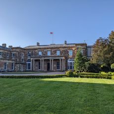
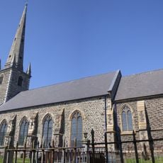
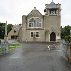
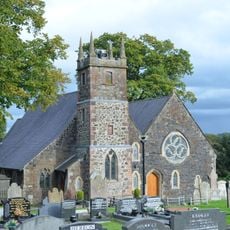
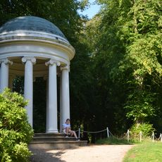
Lagan Valley is a House of Commons constituency in Northern Ireland centered around the River Lagan and the city of Lisburn. The area combines suburban neighborhoods, small villages, and rural fields with the river flowing gently through the landscape.

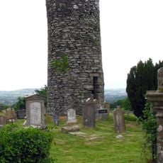
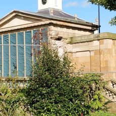
Lagan Valley evolved from a farming area into a major constituency, with mills and factories once powered by the river during the industrial era. The area's economy gradually shifted from manufacturing to residential and service-based activities through the twentieth century.

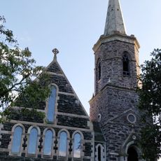
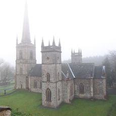
Lagan Valley takes its name from the River Lagan, which has shaped the local identity for centuries and remains central to how residents experience the landscape. Communities gather regularly for local festivals and markets where you can find crafts and regional food, maintaining traditions that connect people to their past.

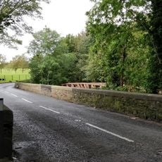
The area is easy to explore on foot or by bicycle, with well-maintained paths running along the river and through the communities. The flat landscape makes it accessible for walkers and cyclists of all abilities.

The area has only recently diversified politically in the early 21st century, with the moderate Alliance Party becoming surprisingly competitive and traditional unionist support weakening noticeably. This shift was triggered by Brexit and changing voter priorities, altering the long-established political dominance of the constituency.

The community of curious travelers

AroundUs brings together thousands of curated places, local tips, and hidden gems, enriched daily by 60,000 contributors worldwide.

Start exploring
Location
Inception
June 9, 1983
GPS coordinates
54.50900,-6.04700
Latest update
February 16, 2026 23:41
Around this place
Hillsborough Castle
United Kingdom

Hillsborough Castle

5.9 km
Casement Park
United Kingdom

Casement Park

8.2 km
Giant's Ring
United Kingdom

Giant's Ring

7.2 km
Sir Thomas and Lady Dixon Park
United Kingdom

Sir Thomas and Lady Dixon Park

5.6 km
Christ Church Cathedral, Lisburn
United Kingdom

Christ Church Cathedral, Lisburn

416 m
Drumbo round tower
United Kingdom

Drumbo round tower

5.7 km
Lisburn Courthouse
United Kingdom

Lisburn Courthouse

562 m
Kilwarlin Moravian Church
United Kingdom

Kilwarlin Moravian Church

7.6 km
Old Town Hall, Lisburn
United Kingdom

Old Town Hall, Lisburn

502 m
Henry Garrett Building Stranmillis College Stranmillis Road Belfast
United Kingdom

Henry Garrett Building Stranmillis College Stranmillis Road Belfast

10 km
8 The Square Hillsborough County Down Bt26 6ag
United Kingdom

8 The Square Hillsborough County Down Bt26 6ag

5.9 km
Lisburn Road Library
United Kingdom

Lisburn Road Library

8.8 km
Summer House Hillsborough Castle The Square Hillsborough County Down Bt26 6ag
United Kingdom

Summer House Hillsborough Castle The Square Hillsborough County Down Bt26 6ag

5.9 km
St. Patricks Church Of Ireland 260 Upper Malone Road Dunmurry Belfast County Down Bt17 9ld
United Kingdom

St. Patricks Church Of Ireland 260 Upper Malone Road Dunmurry Belfast County Down Bt17 9ld

5 km
St Malachy's Hillsborough Parish Church
United Kingdom

St Malachy's Hillsborough Parish Church

5.7 km
Marquis Of Downshire Monument Monument Road Hillsborough Co.down
United Kingdom

Marquis Of Downshire Monument Monument Road Hillsborough Co.down

6.5 km
Hillhall Presbyterian Church 163 Hillhall Road Lisburn Bt27 5ja
United Kingdom

Hillhall Presbyterian Church 163 Hillhall Road Lisburn Bt27 5ja

2.3 km
Lambeg Parish Church Church Hill Lambeg North Lisburn Co. Antrim Bt27 4sb
United Kingdom

Lambeg Parish Church Church Hill Lambeg North Lisburn Co. Antrim Bt27 4sb

3.2 km
Ballyskeagh Bridge Ballyskeagh Road Lisburn Co Antrim
United Kingdom

Ballyskeagh Bridge Ballyskeagh Road Lisburn Co Antrim

3.7 km
Trevor House 9 The Square Hillsborough Co. Down Bt26 6ag
United Kingdom

Trevor House 9 The Square Hillsborough Co. Down Bt26 6ag

5.9 km
Danesfort 120 Malone Road Belfast
United Kingdom

Danesfort 120 Malone Road Belfast

9.6 km
Hill House 35 Main St. Hillsborough Co. Down
United Kingdom

Hill House 35 Main St. Hillsborough Co. Down

5.8 km
Wolfenden's Bridge Ballyskeagh Road Lisburn Co Antrim
United Kingdom

Wolfenden's Bridge Ballyskeagh Road Lisburn Co Antrim

3.3 km
Christ church, Derriaghy
United Kingdom

Christ church, Derriaghy

3.9 km
Wolfenden Tomb Lambeg Parish Churchyard Church Hill Lambeg North Lisburn Co.antrim Bt27 4sb
United Kingdom

Wolfenden Tomb Lambeg Parish Churchyard Church Hill Lambeg North Lisburn Co.antrim Bt27 4sb

3.2 km
The Lady Alice Temple Hillsborough Castle The Square Hillsborough County Down Bt26 6ag
United Kingdom

The Lady Alice Temple Hillsborough Castle The Square Hillsborough County Down Bt26 6ag

6 km
Christ Church Cathedral Market Square Lisburn Co. Antrim
United Kingdom

Christ Church Cathedral Market Square Lisburn Co. Antrim

354 m
Main Building Stranmillis College Stranmillis Road Belfast
United Kingdom

Main Building Stranmillis College Stranmillis Road Belfast

10.2 km
Show the full map
Reviews
Share your experience

No review yet

Discussions
Start a discussion...

No discussion yet

« Lagan Valley - Parliamentary constituency in the United Kingdom, 1983 onwards » is provided by Around Us (aroundus.com). Images and texts are derived from Wikimedia project under a Creative Commons license. You are allowed to copy, distribute, and modify copies of this page, under the conditions set by the license, as long as this note is clearly visible.

Discover hidden gems everywhere you go!

From secret cafés to breathtaking viewpoints, skip the crowded tourist spots and find places that match your style. Our app makes it easy with voice search, smart filtering, route optimization, and insider tips from travelers worldwide. Download now for the complete mobile experience.

Around Us App Screenshot

A unique approach to discovering new places

Le Figaro

All the places worth exploring

France Info

A tailor-made excursion in just a few clicks

20 Minutes

Around Us
Travel Guide & Maps
Download

Send to your phone

QR Code
1

Open the camera app on your mobile.

2

Point at the QR code with your camera. A notification will appear.

3

Tap the notification to open the link.