Buckfast Abbey

Log in to your account

AroundUs is a community-driven map of interesting places, built by curious explorers like you. It grows with every review, story, and photo you share.
Connect to save your favorite spots, contribute locations, and create personalized routes.
Continue with Google
Continue with Apple
Continue with X
Continue with Facebook
Continue with email
By continuing, you accept our Terms and Conditions and our Privacy Policy
Create an account
Add to collection
Map
Suggest a change
Share

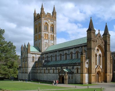
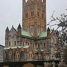
Buckfast Abbey, Benedictine abbey in Buckfastleigh, England.

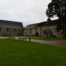
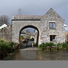
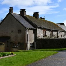
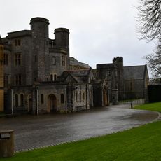
Buckfast Abbey is a working Benedictine monastery in Buckfastleigh, Devon, rebuilt in the Gothic manner with tall spires, colored glass windows, and several acres of enclosed monastery gardens. The grounds connect church, residential quarters for the monks, and landscaped green spaces into a single complex.

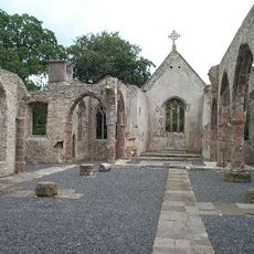
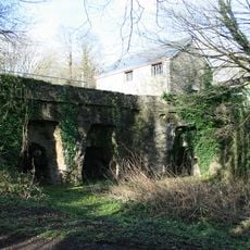
Monks founded the site in 1018, but Henry VIII dissolved it in 1536 and left the buildings to decay. Benedictines returned in 1882 and began rebuilding the church stone by stone, a project that took several decades to complete.

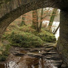
The name comes from the meeting of the River Dart with a smaller stream that once supplied the first settlement. Visitors hear Latin chants during services, sung from ancient manuscripts using notation passed down through generations, offering a direct auditory link to ongoing monastic practice.

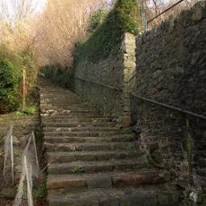
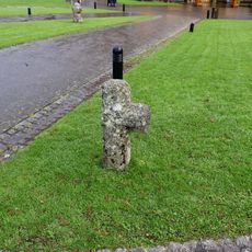
The church and gardens remain open throughout the year, with guided tours of the monastery grounds available daily. Pathways connect all areas, though some sections run over gravel or uneven ground and require sturdy footwear.

Monks developed the Buckfast bee through selective breeding over several decades, creating a hardy honeybee strain now used by beekeepers worldwide. This breeding line resists many diseases and produces generous amounts of honey, making it popular across continents.

Location: Buckfastleigh

Inception: 11 century

Architects: Frederick Walters

Architectural style: Gothic architecture

Website: http://buckfast.org.uk

GPS coordinates: 50.49278,-3.77556

Latest update: December 14, 2025 18:14

Photos
Around this place
Pridhamsleigh Cavern
United Kingdom

Pridhamsleigh Cavern

947 m
Joint Mitnor Cave
United Kingdom

Joint Mitnor Cave

980 m
Hembury Castle
United Kingdom

Hembury Castle

1.9 km
Reed's cave
United Kingdom

Reed's cave

1 km
Parish Church of Holy Trinity
United Kingdom

Parish Church of Holy Trinity

828 m
Buckfastleigh War Memorial
United Kingdom

Buckfastleigh War Memorial

870 m
Milestone Approximately 160 Metres North Of Furzeleigh Mill Country House Hotel
United Kingdom

Milestone Approximately 160 Metres North Of Furzeleigh Mill Country House Hotel

454 m
The King's Arms Public House
United Kingdom

The King's Arms Public House

1.3 km
St Luke's Church
United Kingdom

St Luke's Church

1.4 km
Church Bridge
United Kingdom

Church Bridge

1.2 km
Buckfast Abbey Farmhouse
United Kingdom

Buckfast Abbey Farmhouse

85 m
Flight Of Steps To Church Of Holy Trinity
United Kingdom

Flight Of Steps To Church Of Holy Trinity

1.2 km
Church Ruins To East Of Church Of Holy Trinity
United Kingdom

Church Ruins To East Of Church Of Holy Trinity

835 m
Dovecote Approximately 100 Metres North West Of Pridhamsleigh Manor
United Kingdom

Dovecote Approximately 100 Metres North West Of Pridhamsleigh Manor

831 m
North Gate, Buckfast Abbey
United Kingdom

North Gate, Buckfast Abbey

122 m
Cross Approximately 40 Metres West Of St Mary's Abbey Church
United Kingdom

Cross Approximately 40 Metres West Of St Mary's Abbey Church

91 m
Guest House At Buckfast Abbey
United Kingdom

Guest House At Buckfast Abbey

103 m
Range Of Buildings To South Of Abbot's Tower, Buckfast Abbey
United Kingdom

Range Of Buildings To South Of Abbot's Tower, Buckfast Abbey

72 m
Austin's Bridge (That Part In Buckfastleigh Cp)
United Kingdom

Austin's Bridge (That Part In Buckfastleigh Cp)

1.7 km
2, Plymouth Road
United Kingdom

2, Plymouth Road

1.3 km
St Gudula's Cross
United Kingdom

St Gudula's Cross

2.3 km
Milestone Approximately 100 Metres South Of Gage's Mill
United Kingdom

Milestone Approximately 100 Metres South Of Gage's Mill

1.4 km
3 Lime Kilns At Sx 7436 6650 At William Pengelly Cave Studies Centre (Not Included)
United Kingdom

3 Lime Kilns At Sx 7436 6650 At William Pengelly Cave Studies Centre (Not Included)

914 m
The Valiant Soldier, Including Rear Wing
United Kingdom

The Valiant Soldier, Including Rear Wing

1.3 km
Turnpike Stone Set Into Wall At Sx 7428 6614, South West Of The Rock
United Kingdom

Turnpike Stone Set Into Wall At Sx 7428 6614, South West Of The Rock

1.3 km
Cross Approximately 30 Metres North West Of St Mary's Abbey Church
United Kingdom

Cross Approximately 30 Metres North West Of St Mary's Abbey Church

82 m
Buckfast Abbey, Main Block
United Kingdom

Buckfast Abbey, Main Block

23 m
Milestone, Buckfast Road, 200m S of Gage's Mill
United Kingdom

Milestone, Buckfast Road, 200m S of Gage's Mill

1.5 km
Show the full map
Reviews

Visited this place? Tap the stars to rate it and share your experience / photos with the community! Try now! You can cancel it anytime.

« Buckfast Abbey - Benedictine abbey in Buckfastleigh, England » is provided by Around Us (aroundus.com). Images and texts are derived from Wikimedia project under a Creative Commons license. You are allowed to copy, distribute, and modify copies of this page, under the conditions set by the license, as long as this note is clearly visible.

Discover hidden gems everywhere you go!

From secret cafés to breathtaking viewpoints, skip the crowded tourist spots and find places that match your style. Our app makes it easy with voice search, smart filtering, route optimization, and insider tips from travelers worldwide. Download now for the complete mobile experience.

Around Us App Screenshot

A unique approach to discovering new places

Le Figaro

All the places worth exploring

France Info

A tailor-made excursion in just a few clicks

20 Minutes