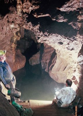
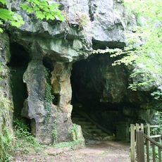
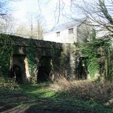
Pridhamsleigh Cavern, Limestone cave system near Ashburton, England.
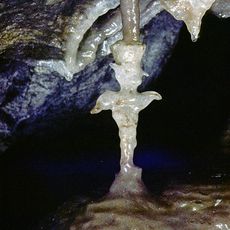
The cavern extends for 1,100 meters through interconnected passages and chambers, reaching a depth of 55 meters below the surface level.
Early 1970s diving expeditions revealed Gerry's Chamber at 80 feet depth, establishing it as the largest underground chamber in Devon.
The Plymouth Library maintains detailed hand-drawn plans of the cave system, documenting its complex network of passages for future generations.
The cave maintains a constant temperature of 12-13 degrees Celsius and requires basic equipment including helmets, suits, and wellington boots.
Pridhamsleigh Cavern houses a population of Niphargus glenniei, a specialized 3-millimeter white cave shrimp found only in southwest England.
Location: Ashburton
GPS coordinates: 50.49800,-3.76500
Latest update: March 30, 2025 18:54
Buckfast Abbey
947 m
Joint Mitnor Cave
1.6 km
Reed's cave
1.6 km
Church of St Andrew
1.9 km
Parish Church of Holy Trinity
1.5 km
Ashburton Methodist Church
2 km
Buckfastleigh War Memorial
1.6 km
Exeter Inn
2 km
Milestone Approximately 160 Metres North Of Furzeleigh Mill Country House Hotel
854 m
Church Bridge
1.9 km
Dovecote Approximately 100 Metres North West Of Pridhamsleigh Manor
179 m
North Gate, Buckfast Abbey
1 km
Church Ruins To East Of Church Of Holy Trinity
1.5 km
32, 32a And 32b Including Detached Rear Building
1.9 km
Flight Of Steps To Church Of Holy Trinity
1.9 km
Buckfast Abbey Farmhouse
1 km
Guest House At Buckfast Abbey
1 km
Cross Approximately 40 Metres West Of St Mary's Abbey Church
1 km
42, West Street
1.9 km
Range Of Buildings To South Of Abbot's Tower, Buckfast Abbey
1 km
Warehouse At Sx 7568 6970 Warehouse At Sx 7568 6970 (Former Railway Goods Shed)
1.9 km
Gates, Piers, Railings, Boundary Wall And Conduit Head On North Of Churchyard
1.9 km
St Gudula's Cross
1.5 km
Milestone Approximately 100 Metres South Of Gage's Mill
864 m
Buckfast Abbey, Main Block
968 m
3 Lime Kilns At Sx 7436 6650 At William Pengelly Cave Studies Centre (Not Included)
1.6 km
Turnpike Stone Set Into Wall At Sx 7428 6614, South West Of The Rock
1.9 km
Cross Approximately 30 Metres North West Of St Mary's Abbey Church
992 mReviews
Visited this place? Tap the stars to rate it and share your experience / photos with the community! Try now! You can cancel it anytime.
Discover hidden gems everywhere you go!
From secret cafés to breathtaking viewpoints, skip the crowded tourist spots and find places that match your style. Our app makes it easy with voice search, smart filtering, route optimization, and insider tips from travelers worldwide. Download now for the complete mobile experience.
A unique approach to discovering new places❞
— Le Figaro
All the places worth exploring❞
— France Info
A tailor-made excursion in just a few clicks❞
— 20 Minutes