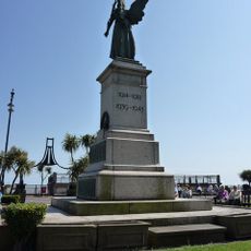
Jaywick, Coastal settlement in Tendring district, England
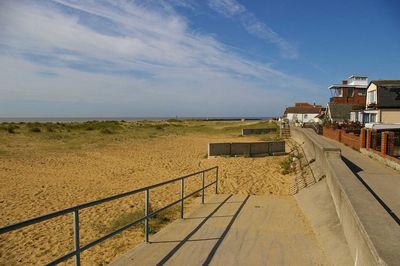
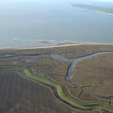
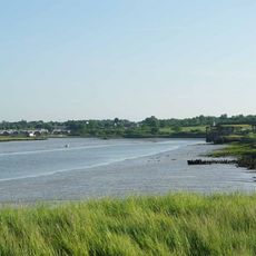
Jaywick is a coastal settlement in Tendring district on the North Sea coast of Essex, located east of Clacton-on-Sea. The site consists of several sections of low-rise housing extending behind seafront promenades and a sea defense wall.
Frank Stedman purchased the marshland in 1928 and subdivided it as an affordable holiday destination for London workers who could buy small plots for £25. The settlement grew rapidly during the 1930s before a severe flood in 1953 destroyed large portions of the community.
The eastern Brooklands area preserves a 1920s grid layout where small bungalows and chalets stand close together on narrow streets. Many homes still carry names instead of numbers, a reminder of the original holiday colony tradition.
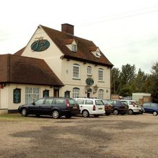
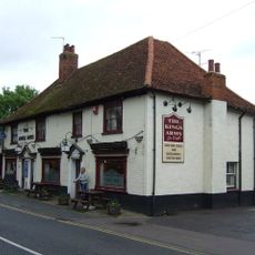
Regular bus services link the settlement to Clacton-on-Sea, where direct trains operate to London Liverpool Street and Colchester. Many streets remain unpaved or have damaged surfaces, so sturdy footwear should be planned for walking and cycling routes.
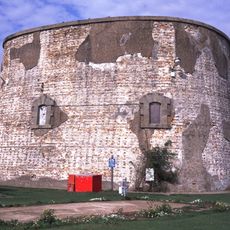
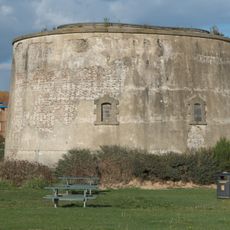
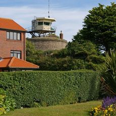
The Napoleonic-era Martello Tower now serves as an arts center hosting exhibitions by local artists. The nearby Sunspot center provides 24 business and office units at affordable rents along the seafront promenade.
Location: Tendring
GPS coordinates: 51.77950,1.11740
Latest update: December 13, 2025 15:56
Clacton Pier
2.8 km
St Osyth's Priory
3.7 km
Jaywick Martello Tower
1.7 km
Clacton Town Hall
2.8 km
Clacton Cliffs and Foreshore
549 m
Colne Point nature reserve
4.5 km
Howlands Marsh
4.9 km
Riddles Wood
4.7 km
St Osyth Pit
4.7 km
Pickers Ditch Meadow
4.4 km
Church of St John the Baptist
3.9 km
Church of St Peter and St Paul
3.5 km
Church of St James
5.4 km
St Osyth's Priory: The Abbot's Lodging and South Wing, the Darcy Clock Tower and C18 House (formerly listed as the Convalescent Home)
3.7 km
Church of St James
2.3 km
The Ship Inn, Clacton
3.8 km
The Flag Inn
5.6 km
The Kings Arms Hotel
3.6 km
Clacton Library
2.9 km
Martello tower E
1.6 km
Clacton-on-Sea War Memorial
2.6 km
The Robin Hood
3.9 km
St Clere's Hall
2.8 km
St Osyth's Priory, Tithe Barn Adjoining The West Range Of Gatehouse
3.7 km
Milestone On Western Verge Opposite Numbers 76/82
3.8 km
Martello tower F
2.3 km
St Osyth's Priory Boundary Walls
3.7 km
St Osyth's Priory, Gatehouse And East And West Flanking Ranges
3.7 kmVisited this place? Tap the stars to rate it and share your experience / photos with the community! Try now! You can cancel it anytime.
Discover hidden gems everywhere you go!
From secret cafés to breathtaking viewpoints, skip the crowded tourist spots and find places that match your style. Our app makes it easy with voice search, smart filtering, route optimization, and insider tips from travelers worldwide. Download now for the complete mobile experience.
A unique approach to discovering new places❞
— Le Figaro
All the places worth exploring❞
— France Info
A tailor-made excursion in just a few clicks❞
— 20 Minutes