Wetherby, Market town in West Yorkshire, England
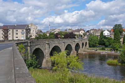
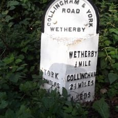
Wetherby is a market town situated on the banks of the River Wharfe, positioned at a key crossroads between Leeds, York, and Harrogate. The settlement sits along major transport routes that connect larger urban centers across the region.
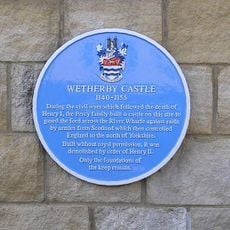
The Knights Templar granted market rights in 1240, establishing the town as a commercial hub. This foundation shaped its role as a vital stopping point on the Great North Road between southern and northern regions.
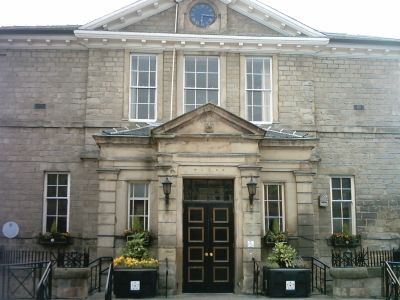
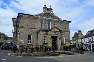
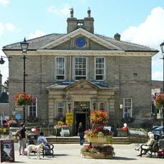
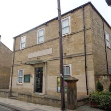
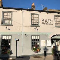
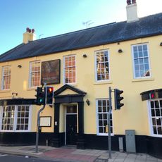
The Market Place sits at the heart of town life, where residents shop and gather throughout the week. The Town Hall overlooks this central space, which remains the focal point of the community.
The town is easy to reach by road and offers parking for visitors exploring the town center. Walking routes lead naturally to the river and main streets, making the place straightforward to navigate on foot.
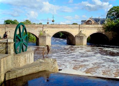
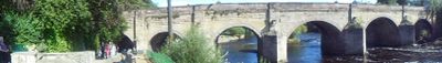
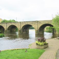
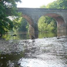
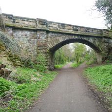
The bridge crossing the River Wharfe dates back to medieval times and carries protected heritage status today. It stands as a physical reminder of the town's long history as a crossing point for travelers moving between north and south.
Location: Leeds
Website: http://wetherby.co.uk
GPS coordinates: 53.92750,-1.38389
Latest update: December 14, 2025 20:00
Photo license: CC BY-SA 4.0
Wetherby Bridge
172 m
St James' Parish Church, Wetherby
314 m
Wetherby Ings
495 m
Linton Bridge
2.4 km
Wetherby Town Hall
201 m
St. Oswald's Church, Collingham, West Yorkshire
2.5 km
St Joseph's Church, Wetherby
354 m
Wetherby Wesleyan Methodist Church
274 m
St. Mary the Virgin Church, Boston Spa
3.3 km
Wetherby Bridge (Over River Wharfe) With Attached War Memorial
181 m
The Brunswick
116 mParkside House
2.6 km
Bar Three
206 m
Wetherby Library and Tourist Information
272 m
Sant Angelo
140 m
Barleyfield Road Bridge
950 m
Railway Engine Shed Approximately 200 Metres North East Of Junction With Deighton Road
625 mRye Cottage And Adjoining Cottage
3.5 km
Swan And Talbot
235 mClarendon Lodge Lismore House
3 km
6 And 8, Scott Lane
264 mMoor End Cottage
2.7 km
41, 43, 43A And 45, High Street
164 m
Milepost Approximately 120 Metres To North East Of Junction With Audby Lane
834 m
Wetherby Castle
325 mFlintmill Grange Farmhouse With Attached Pavilions And Wall Lining East Side Of Farmyard
1.9 kmL Shaped Range Of Farm Buildings Enclosing Farmyard To Rear Of Flintmill Grange Farmhouse
1.9 kmThorp Arch Hall Including East Wing And West Wing
3 kmVisited this place? Tap the stars to rate it and share your experience / photos with the community! Try now! You can cancel it anytime.
Discover hidden gems everywhere you go!
From secret cafés to breathtaking viewpoints, skip the crowded tourist spots and find places that match your style. Our app makes it easy with voice search, smart filtering, route optimization, and insider tips from travelers worldwide. Download now for the complete mobile experience.
A unique approach to discovering new places❞
— Le Figaro
All the places worth exploring❞
— France Info
A tailor-made excursion in just a few clicks❞
— 20 Minutes