Ivybridge, Administrative town in South Hams, England
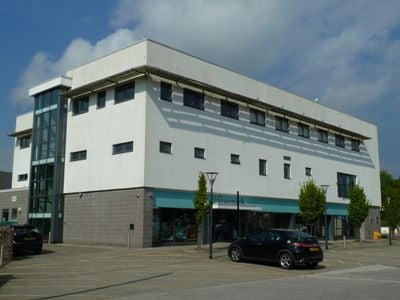
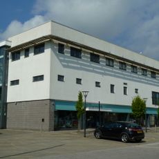
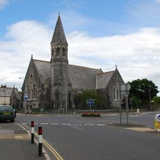
Ivybridge is a town at the southern edge of Dartmoor National Park, spreading across both banks of the River Erme. The built-up area mixes residential neighborhoods with shopping and business zones, creating a typical small English town layout.
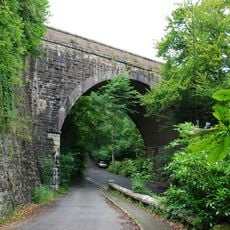
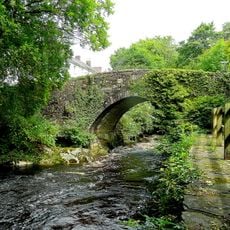
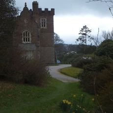
The settlement first appeared in the 1086 Domesday Book and grew around a bridge built in the 1200s. This crossing was the only route between Exeter and Plymouth for centuries, turning the location into a key stopping point.
The name comes from a medieval bridge that once served as the main crossing point and shaped how people connected across the river. This heritage remains visible in how the town is organized around its core, reflecting its origins as a practical stopping point.
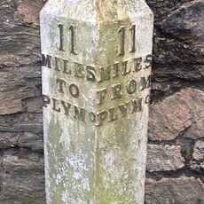
The town sits on the A38 Devon Expressway, which links directly to Plymouth and makes reaching the area straightforward for travelers. Shops, restaurants, and services are located throughout the town center, making it easy to find what you need.
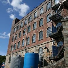
A paper mill operated here from 1787 until 2013, providing work for many local residents across generations. The factory was a central part of life in the town and shaped how the community developed.
Location: South Hams
Shares border with: Cornwood
Website: http://ivybridge.gov.uk
GPS coordinates: 50.38900,-3.92100
Latest update: December 7, 2025 10:05
Stowford House
1 km
Church of St Petroc
3.4 km
Church of St Peter and St Paul, Ermington
2.9 km
Curzon Cinema at the Watermark
156 m
Lower Keaton Bridge
1.7 km
Ivybridge Viaduct including adjacent piers of earlier viaduct
832 m
The Bridge
256 m
Methodist Church Including Boundary Wall To North And West
182 m
Harford Bridge
3.5 km
Penquit Manor House
2.3 km
Cross In Church Yard Approximately 50 Metres South South West Of Church Of St Petroc
3.3 km
Bittaford Viaduct
3.2 km
Blachford Viaduct Including Adjacent Piers Of Earlier Viaduct
3.5 km
Unenclosed stone hut circle settlement west of Butter Brook Reservoir
3.3 km
Stowford Paper Mills
434 m
Lychgate Approximately 30 Metres South South East Of Church Of St Peter And St Paul
3 km
Milestone Immediately North East Of Torr Hill (House)
635 m
Barn Approximately 10 Metres West Of Penquit Manor House
2.3 km
Caton House
1.7 km
Lukesland
2 km
Hall Farm House
3.6 km
One of a group of four cairns on Butterdon Hill
3.2 km
Cairn near the summit of Western Beacon
2.5 km
Chambered cairn in Cuckoo Ball newtake
3.2 km
Ludbrook Mill And House
2.9 km
Guidestone, Cross In Hand, Exeter Road, turn to Rugby Club
1.2 km
Milestone, 150m W of turn to Higher Ludbrook
3 km
Milestone, 30m E of Erme Bridge
3.1 kmVisited this place? Tap the stars to rate it and share your experience / photos with the community! Try now! You can cancel it anytime.
Discover hidden gems everywhere you go!
From secret cafés to breathtaking viewpoints, skip the crowded tourist spots and find places that match your style. Our app makes it easy with voice search, smart filtering, route optimization, and insider tips from travelers worldwide. Download now for the complete mobile experience.
A unique approach to discovering new places❞
— Le Figaro
All the places worth exploring❞
— France Info
A tailor-made excursion in just a few clicks❞
— 20 Minutes