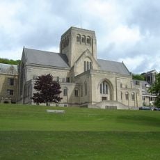
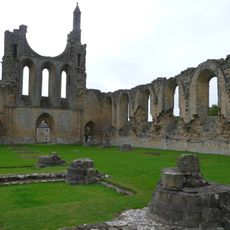
Byland Abbey, Medieval Cistercian monastery ruins in North Yorkshire, England.
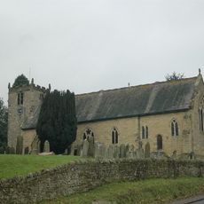
Byland Abbey is a monastery site with extensive stone ruins in North Yorkshire, where the main church features a large rose window and pointed arch openings. The remains reveal how a Cistercian community organized its buildings around a central courtyard.
The monastery was founded in 1177 after monks relocated to this location from elsewhere. Over a century later, the site became caught up in a major military conflict that shook the region.
The manuscripts created here show how monks recorded local stories and blended them with religious teachings. Visitors can sense how this place inspired people to tell tales and reflect on spiritual matters.
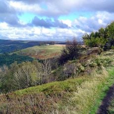
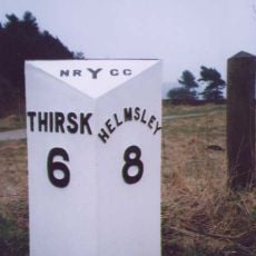
The site is accessible on foot via field paths and woodland trails that connect to the nearby village. Visitors should wear sturdy footwear since the ground is uneven and paths can become slippery after rain.
A medieval king had to flee from this place during a battle and abandoned his army behind. The event is still remembered in the region's history to this day.
Location: Byland with Wass
Inception: 12 century
Website: http://english-heritage.org.uk/visit/places/byland-abbey
GPS coordinates: 54.20326,-1.16077
Latest update: December 7, 2025 20:46
Kilburn White Horse
4.1 km
Ampleforth Abbey
5 km
Stanbrook Abbey
1.6 km
Newburgh Priory
2.5 km
Shandy Hall
2.4 km
Ryedale Windypits
5.5 km
Church of St Michael, Coxwold
2.3 km
Church of St Mary
3.5 km
Church of St Mary
5.3 km
Church of Saint Mary
4.7 km
Church of Saint Hilda
3.5 km
Church of St Nicholas
4.9 km
The Abbey Inn
27 m
War Memorial Set in Wall Approximately 7 Metres to South of Churchyard South Gateway
3.5 km
Coxwold War Memorial Within The Churchyard Of Saint Michael's Church
2.3 km
Hood Grange Farmhouse
5.5 km
Wayside cross known as Cooper Cross on Sutton Bank
5.2 km
Thatch Cottage
5.4 km
Milepost Approximately 150 Metres East Of Spring Cottage And Greystones
4.5 km
Studford Ring
3.4 km
Milepost Approximately 30 Metres South Of High Lodge
3 km
Milepost Approximately 225 Metres To West Of Track To Gormire Lake
5.6 km
Former School
3.5 km
Wayside cross base on south side of the churchyard wall at Scawton
4.6 km
Mounting Block Approximately 6 Metres To South West Of South Gate To Church Of St Mary
3.5 km
Husthwaite War Memorial
4.9 km
Milestone, top of Sutton Bank
5.2 km
Milestone, on straight road
4.8 kmVisited this place? Tap the stars to rate it and share your experience / photos with the community! Try now! You can cancel it anytime.
Discover hidden gems everywhere you go!
From secret cafés to breathtaking viewpoints, skip the crowded tourist spots and find places that match your style. Our app makes it easy with voice search, smart filtering, route optimization, and insider tips from travelers worldwide. Download now for the complete mobile experience.
A unique approach to discovering new places❞
— Le Figaro
All the places worth exploring❞
— France Info
A tailor-made excursion in just a few clicks❞
— 20 Minutes