Enable Location

We need your location to show you interesting places around you

Discover nearby places

Find interesting locations and hidden gems around you

Precise directions

Get accurate directions and distances to places

Your location is never shared with other users. It's only used when you tap the location button.

Combe Martin

Log in to your account

Start exploring — it's free

Trusted by 65,664 travelers worldwide

Continue with Google
Continue with Apple
or

We will send you a code to connect

By continuing, you accept our Terms and Conditions and our Privacy Policy

Check your inbox

We've sent a pincode in your inbox. Please enter the code below.

Discussion Reviews 1 Photos
21.9k Popularity

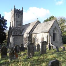
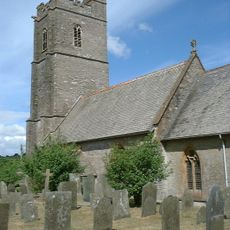
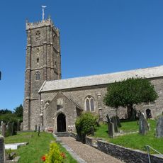
Combe Martin, village in Devon, England, UK

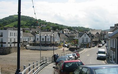
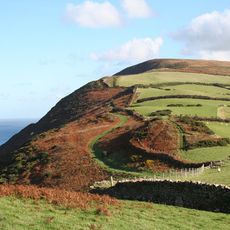
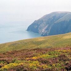
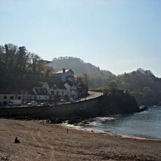
Combe Martin is a village in North Devon that runs through a narrow valley down to the shore of the Bristol Channel. The valley is flanked by wooded hills on both sides, and the village ends at a pebble beach that opens up at low tide.

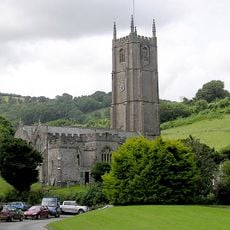
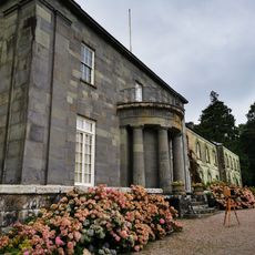
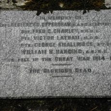
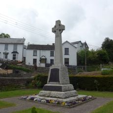
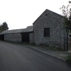
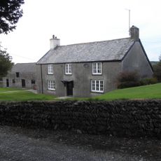
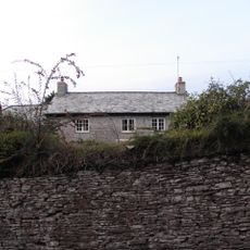
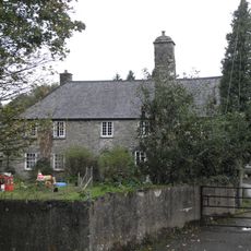
The settlement dates back to medieval times and was once known for silver and lead mining in the surrounding hills. In the 19th century, growing tourism changed its character and drew visitors from towns across the region.

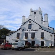
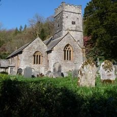
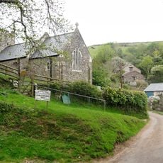
Combe Martin's main street is said to be one of the longest village streets in England, running the full length of the valley to the shore. Along the way, pubs, small shops, and homes of different eras sit side by side, giving the place a relaxed and lived-in feel.

The village is best seen on foot, since most of what there is to see runs along the main street and down to the beach. Parking can be hard to find in summer, so arriving early in the day or leaving the car at the edge of the village makes the visit easier.

The village was once home to a local tradition called the Hunting of the Earl of Rone, a costumed procession that was banned in the 19th century but revived in the late 20th century and still takes place each spring. The event involves musicians, dancers, and a figure on a donkey parading through the main street to the beach.

The community of curious travelers

AroundUs brings together thousands of curated places, local tips, and hidden gems, enriched daily by 60,000 contributors worldwide.

Start exploring
Location
GPS coordinates
51.19000,-4.02000
Latest update
March 3, 2026 08:22
Around this place
Hangman cliffs
United Kingdom

Hangman cliffs

3 km
Arlington Court
United Kingdom

Arlington Court

5.3 km
Watermouth Castle
United Kingdom

Watermouth Castle

4.9 km
Pack o' Cards
United Kingdom

Pack o' Cards

1.5 km
Chambercombe Manor
United Kingdom

Chambercombe Manor

5.8 km
Combe Martin Wildlife and Dinosaur Park
United Kingdom

Combe Martin Wildlife and Dinosaur Park

1.2 km
Wistlandpound Reservoir
United Kingdom

Wistlandpound Reservoir

6.4 km
Church of St Peter Ad Vincula
United Kingdom

Church of St Peter Ad Vincula

993 m
National Trust - Arlington Court and the National Trust Carriage Museum
United Kingdom

National Trust - Arlington Court and the National Trust Carriage Museum

5.3 km
Exmoor Coastal Heaths
United Kingdom

Exmoor Coastal Heaths

4 km
Church of St John the Baptist
United Kingdom

Church of St John the Baptist

3.8 km
Church of St Peter
United Kingdom

Church of St Peter

6.6 km
Church of St James
United Kingdom

Church of St James

5.4 km
Church of St Thomas
United Kingdom

Church of St Thomas

3.7 km
Church of St Peter
United Kingdom

Church of St Peter

3.2 km
Combe Martin Museum
United Kingdom

Combe Martin Museum

2.2 km
Kentisbury War Memorial
United Kingdom

Kentisbury War Memorial

3.6 km
Church House Used For Storage, Adjacent To North West Corner Of Church Of St Thomas
United Kingdom

Church House Used For Storage, Adjacent To North West Corner Of Church Of St Thomas

3.7 km
Cattle Shelters Approximately 15 Metres East Of Middle Beccott Farmhouse
United Kingdom

Cattle Shelters Approximately 15 Metres East Of Middle Beccott Farmhouse

4.6 km
Combe Martin War Memorial
United Kingdom

Combe Martin War Memorial

972 m
Shippon And Barn Approximately 5 Metres East Of Penberthys Farmhouse
United Kingdom

Shippon And Barn Approximately 5 Metres East Of Penberthys Farmhouse

4.6 km
Kentisbury Village Hall
United Kingdom

Kentisbury Village Hall

3.6 km
Middle Beccott Including Attached Lofted Stable, And Shippon Range Extending To West
United Kingdom

Middle Beccott Including Attached Lofted Stable, And Shippon Range Extending To West

4.6 km
Sand Park With Stable Range Attached At West End
United Kingdom

Sand Park With Stable Range Attached At West End

3.8 km
Penberthys Farmhouse
United Kingdom

Penberthys Farmhouse

4.6 km
Kentisbury Barton
United Kingdom

Kentisbury Barton

3.6 km
East Down Manor
United Kingdom

East Down Manor

3.7 km
Four bowl barrows and a standing stone 330m west of Higher Mattocks Down
United Kingdom

Four bowl barrows and a standing stone 330m west of Higher Mattocks Down

1.9 km
Show the full map
Reviews
Share your experience

No review yet

Discussions
Start a discussion...

No discussion yet

« Combe Martin - village in Devon, England, UK » is provided by Around Us (aroundus.com). Images and texts are derived from Wikimedia project under a Creative Commons license. You are allowed to copy, distribute, and modify copies of this page, under the conditions set by the license, as long as this note is clearly visible.

Discover hidden gems everywhere you go!

From secret cafés to breathtaking viewpoints, skip the crowded tourist spots and find places that match your style. Our app makes it easy with voice search, smart filtering, route optimization, and insider tips from travelers worldwide. Download now for the complete mobile experience.

Around Us App Screenshot

A unique approach to discovering new places

Le Figaro

All the places worth exploring

France Info

A tailor-made excursion in just a few clicks

20 Minutes

Around Us
Travel Guide & Maps
Download

Send to your phone

QR Code
1

Open the camera app on your mobile.

2

Point at the QR code with your camera. A notification will appear.

3

Tap the notification to open the link.