Enable Location

We need your location to show you interesting places around you

Discover nearby places

Find interesting locations and hidden gems around you

Precise directions

Get accurate directions and distances to places

Your location is never shared with other users. It's only used when you tap the location button.

Radstock

Log in to your account

Start exploring — it's free

Trusted by 64,044 travelers worldwide

Continue with Google
Continue with Apple
or

We will send you a code to connect

By continuing, you accept our Terms and Conditions and our Privacy Policy

Check your inbox

We've sent a pincode in your inbox. Please enter the code below.

Discussion Reviews 1 Photos
18.1k Popularity

Radstock, town in Somerset, England

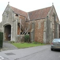
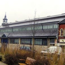
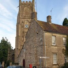
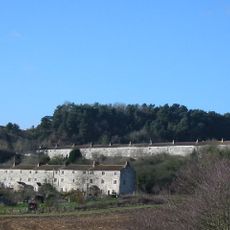
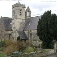
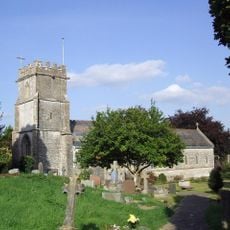
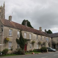
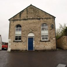
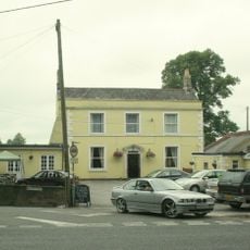
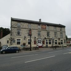
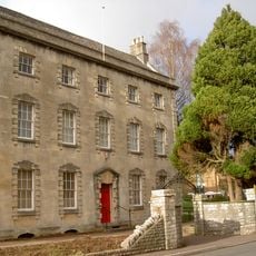
Radstock is a small town on the northern side of the Mendip Hills in Somerset, where old and new buildings blend along narrow streets and the landscape. The place has a museum, several churches, and green spaces woven throughout the community.

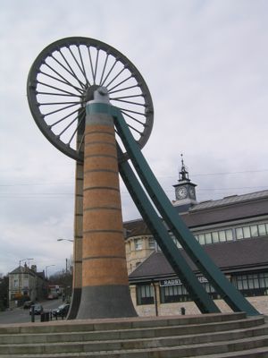
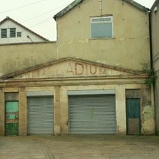
Settlement dates back to the Iron Age, and the Romans built the Fosse Way through the area. Coal discovery in the 18th century sparked rapid growth, with up to 79 mines at their peak in the early 1900s, all closing by the 1970s.

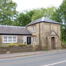
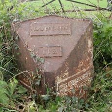
The name Radstock comes from its location near the Roman Fosse Way and the red soil common to the area. The town keeps its connection to this past visible in its buildings and streets, where you can still sense the layers of time as you walk.

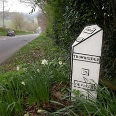
The best way to get around Radstock is by car or bike, since the old railway lines no longer operate as transport. The town connects to main roads leading to Bath and other parts of Somerset, and offers many walking and cycling paths through the countryside.

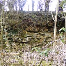
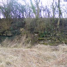
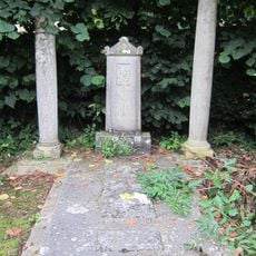
The Writhlington Colliery, a former coal pit, holds fossil remains of insects from the Carboniferous period and is now a protected nature site. This spot shows how nature slowly returns and grows over the industrial past.

The community of curious travelers

AroundUs brings together thousands of curated places, local tips, and hidden gems, enriched daily by 60,000 contributors worldwide.

Start exploring
GPS coordinates
51.29270,-2.44770
Latest update
February 17, 2026 00:00
Around this place
Church of the Holy Ghost, Midsomer Norton
United Kingdom

Church of the Holy Ghost, Midsomer Norton

2.4 km
Radstock Museum
United Kingdom

Radstock Museum

116 m
Church of St Peter and St Paul, Kilmersdon
United Kingdom

Church of St Peter and St Paul, Kilmersdon

2.6 km
Church of St John the Baptist, Midsomer Norton
United Kingdom

Church of St John the Baptist, Midsomer Norton

2.7 km
Writhlington SSSI
United Kingdom

Writhlington SSSI

1.5 km
Town Hall
United Kingdom

Town Hall

2.6 km
Kilmersdon Road Quarry
United Kingdom

Kilmersdon Road Quarry

735 m
Bowlditch Quarry
United Kingdom

Bowlditch Quarry

2.3 km
Holy Trinity Church, Clandown
United Kingdom

Holy Trinity Church, Clandown

1.4 km
Parish Church of St Nicholas
United Kingdom

Parish Church of St Nicholas

299 m
The Jolliffe Arms And Nos 235 And 236
United Kingdom

The Jolliffe Arms And Nos 235 And 236

2.6 km
Welton Baptist Chapel
United Kingdom

Welton Baptist Chapel

2.2 km
Palladium
United Kingdom

Palladium

2.4 km
The Railway Public House
United Kingdom

The Railway Public House

509 m
Group Of 7 Monuments In Churchyard, Adjacent To Nave, Church Of St Peter And St Paul
United Kingdom

Group Of 7 Monuments In Churchyard, Adjacent To Nave, Church Of St Peter And St Paul

2.6 km
Boundary Marker About 10 Metres South West Of Red Post Inn
United Kingdom

Boundary Marker About 10 Metres South West Of Red Post Inn

2.4 km
Lych Gate, Flanking Walls And Gates On North Side Of Church Of St Peter And St Paul
United Kingdom

Lych Gate, Flanking Walls And Gates On North Side Of Church Of St Peter And St Paul

2.6 km
Midsomer Norton War Memorial
United Kingdom

Midsomer Norton War Memorial

2.5 km
The Waldegrave Arms Hotel
United Kingdom

The Waldegrave Arms Hotel

81 m
Radstock War Memorial
United Kingdom

Radstock War Memorial

64 m
The Toll House
United Kingdom

The Toll House

2.6 km
Thomas Jolliffe monument in churchyard, about 50 m south-east of Church of St. Peter and St. Paul
United Kingdom

Thomas Jolliffe monument in churchyard, about 50 m south-east of Church of St. Peter and St. Paul

2.6 km
Milepost At Ngr St 6948 5248
United Kingdom

Milepost At Ngr St 6948 5248

2.5 km
Council Offices, Midsomer Norton
United Kingdom

Council Offices, Midsomer Norton

2.5 km
Milestone, Bath New Road; out of Radstock
United Kingdom

Milestone, Bath New Road; out of Radstock

785 m
Milestone, Peasedown Flat, nr entrance to Woodborough House
United Kingdom

Milestone, Peasedown Flat, nr entrance to Woodborough House

1.8 km
Milepost, near Charlton village
United Kingdom

Milepost, near Charlton village

2.7 km
Milestone, Charlton Crossroads, Midsomer Norton
United Kingdom

Milestone, Charlton Crossroads, Midsomer Norton

2.5 km
Show the full map
Reviews
Share your experience

No review yet

Discussions
Start a discussion...

No discussion yet

« Radstock - town in Somerset, England » is provided by Around Us (aroundus.com). Images and texts are derived from Wikimedia project under a Creative Commons license. You are allowed to copy, distribute, and modify copies of this page, under the conditions set by the license, as long as this note is clearly visible.

Discover hidden gems everywhere you go!

From secret cafés to breathtaking viewpoints, skip the crowded tourist spots and find places that match your style. Our app makes it easy with voice search, smart filtering, route optimization, and insider tips from travelers worldwide. Download now for the complete mobile experience.

Around Us App Screenshot

A unique approach to discovering new places

Le Figaro

All the places worth exploring

France Info

A tailor-made excursion in just a few clicks

20 Minutes

Around Us
Travel Guide & Maps
Download

Send to your phone

QR Code
1

Open the camera app on your mobile.

2

Point at the QR code with your camera. A notification will appear.

3

Tap the notification to open the link.